I had signed up to do a walk today with the Club but only two of us and the organiser were going so it was cancelled last night. I guess it’s too close to Xmas for most people but it will be run again in 2026.
The weather was looking good and I had myself geared up for the hills so I decided to go myself instead. First time walking solo since January!
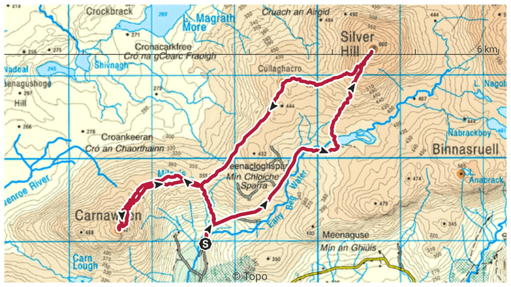
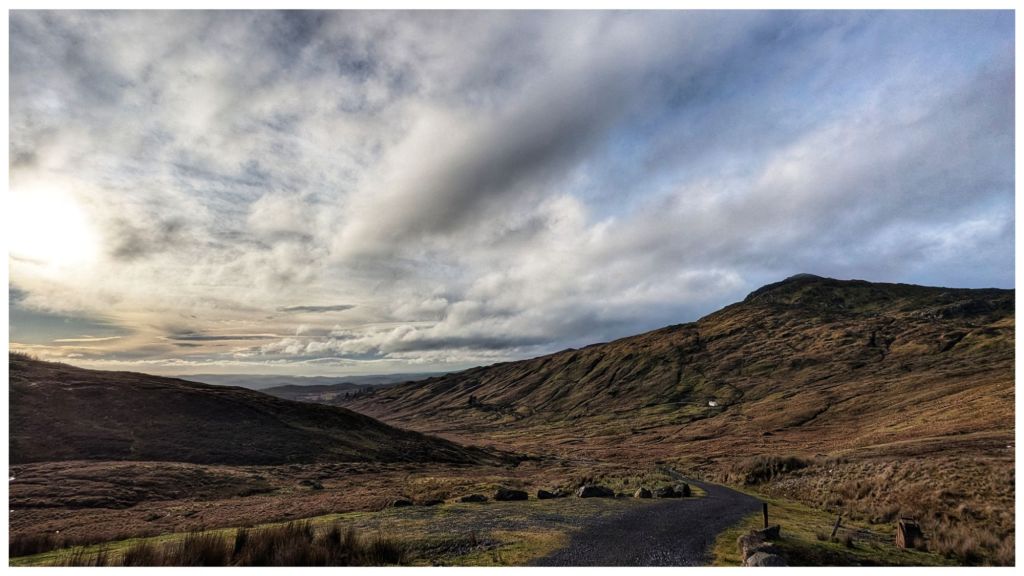
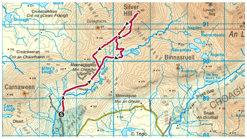
With limited daylight I wanted something relatively easy and not too long so after a trawl through my saved routes I found one that fit the bill in the Bluestack Mountains taking in two summits I haven’t been on before and at 10.5km manageable in about 4 hours.
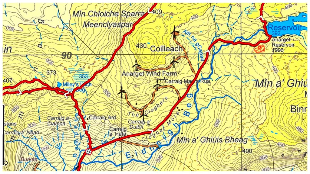
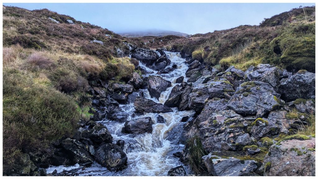
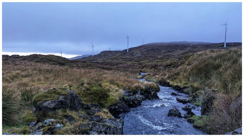
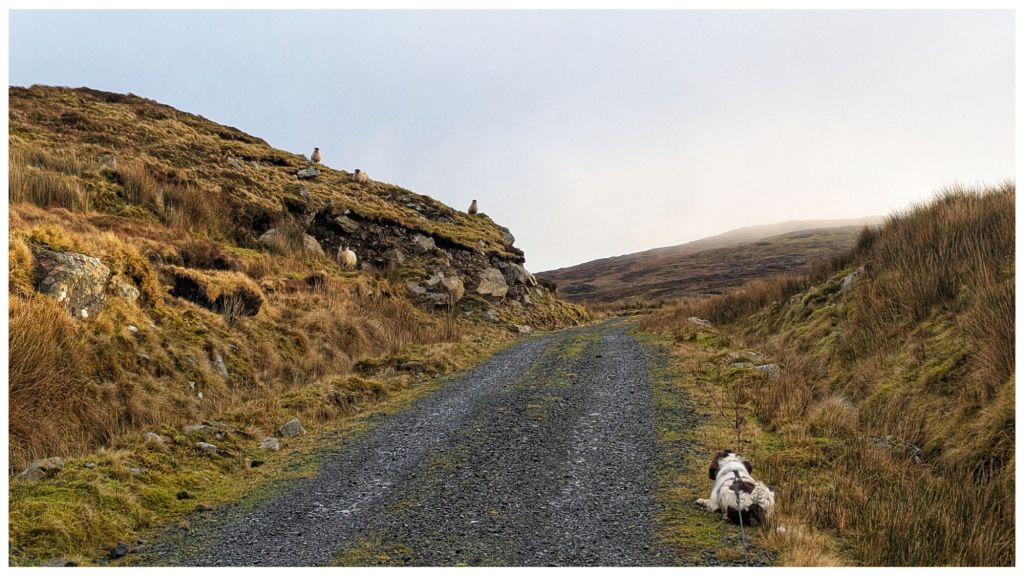
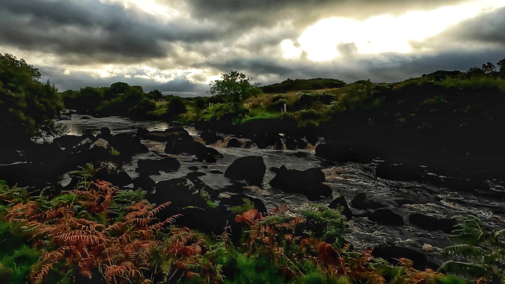
The first section is along access tracks for the windfarm that sits on the lower slopes between Silver Hill and Carnaween. It’s simple walking but steeper than I expected as it rises steeply from 200m along the Eany Beg Water to the Anarget Reservoir at just under 400m in just under 3km.
It was on this very first section that I realised I had made a bad assumption about sheep. I figured there wouldn’t be many about the hills this late in the year but I was wrong. Especially wrong here as it looks like the windfarm company have leased the land from a local sheep farmer! Also with the land sitting in a valley it’s very sheltered and a perfect location to over-winter a flock.
Cooper and sheep in a staring contest
This was Cooper’s first experience of sheep “in the wild” and he really struggled to cope. He’s hardwired to chase when something runs so it became a constant challenge to keep him under control. Thankfully I’d decided to bring my 10m long lead that allowed him to explore but also gave me the ability to restrain his exuberance!
The steep track, heavy boots that are better on hill than road and the constant stress of keeping Cooper under control meant I was glad to reach the reservoir and the main hill.
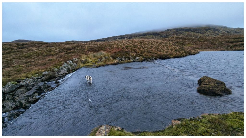
A bit OTT but the track/water interface is quite sudden!
The reservoir appears to be a small lough that has been dammed at one end to create both a larger lough and a controllable stream that has a small hydro plant close to where we started. From the map I wasn’t sure how to cross the outflow end but there’s a large concrete wall that acts like a ford. I’m not sure how deep this gets but it was only a few inches deep today and easily crossed.
Cooper’s talents include the ability to walk on water
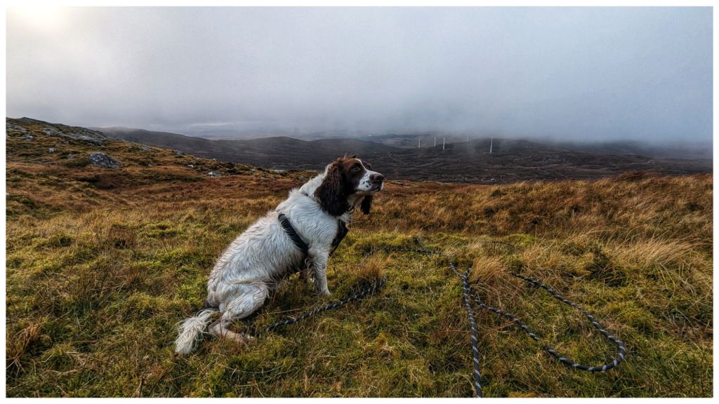
Across the lough and it was straight into open hillside. I should know better by now but I had expected better ground than what was in front of me. The Bluestacks are renowned for heavy, wet and boggy terrain but above a certain height it tends to be drier and rockier making for really nice walking. Today I had about 100m to go to get onto the good ground and in between it was some of the most difficult I’ve crossed. A constant mix of peat hags, boggy sections and cut by small steep ravines that knocked my legs for six! I was still hyper alert for wandering sheep so I’d kept Cooper on the long lead and it was a constant challenge to keep it from getting tangled in my legs and from getting caught on rocks and clumps. He had his own ideas about the best way to navigate this terrain and at 10 times the speed I was moving!
Once I made it to the drier ground it was pretty clear that I was going to need more daylight than I expected to get the full route completed. The day was quite dull with patchy low cloud rolling across from about 500m and above. Combined with my slow pace I made the decision to skip Carnaween for today and just focus on Silver Hill and getting home safe.
Looking back at Carnaween hiding in the clouds
The downside of hitting the drier ground is that it’s also steeper! Legs that were tired from the boggy bits were now complaining about the power being demanded to scramble up the rocky slope 🥵
Silver Hill is a really nice mix of rocky outcrops on this side. It was a challenge to pick the best route through but it made for interesting walking and very atmospheric as wispy clouds were blowing in and out.
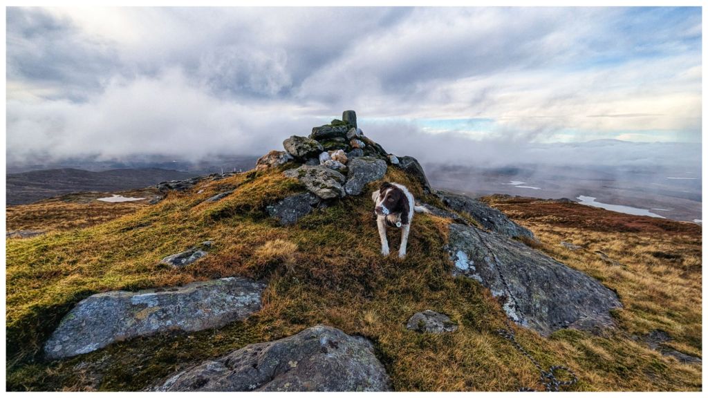
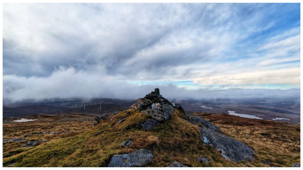
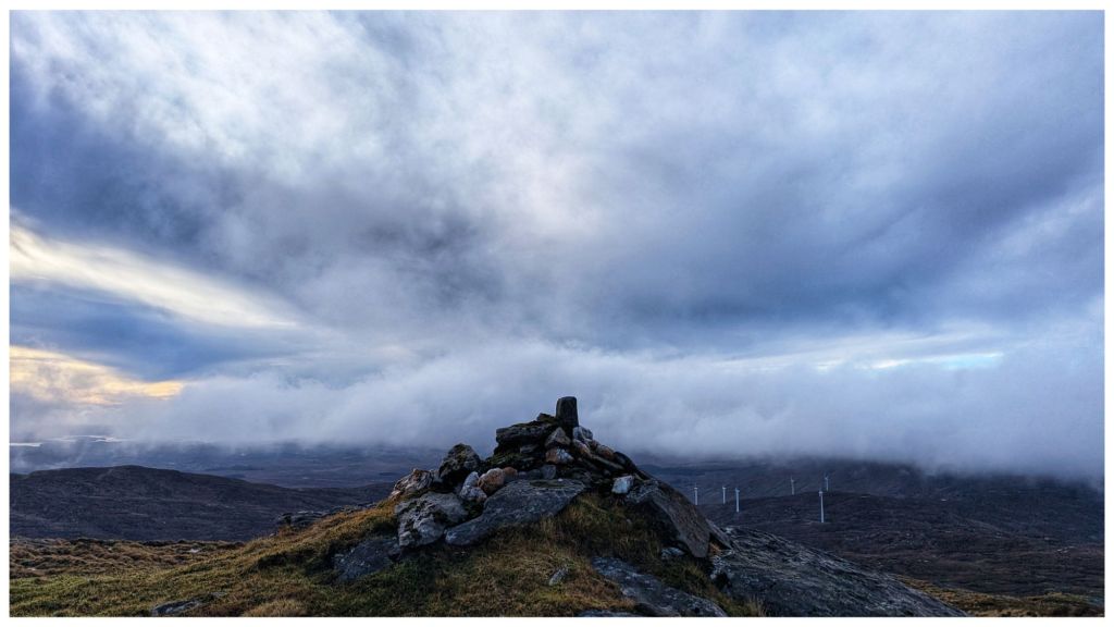
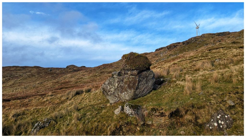
After the inevitable false summit at 550m 🙈 I got sight of the summit with a distinctive rocky cairn built on a small crag. A very regular shaped rock has been inserted into the cairn. Covered in moss, it has obviously been there for many years but gave a strong impression that it was a man made mini trig.
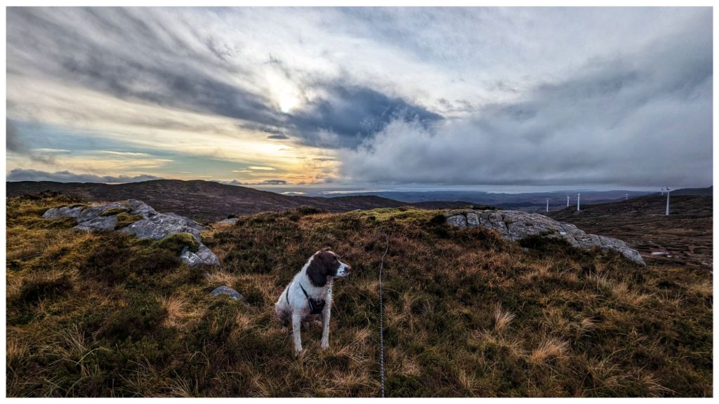
Cooper’s first summit. He wasn’t as impressed as I was! Very picturesque views all around with intermittent cloud cover.
Rather than head back the way I came I decided to drop off the summit staying above the route in and heading for the highest of the windmills. This brought me roughly parallel to the planned route across to Carnaween but at a lower elevation and with an easy finish back along the windfarm tracks.
Despite improving visibility I was happy with my decision to do the shorter walk as I was once again in the same kind of ground I’d experienced just above the reservoir. Descending though was a bit easier than climbing up through it.
Descending the first section off the summit with Cooper was a challenge for the two of us. Still on the long lead Cooper was bombing on ahead in full 4×4 mode. He was happily picking his own route that usually didn’t suit me and once again at 10 times the speed I was moving. I had to keep a close eye on him to make sure he didn’t go over too steep a drop, hit the limit of the lead and jerk me off my feet. Poles were once again, unmanageable due to the lead so I was already feeling less stable than normal and was very wary of taking a tumble on slippery, steep terrain.
Pausing on the descent to admire the brightening sky
Finally reaching the windfarm again the afternoon decided to brighten up. The clouds had mostly blown away and the sun came out to give me fantastic views of Carnaween and its craggy summit. Despite this I was happy with my shorter walk and I’m looking forward to reaching Carnaween’s summit via a different approach, hopefully in the Spring.
Carnaween in the sunshine Fabulous, clear views down the Eany Beg Valley Glacial erratic with a turf top. How many years did that take to develop!
Running the final sheep gauntlet with a tired and therefore, better behaved Cooper, I was back at the car just under 3hrs after starting. I finally took the chance to have lunch and sat in pleasantly warm sunshine. You wouldn’t think it’s Xmas in 4 days!
⛰️ Silver Hill, Bluestack Mountains, Co. Donegal. 600m which qualifies it as an Arderin and also the smallest of the Vandeleur-Lynams, just sneaking over the line. Also on my Local 100 and 50 Highest in Ulster lists.
Silver Hill is definitely a summit I’d like to go back and revisit in a different season. Gerry McVeigh has a video of a wild camp on the summit as part of a longer two day hike in May this year. It’s a bit adventurous for me but I think the loop taking in Lavagh Beg and Lavagh More from Silver Hill would be manageable.
So I finally did it! The Bluestack Way in a Day – 52km from Ardara to Donegal Town via Glenties on a mixture of tarmac roads, forest and bog tracks and some open hillside. It’s one of my biggest achievements and also one of the hardest, most physically and mentally demanding things I’ve ever done!
My original date that I decided on way back in May was Sunday 27th August. This gave me 12 weeks to “train” and also gave me a good window of daylight to complete the walk. My aim was to start at 730am, aiming for a 12hr finish but planning for 14hrs if needed. Going from Ardara meant that the last 10km were on tarmac roads and easier and safer to walk in the dark, if necessary, with a headtorch and hi viz jacket.
I also had a mental option to delay by one week to allow for any last minute issues such as injury or weather. In the end up I did delay and the walk ended up happening on Sunday 3rd September. The previous Sunday was a day of heavy rain and I decided the walk was difficult enough without trying to complete it in conditions like that. Plus the long range forecasts were all shouting about a change in the weather to warm and dry with Sunday 3rd looking pretty much perfect.
Sunday 3rd September
The final decision to postpone wasn’t made until Saturday 26th so the week running up to this was my prep week for the event with 2 x 20km walks at the weekend and a few shorter 5km walks mid week before resting a few days. I was also in bed by 930pm each night trying to build my reserves for the weekend. I was mentally focused and ready to go. The deflation of not going on Sunday kind of caught me unawares and left me feeling very unfocused in to Monday, like post-event blues without the event! It was a real effort to build myself back up for the weekend and I ended up going into Sunday feeling less prepared and pretty nervous.
We left home just after 6am for the 1hr drive to Ardara with nerves gradually building in my belly the whole way. Getting out of the car in an eerily quiet and grey Ardara my legs felt quite wobbly and I had a brief moment of panic. A big hug and kiss from Catriona and I told her to head home to give me a chance to settle myself and get started – no way back now! I took a couple of quick and shaky shots of the first sign post of the day, settled my bags, pressed start on my Garmin and took my first of what turned out to be 69,728 steps.
Ardara
I was really looking forward to this first section to Glenties as it was totally unknown to me. I’d watched a couple of videos on YouTube of other people that had walked the Bluestack Way and knew that a lot of it was along the banks of the Owenea River. ToughSoles in particular were big fans of this section and I hoped to enjoy it.
The river was beautiful. After a short section through the town and a gravelled track I wound down to the river. It’s obviously a popular fishing spot with proper bridges and clear tracks on both banks with stiles and boardwalks to help cross fences and boggy sections. Along the way I saw quite a few ducks, most of them flapping away startled by my presence on this early morning. I also heard a few fish rising for early flies and judging by the noise and resulting rings in the water they must have been pretty sizeable. I was hoping to see herons along the river but I suspect they wouldn’t be too popular with the local fishermen and have probably been discouraged from settling in the area.
A lot of the riverside path is bordered on each side by bracken. Enterprising spiders have realised that spinning a huge web across the path will trap insects as they fly between. Unfortunately for them I was having to destroy all their hard work by breaking down their webs to get past. It felt like a cross between Indiana Jones and Lord of the Rings as the spiders were huge and obviously (normally!) well fed. Most of them were about the size of a 20c/2p coin and I really didn’t fancy having them crawling on my bare legs, especially pissed off having had their web destroyed!
Eventually it was time to leave the river and skirting the edge of a field I followed the path to the first tarmac since leaving Ardara. A 3.5km straight run brought me to the edge of Glenties and along the main street exiting the town on the back road to Ballybofey beside the Garda station. A surprisingly well maintained and clean public toilet (must be the only remaining Council operated toilet in Donegal!) allowed me the luxury of not having to dig a cat hole in the wilds because no matter how much I enjoy the outdoors nobody likes having a dump outside!
Leaving a very highly decorated Glenties (this was the weekend of the Harvest Festival) I followed the tarmac road for approximately 1.5km before crossing back over the now much narrower Owenea River and back on to gravel tracks. The road out of Glenties was much more pleasant than the way in as it wound through sections of large trees with nice cottages and houses with quirky garden displays. This was my last signs of civilisation until arriving in Donegal Town almost 40km later!
The gravel track climbed steeply away from the river taking me past long abandoned homes and farmyards still locked up and quiet on this Sunday morning. This was a bit of a lung-buster with slippery conditions underfoot and a number of gates and stiles to negotiate but taking breathers and looking back I could see how quickly I was gaining height with great views back over Glenties, back towards Ardara and out towards the coast with Slievetooey looming away off in the distance.
Eventually reaching the top of this low ridge I got my first proper views of the Bluestack range itself. The track ahead ran in an almost straight line for 2-3km with a variety of conditions underfoot from gravelly to squelchy sections of bog, some bare of vegetation for 10-20m at a time while other sections were overgrown with long grass and small bushes. This was my first indication that the terrain was going to be a lot wetter than expected and that I’d made a mistake with my decision to wear trail shoes.
The first section of this bog track was very exposed with a strong Westerly wind, the first and only windy section of the whole day. After approximately 1km I reached a forested section with the trees on my left somehow reducing the force of the wind coming from my right. The breeze was still strong enough to keep me from overheating in what had turned into a very sunny day as well as preventing any midges from coming out to feast.
This boggy track eventually reached a gate and a much better surfaced forest access trail. Coming around the next corner I had a sudden recognition of this spot from walking the 30km Bluestack Challenge Walk in 2012. This was where the Army had set up a tented food station with bacon baps and tea. I could have murdered one of those at this stage today!
Just past this spot the route takes a sharp turn to follow the Owenroe river as it tumbles noisily through the narrow ravine below the track. This is where the alternative “lowland” section also starts. This alternative avoids the higher ground for anyone that doesn’t fancy it or when there is particularly bad weather. I, of course, was taking the high route.
Walking along this track with a mature forest plantation on my right and the river rushing below on my left was really enjoyable. As the path flattened out I had really good views of the craggy summit of Carnaween off to the East. The sun was out and I was feeling good. I was tempted to refill my water from the river but I still had over a litre and didn’t fancy the scramble down and back up from the river. This turned out to be a bad decision as my water choices for the rest of the day were very limited.
Eventually the track petered out and it was time to head on to the open hillside as the route headed up and over the shallow col below Cloghmeen Hill. At slightly over 400m this was the highest elevation of the whole route. At the access gate a picnic bench sat looking very out of place and seemed like it would be completely in the way of any machinery looking access to the moorland above. An abandoned Race Ireland sign from an old event helpfully told me it was 20km but I’m not sure where from. It did coincide with my distance since Ardara but I think it related to the distance from Lough Eske coming towards Glenties based on the orientation of some signs found further along the route.
It was on the climb over this ridge that the wheels came off the wagon for this walk, where my choice of footwear was proven to be a disaster and this was clear within the first few steps. The terrain changed from track to open grazed moorland, so typical of the Bluestacks. It was also incredibly wet! Every step was a squelch, the ground was saturated with thick moss below the layer of grass. Water was squeezing out of the soil and within 10m my shoes and feet were soaking wet. The climb was steep but not incredibly difficult. However, with tired legs after 20km, shoes that now felt like blocks of concrete and heavy ground it was a slog to the top. At the top of this ridge the route bears left with the official summit of Cloghmeen Hill some 50-100m to the right. My original plan was to make a short detour at this point to grab the summit but with serious concerns about my shoes, the boggy approach to the summit and legs drained after the climb up I decided to focus on getting off the hill instead.
The drop down the other side of the ridge was steeper than the ascent but just as wet and I’m sure it was here that the majority of the damage was done to my feet. With socks and shoes completely sodden my feet were moving far more than usual in my shoes and my weight was focused towards the front of my feet creating friction that wet skin could do without. By the time I reached the bottom, followed the route as it inexplicably weaved through the walls of an abandoned and overgrown homestead and out to the gravel track where it rejoined with the alternative route, I knew I was going to have problems for the rest of the day. I could feel a burning sensation on the pads of both feet, just behind my toes as well as on the heel of my right foot despite having it really well taped specifically to prevent blisters.
My original plan was always to take a longer break at Letterbarrow soccer pitch which was at the 27/28km mark. I’d planned to get my shoes off, retape my feet and put on fresh socks. This was going to be even more crucial now than I had planned.
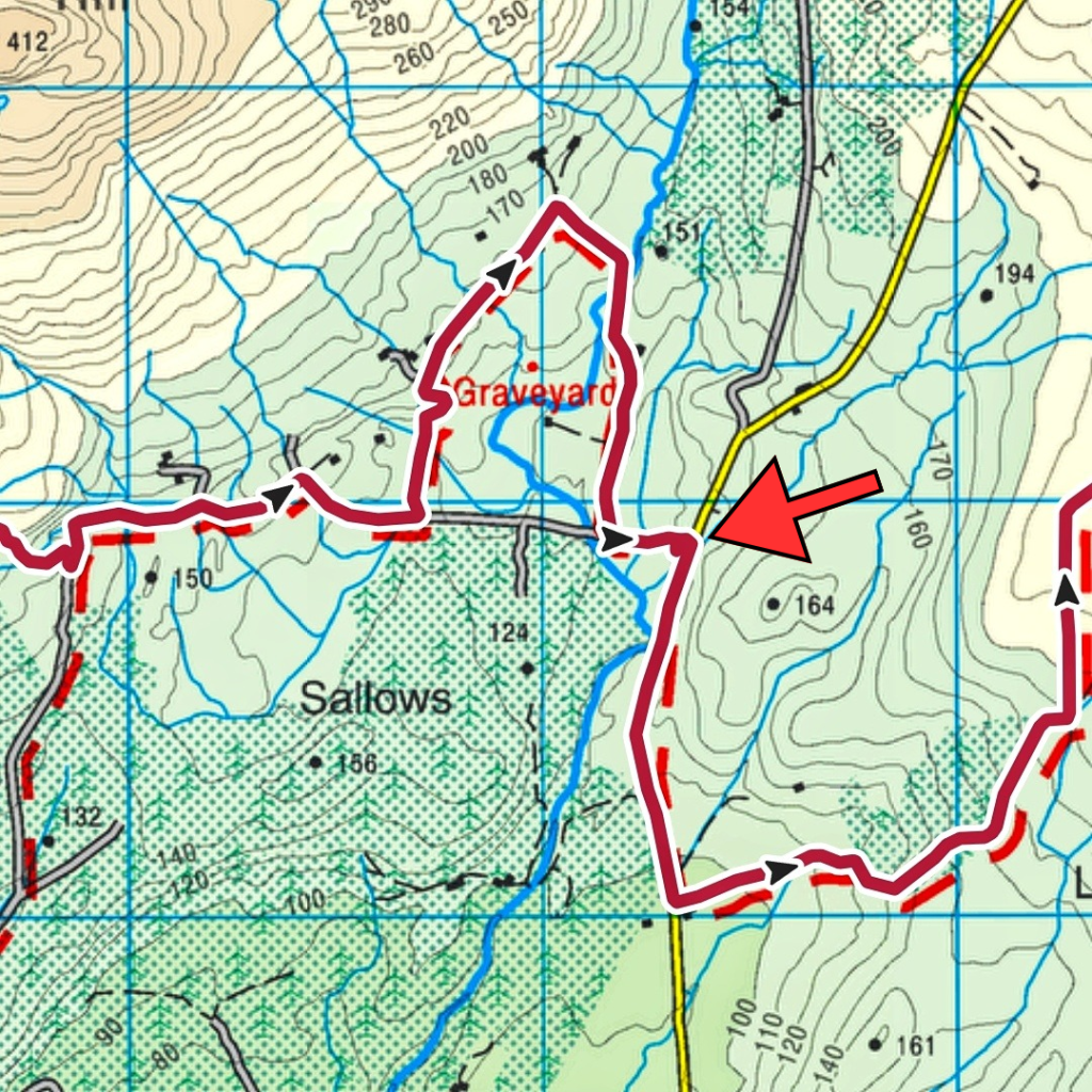
The Bluestack Way takes what seems like a random loop just a few hundred metres from Letterbarrow pitch. It brings you back to the same road having walked an extra kilometre up and down a fairly steep hillside. The aim is not to piss you off but to bring you past the ancient Disert Graveyard. Again, on any other day I would have been tempted to pay this spot a visit but I pushed on past the entrance, focused on getting to the pitch and getting my shoes off.
The arrow marks the pitch.
The one advantage of the extra walk was that my feet squeezed most of the water out of my shoes leaving them a tiny bit drier and not completely waterlogged. Reaching a picnic bench at the back of the clubhouse it was like heaven to finally sit down on a proper seat and peel off my sodden socks. Leaving my shoes in the strong sunshine I let my feet dry out and breathe in the warm air for 20min while I lay back and rested having eaten most of a flapjack bar to fill my belly. Restarting with fresh tape, blister patches and clean, dry socks my feet, though tender, felt so much better.
I had also hoped for an outside tap at the clubhouse but there was none. Reading the rules for an unsupported FKT attempt I since realised that water can only be taken from natural sources so it’s just as well!
A short section of tarmac route and I was once again diverting on to gravel tracks. The first section was through a farmyard with loads of warning signs on the gate about trespassing and liability etc. It was all a bit intimidating but the waypoint signs gave me the confidence to keep on. A few more gates with similar signs and I was in a short section of cool, shady forestry before popping out on a wide flat bog area with beautiful, expansive views of the high Bluestack range. I could pick out some familiar hills and had a brilliant view of the Sruell Gap and just a peek of The Grey Mare’s Tail waterfall that I saw up close a few months ago.
Sruell Gap in the middle, Croaghgorm on the right Close up, Grey Mare’s Tail Waterfall just about visible on the left
This section of bog is also extensively used for turf harvesting. There were some stacks of bags sitting ready to be taken home with many more bags sitting in rows ready for lifting. There was one group of men busily loading a quad trailer and transferring bags to a tractor trailer for taking home. Harvesting turf is very labour intensive and I often wonder if the payback is worth the effort involved. One thing for sure though is that turf will heat you many times over, not just when you burn it!
A sharp right turn in the middle of the bog brought me back to tarmac and the familiar road that takes you to the start of Sruell Gap. A short walk along this remote single track road and I was sent on to another track and over a concrete slab bridge across the Sruell River as it tumbled down from the gap. Over the bridge and it was back to a low section of trackless grassland. Boggy again but thankfully not a sponge like earlier and I was able to find enough rocky spots and firmish ground to avoid any more water getting in to my shoes. If anyone saw me gingerly stepping across the fields I must have been like a middle aged child trying to avoid the cracks on a pavement!
It was somewhere across this section that I passed the 33km mark and was now officially on the longest walk I’d ever done in a day. My previous record was 33.1km in March 2022
March 2022
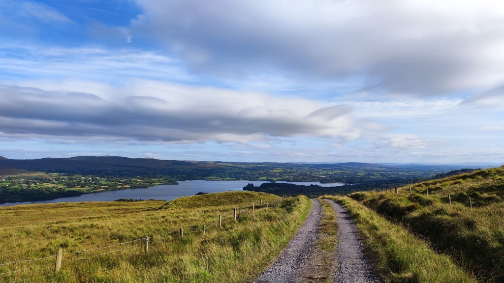
Another short section of tarmac brought me to the Eglish River and a very familiar gravel trail that curves around Banagher Hill and along the Eglish Valley with more expansive views of the Bluestack ridge. I’ve been on the lower section of this track a number of times, most recently just 4 weeks ago, so I was really beginning to feel like I was on home ground now. The track ascends gently as it rounds Banagher Hill until eventually you are rewarded with the very welcome view out over beautiful Lough Eske and Donegal Town in the distance. Still 13km to go but I could sense the end.
Lough Eske
For the next 3km it was a steady downhill on gravel which eventually morphed into tarmac, steadily dropping down towards Lough Eske. On the way down I met a lady with her dog She asked if I was walking the Bluestack Way and was very impressed when she asked where I started and I said Ardara. Her jaw nearly hit the floor when I told her I was going the whole way to Donegal Town. She hopes to walk it in two days and was amazed I was doing it in one!
I really needed this boost though. The dampness from my shoes had now penetrated both pairs of dry socks and I was back to walking with wet and increasingly painful feet. The pads of both feet and my right heel were burning, a sure sign that blisters were developing. At this stage it was now a matter of every step was one step closer to the end.
Once down close to Lough Eske I joined the fairly busy scenic road that loops around the West shore but thankfully only for a few hundred metres as lots of people were out for a drive on this lovely Sunday afternoon.
The route leaves the road to descend through the tree-lined narrow road that skirts the edge of Ardamona Nature Reserve and the very edge of the lough before arriving at Harvey’s Point Hotel. Just before the turnoff I was finally able to get access to the small Clady River as it tumbled down the steep hillside from Banagher Lough high up in the mountains above. My water bladder was completely empty and I had no water for almost an hour at this stage. I wasn’t happy with any water sources up to now as the route had come through grassland that was heavily grazed with sheep and nothing was flowing fast enough to give me confidence until now. A couple of shots with my filter gave me almost a litre and enough to keep me going to the end.
Just before Harvey’s Point I passed the significant 42km milestone. In old money this is just over 26 miles and the distance of a marathon. I doubt I’ll ever run a marathon but it felt damn good to have walked one! Still another 10K to go though…
Reaching the hotel entry gates and heading along the road towards the Famine Pot junction I was tormented by cars and a couple of buses. This is a popular hotel and this is the only access road. After the peace and tranquility of the whole day up to now this was a real culture shock and I was very relieved to see the marker post sending me off the road and into the forest that surrounds Lough Eske Castle Hotel right on the lough shore and thankfully away from all the traffic.
This section was absolutely gorgeous but I was really starting to suffer at this stage and couldn’t enjoy it anywhere close to what it deserved. It was a wonderfully cool variety of shaded forest paths and gravelly tracks through the trees and boardwalk right on the very edge of the lake. Swans and ducks were enjoying the water which was visible through small breaks in the tall shoreline foliage. The path meanders through this beautifully tranquil area for approximately 3km but to me it felt like an eternity. In among the trees I lost all sense of progress and every step felt like walking on broken glass. I hit a massive low point through here and for the first time really felt like packing it in. Even eating was a chore with the flapjack bar feeling like sawdust in my mouth and having to be forced down. Looking back I was probably suffering from dehydration and maybe even a touch of heatstroke at this point.
I have a memory of leaning on the rail of a small bridge over a little stream, my forehead resting on the wood, arms dangling loosely and feeling for all the world like I could burst into tears. My feet were in bits and my head was gone. SomehowI managed to drag myself out of this and forced myself to get moving. I had about 7-8km left and couldn’t give up now!
Emerging from the never ending tunnel of trees (usually my favourite environment!) I came back to the road at a junction I’ve driven through maybe a hundred times. It was here that the switch flipped back to positive. Despite having at least another hour to go to reach Donegal Town this was the first point where I thought “I’m gonna do this!“. Every step was horribly painful but every step was closer to the end, I just kept repeating this in my head as I trudged along the narrow little rural road towards town.
Along the way there were three steep little hills, those you would think nothing of regularly, the ones on a bike where you keep the high gear, stand up and push for the top to keep momentum and enjoy the short, fast descent on the other side. Today they were agony, heavy, tired legs on the climb up and burning, blistered feet on the other side. “Every step is another step closer to the end“…..
Suddenly I seemed to be approaching the busy bypass that skirts around the edge of Donegal Town. The volume and speed of traffic had me in a bit of a panic that I wouldn’t be able to cross safely, shuffling along as I was, hardly able to walk never mind run! Then, just before the junction, a small waymarker sent me to the right via a barely visible narrow footpath that went through the hedge, dropped down to a wild and noisy River Eske, past a very impressive and noisy waterfall, passed under the main road and out the other side to a housing estate on the edge of town.
Looking at the map at home I thought that I was to come out in the town via the old railway yard and close to the Diamond. Entering this housing estate I thought I was close to the end. Walking through to the main road I suddenly realised I was wrong, I was on the far eastern edge of town and still had well over a full kilometre to go but “Every step is another step closer to the end“…..
I have to say I absolutely hated this last section. It was totally unexpected, on footpaths beside a busy road and seemed to go on for ever! I was meeting people out for a Sunday evening walk and I must have looked like shit, I certainly felt like I did anyway. It was a real effort to summon enough energy to reply to friendly smiles and hellos and I’m sure they must have thought I was a complete weirdo!
Eventually I reached the Church and could feel the road start to slope down towards the Diamond. Rounding a final corner I could see it ahead and all of a sudden I saw Catriona getting out of the car. Her hand in mine, a quick hug and kiss felt like the best feeling in the world but I couldn’t stop, I was afraid I wouldn’t start again! I switched on the GoPro, and she scooted ahead to film my on the final hundred metres into the Diamond and to the marker commemorative stone at the far side where I slumped down, physically and mentally exhausted and totally unable to film a final piece on camera. But, I’d done it, I’d walked “The Bluestack Way in a Day!” I’d actually bloody done it and despite being wrecked I was overjoyed…..
Sunday past (August 27th) was my target day to complete the 53km Bluestack Way in a Day. Although my training plan has been a bit hit and miss over the 12 weeks I had an excellent plan for the final lead-in week. Sunday and Monday saw me walk 20km each day back to back followed by a rest day Tuesday and early morning 5k walks Wednesday and Thursday with Friday and Saturday as rest days. I was in bed every night at 930pm with the aim to be settled to sleep by 10pm.
All that went exactly to plan but the weather refused to play ball. All week Sunday’s forecast stubbornly refused to waiver from heavy rain between 7am and 3pm. All week I flip-flopped from yes or no to the extent I was still 50/50 on Saturday morning. Late that afternoon though I finally made the call to delay by one week.
Living in Ireland I’m well used to rain. My training has seen plenty of wet days and I’m not that foolish not to expect some rain at this time of year but somehow trudging for anywhere between 10-14 hours soaking wet didn’t appeal. This will be a tough enough challenge without that! Plus the long range weather forecast was showing Sunday 3rd September to be near perfect.
Now it’s Tuesday, I didn’t walk either Sunday* or Monday but I did get to bed reasonably early last night and I was out before dawn for a 5K walk before work this morning. The plan is 2 more days of that, back to early nights for the week and rest again Friday and Saturday. I need to get my head back in the zone I was in last week and be 100% focused on this weekend being the final option. With rapidly decreasing day length it pretty much is! I had built in the option of a one week delay from the very beginning but as the title of this post says this is it!
Thankfully this week the weather forecast is also holding steady at a fairly good day.
*my decision to postpone was fully justified by a wet, cold and generally horrible day all the way until mid afternoon.
I will probably post up a link to a Garmin Live Track on Sunday in case anyone is struggling for a way to pass a Sunday afternoon.
For anyone that follows me on Strava it probably appears that I’ve fallen off the face of the Earth or have decided to rededicate my life to the couch potato lifestyle. While I’m no athlete I haven’t been completely idle either.
At the beginning of May I came to the realisation that cycling had become something of a chore, it had developed into an activity I was doing for reasons other than enjoyment. It wasn’t that I’d fallen out of love with cycling, it was that I’d rekindled my old love of hillwalking (or hiking if you prefer) and walking in general and I was finding them much more fulfilling than cycling. I’ve spent a lot more time in the hills this year and rediscovered why I enjoyed it so much. For the last 10 years I’ve defined myself as a cyclist so, while I haven’t turned a pedal since the 26th of April, I don’t think I’m finished completely and have no intention of getting rid of my bikes.
Me being me, I felt the need for a challenge to motivate a daily walking habit to build strength and fitness for my weekend trips into the hills. With my 50th birthday this year (now into the final countdown) I also wanted this challenge to be out of the ordinary and something I’d have to push myself to the limit to achieve. I wanted a walking challenge to replicate the challenge of Audax.
While looking for ideas I took my inspiration from two illustrious sources. Fellow blogger Unironedman (Declan) is an avid runner with many long distance challenges under his belt. Last year he organised and completed an FKT (Fastest Known Time) attempt on the 115km long St. Declan’s Way. You can read his description of the “Day on the Way” here and watch his video below.
This year Declan completed a run of the full Wicklow Way (~130km) as a memorial to his recently deceased Dad. You can also read about that epic adventure here.
My second source of inspiration was (is?) Ellie from the excellent Tough Soles. Ellie and her partner Carl have a well established website and YouTube channel that originally started as a challenge to walk every official waymarked trail in Ireland. They completed this a while ago but the channel is still going strong. Ellie is currently climbing every Vandeleur-Lynam peak in Ireland (600m+) on back to back days. More info on their website or follow their channel to see how she gets on.
In July last year Ellie ran the 56km Leitrim Way setting an FKT in the process. She documented that day and you can watch the video below.
Despite flirting with running a few years ago I’m not very good at it and just about managed to get to the 5K distance. Ultra-running is simply not for me. However, ultra-walking (any distance greater than a marathon – 42km) is also a thing and walking I am good at!
My nearest waymarked trail is The Bluestack Way. It runs from Donegal Town through the Bluestack Mountains to Glenties and finishes in Ardara. I’ve walked bits of it to access walks in the Bluestacks and I walked a large chunk of it in 2012 on the 30km Bluestack Challenge. Overall it is 52km although, in typical Irish fashion, it is listed as 65km. This is because there is a lower level alternative route for the more mountainous section, that is recommended in bad weather and they’ve lumped both together to come up with 65km.
At 52km it definitely qualifies as an ultra route and I feel that it is doable in one day. With that in mind I registered the reverse route (Ardara to Donegal Town) on the official FKT website and plan to complete it on Sunday 27th August. I also plan to complete it fully unsupported meaning I have to carry all my own food and water, I can’t have any support en route, can’t buy anything in shops (not that there are many anyway) and can’t cache food or supplies along the way.
I threw together a 12 week “training plan” that essentially consists of daily walking with progressively longer walks at the weekend. Today saw me at the halfway mark and appropriately completing a 26km training walk. Although I’m tired this evening I’m feeling better than I expected.
My only issue is that I’m fighting a recurrence of Plantar Fasciitis in my left foot. This flared up before I started walking regularly again but unsurprisingly the increase hasn’t helped it much. Ice and massage will hopefully keep it at bay and prevent it derailing my challenge.
On Sunday last week I was supposed to be walking with the Club but due to the yellow weather warning for thunderstorms the walk leader decided to cancel the evening before. I thought this was a bit over cautious but then I’ve never had to take responsibly for a group in the hills.
With a close eye on the forecast I was able to see on Sunday morning that the Bluestack Mountains weren’t going to be at any risk until late Sunday evening so I made the decision to head out, properly equipped in case the weather did turn nasty of course.
I followed a walk from Mountainviews.ie by Gerry McVeigh who has a great YouTube channel also. It was 11km (that somehow turned out to be 12.5km?) and took in 4 summits, all slightly over 400m, on the less trodden section of the range. It was an intensely warm and humid day with hard ground for walking that really took it out of me but it was also a lovely walk and very satisfying to complete. It’s also given me a real confidence boost for the higher Bluestacks.
Unsurprisingly there’s a video on my channel if you are interested in seeing how it went.
On Sunday last week I went for my second guest walk with the Bluestack Ramblers Walking Club. My first was out to Inishbofin Island a few weeks ago. Before joining the Club I wanted to try a mountain walk to see if the group dynamic would be any different.
Turning up at the meeting point it was nice to see some familiar faces from the first day, to be recognised by some and to see some new faces also. The group demographic was quite similar but tilted more towards the older 60+ range. This surprised me as I expected a younger group on the tougher walk. There was also a good few more men this time and the mix worked well for socialising.
The walk started high above Lough Eske just outside Donegal Town. It followed part of the Bluestack Way before heading off into the lower slopes of the Bluestack Mountains. The initial terrain was gravel track before changing to a grassland and bog mix. Ground underfoot was damp and boggy at times but easily manageable. I was surprised how much easier going it was in comparison to the terrain on Barnes Gap. I think this area has been used much more for sheep grazing which has kept the heather at bay and kept the grass at a shorter length.
On the way up we were following a faint track that was either a reasonably well established hiker track or a sheep highway. Either way it was a convenient guide to a small river crossing with a waterfall, that must be impressive in Winter, and a climb up a small gully that brought us to the first of many small lakes.
lough nacollum
Retaining the height we had gained we continued along the lower slopes of the main Bluestack ridge and were soon at a great viewpoint high above Lough Belshade. We had a great view of the basin the lough sits in and a great feeling of the surrounding higher hills.
wide angle view
With a slight breeze and a great view this was to be our halfway point for lunch. However, the breeze quickly dropped away allowing the dreaded midge to rise, resulting in a very hurried lunch break and putting us quickly back on the track.
The way back was slightly different. We dropped down to a slightly lower level to wind our way among a few of the other small lakes and streams. This was a really nice walk back and I was surprised at the number and variety of little loughs as well as the small waterfalls and streams wending between each of them.
lough fad
loughinisland
lough anabosin
We soon arrived back at the gravel track and dropped down to the parking area where we started and I took the opportunity to enjoy the great views of Lough Eske that I missed getting ready to hike earlier in the day.
This hike was a very different experience for me. With it being a guided walk all the concerns about route and navigation were removed. While I was equipped and aware of my location, in case I got separated from the group, I didn’t have to worry at all about where we were going and I was able to relax, enjoy the scenery and chat to other members of the group.
While I won’t give up solo walking I’ve decided that I’m going to enjoy being a member of this club and have already signed up. There’s a hike every Sunday and I’m planning to go on a more challenging walk next week up Dooish in Glenveagh.
Anxiety and dealing with it has been on my mind a lot recently. A recent event really annoyed me and then I read Reg Spittle’s book “Camino Sunrise”. I reviewed it a little while back but essentially he writes about walking the Camino and dealing with significant anxiety issues before and during the walk. He describes a lifetime of anxiety and how it affected his life, his interactions with others and how it prevented him taking part in many social events and activities.
His story really made me think. I’ve had a few issues with anxiety over the last number of years but thought it was a recent thing. However, a number of his memories made me look again at events when I was younger. I was always shy and socially awkward as a teenager and a young adult. I found it difficult to make friends (still do to a certain extent) and found new and unfamiliar people and events difficult to navigate. I would worry about what could or might happen, would be concerned about being unliked or doing something embarrassing that would leave me open to ridicule.
I vividly remember one event in my first year at college when I made arrangements to go to a student night club with a group. One of the girls was on my course and the others shared a house with her. We arranged for them to pick me up on the way as we were all walking and they passed my digs. I remember hiding in the house with the lights off, pretending not to hear them at the door and claiming the next day that I wasn’t feeling well and went to bed early. All of this was caused by an intense fear that I wouldn’t fit in with them.
Other small events come to mind over the years, usually to do with social events and you can imagine how difficult it was to start dating! I cringe now when I look back at the first few times I met girls that I liked but was frozen by a fear of rejection and humiliation.
In the last few years I’ve had episodes of anxiety linked to big events but also for surprisingly minor undertakings. I remember binning at least one Audax cycle due to a fear of not being able to complete the route and worry about getting stranded with no way home. In the last couple of weeks I had a similar experience that really annoyed me.
I’ve done a few short and reasonably easy hikes in the last year or so and I have been developing a hunger for more challenging mountain hikes again. I’ve rooted out all my old books and rediscovered a circuit of the Sruell Valley that goes into the heart of the Bluestack Mountains and includes the highest point along the way. I made plans and pencilled it in for one of my days off. I was really looking forward to this hike for the best part of a week and had everything lined up days in advance and even the weather looked good.
The day before this all changed. I started worrying about all the things that could go wrong. My fitness is shot to hell, I’m carrying 10kg more than I should and it’s been 10-15 years since I attempted a hike with this kind of challenge. I was worried about the remoteness of the walk and my total inexperience of an area I hadn’t walked in before.
The morning of the hike I had an early appointment and I also had to be finished and back home by a certain time. My early morning anxiety manifested itself in an upset stomach and when the morning appointment went on longer than expected I was in a high state of anxiety. I somehow managed to convince myself to go anyway but the whole way to the starting point I was running through reasons to call it off. One of my ingenious excuses was to lie and say it was too cloudy as I could see a lowish cloud base on the drive over. By the time I arrived at the start this actually was the case. A weather system had creeped in that consisted of steady, heavy drizzle and a very thick, dark and low bank of cloud over the whole range. I couldn’t see anything above 200m and it was foolish to contemplate the hike in those conditions.
Within 10min of making the decision to abandon the hike and on my way home I could physically feel the anxiety lifting. It was like someone opened a valve and let it all drain out. The knots in my stomach that had been there all morning unravelled and I felt like I was floating with the decision made for me. It brought a sense of relief but also huge anger. I was furious and felt that I’d let the anxiety beat me and simply used the weather as an easy escape. I’m still not sure if I did or not but it certainly opened my eyes to how anxiety could and had prevented me from doing something I should have enjoyed. Reading Reg’s book a few days later really brought it all home to me but also gave me an urge to beat it.
Within a day or so I’d come up with an alternative plan, to complete a different challenging hike of a similar level but one I had done before. In fact on the way home that first day I actually scouted out the start point for parking as I hadn’t been there for almost 15 years. On Sunday I did that hike.
barnesmore hike
It’s a hike up Barnesmore Gap climbing Croaghonagh from the steep side and descending by a very steep gully. The first few kilometres follow the track of the decommissioned Donegal Railways line that ran from Stranorlar through the Gap to Donegal Town from 1889 to 1959. Walking this track there is ample evidence of the old railway. There are many of the original telegraph poles still standing, there are stone retaining walls on the hill to protect from landslides as well as stone culverts to divert streams under the tracks. The ground is clearly modified to provide a flat surface for the railway and the gravel used to grade the line is still visible on many sections. There is a subtle feel underfoot of the regular humps where the sleepers would have sat to support the rails.
After approximately 3.5km a convenient sheep trail provides a reasonably easy location to cross the old stone wall and get access to the hill. This is where the hard work begins. The next 45min was a slog through deep grass and heather, dry and brittle from the winter winds and the last week of dry weather. This is trackless terrain that is best traversed using vague sheep trails to avoid the worst of the boggy ground and hidden holes that could easily result in a broken leg or twisted ankle. Around and between craggy outcrops, crossing a couple of small streams and climbing a steep, grassy ramp eventually gives you your first clear view of the summit having climbed approximately 280m in 2km. The final push to the summit dips and climbs across a mixture of peat hags, boggy grassland and eventually a short steep climb up an enjoyable rocky outcrop.
The rocky summit is spoiled by 3 masts surrounded by fences and support cables but the views are amazing. Despite the haze there were great views out over Lough Eske and Donegal Bay to St John’s Point and Slieve League just about visible in the far distance with the Dartry Mountains to the Southwest and Benwiskin and Benbulben clearly visible. Eastwards you are looking out over Lough Mourne and the bleak expanse of bogland stretching into Co. Tyrone as well as down the Finn Valley with the Sperrins clearly visible and the mountains of Inishowen in the far distance. Close by the craggy hulk of Croaghconnellagh looms just across Barnesmore Gap.
looking west
looking east
Lunch was had in the shelter of a large boulder with the wind thrumming through the mast cables sounding like a jet engine readying for take off. Out of the wind it was warm in the strong sunshine and I sat for almost 45min enjoying the view.
It’s possible to descend from the summit using the access track for the masts and forest tracks for approximately 5km. However, I opted for the much more direct option that follows a gully just below the summit that drops over the edge and the very steep drop back to the earlier approach trail. This is an incredibly steep and demanding descent that requires great care to choose the best line. Rushing here and a resulting trip or fall could have disastrous consequences. After the dry spell I probably had the best possible conditions for attempting it. Reaching the bottom my thighs and calves were throbbing with the effort and my knees were aching but looking back up I had an intense feeling of satisfaction for having done it.
The last 1.5km trace the original path in through the forest and back to the parking spot. A difficult, challenging but very rewarding hike.
Altnapaste is 364m high and located on the Eastern edge of the Bluestack Mountains just a few kilometres west of Ballybofey. It’s a hill I’ve had on my radar since I first started looking at my Local 50 peaks on Mountainviews.ie a couple of months ago. A number of cycling routes pass near Altnapaste and although it’s not that high it is fairly distinct.
At the time I climbed it there wasn’t a specific GPS track but there were a number of logs giving good descriptions and waypoints and I managed to create my own track quite easily.
The first section of the walk is along a farm/forestry access lane so there was a good wide area for parking at the start. The first few kilometres on the track gave me a good chance to warm up the legs before I turned off track and onto the rough grass/heather hillside along the edge of a small pine plantation.
The hillside soon turned steep and the going was pretty tough with no track and deep grass and heather. After a few hundred metres the ground eased off a little and continued climbing until I reached a fenceline that was easily crossed. With a bright clear day I was easily able to plot the route ahead and crossed a flatter area before hitting a grassy ramp that climbed between two sections of the hill. Although the ground steepened the grass made the going a lot easier to manage and I soon reached a second fenceline. I knew this one went all the way to the summit and that I was only a few hundred metres from the top.
The final climb was once again through steep, rough ground, heavily overgrown with knee deep heather before levelling off on a rocky flat summit with a short walk to the summit cairn. The views were fabulous in all directions, especially to the west where the sun was starting to set and appearing below ominous grey clouds but creating one hell of an atmosphere.
The breeze was bone chilling and relentless so I didn’t hang around too long before I started to retrace my steps and returned the way I’d ascended, this time enjoying the great views that were mostly behind me on the way up.
At the bottom of the hill I diverted into the pine plantation to have lunch and some peace and quiet. I’d brought my gas stove to heat water for a fresh cup of tea. This is a recent change for me and one of the best things I’ve started doing out walking this year. A fresh cup of tea beats a flask any day of the week and is more than worth the little bit of extra weight in the rucksack.
This spot turned out far nicer than I expected from my very brief glance on the way up. Once through the branches at the edge the space opened out nicely with lots of deadfall allowing loads of light in and enough space to feel surprisingly open for a plantation. It was so peaceful out of the wind and I could have stayed there for hours. I didn’t think my mind needed clearing but that half hour definitely did.
The last couple of kilometres, back along the lane again, were a perfect finish with great views again of the sun setting behind the main Bluestacks. What a cracker of a day!
The reason I have delayed so long in writing this post is that I also filmed the walk. I finally got around to editing the footage yesterday to be able to add it to this post. Link below as usual.
I’m struggling to get the audio to align with the video. It’s out of sync on the original, synced up fine in the app and then seems out of sync again once finalised. I’m not sure if it’s my camera, the app or me but it’s very frustrating! I may try a different app next time to see if that works better.
edit (29.12.21): I think I’ve now worked out how to correct the out of sync audio and keep it in sync during the finalisation process. At least the morning commute was useful for something 😆