Happy New Year Everyone. I hope everyone had a happy Xmas and wish you all a healthy and prosperous 2026.
At the end of 2024 I didn’t set any goals for the year ahead but ended up hitting a good many milestones regardless, almost 5000km cycling for the year, starting the Audax RRTY 100 challenge, completing the Festive 500 and ticking off a good few summits on my various Mountain lists. We had a great family holiday in Spain at the end of August and Catriona and myself had a really enjoyable long-weekend visit to the Xmas markets in Budapest at the start of December.
For 2026 I’m not setting any massive goals either but there are things I’d like to do this year. I definitely want to keep up the progress I’ve made cycling this year. I want to finish the RRTY 100 but I’m also determined to get back to full Audax long-distance cycling. In 2016 I completed the Audax Ireland Four Provinces Challenge and I’d like to do that again 10 years later for 2026.
I’ve identified four events I’d like to do for the Challenge. The first of these is on Saturday March 21st so that gives me 11 weeks to train for it.
All four events have been chosen to hit the four Provinces but also to find events with as little climbing as possible. The first goal is to get fit enough for March and then I’ll see how the rest go.
I want to keep ticking off my mountain lists but this year I’d like to get a better mix of solo hiking as well as walking with the Club. In 2024 I only managed two solo hikes in Ireland plus one on holiday in Spain.
I did no camping in 2025 at all, partly due to the lack of solo hiking and an increase in cycling. However, a big part of that is nervousness about solo camping. I have all the gear so no excuses. I’m not setting any big goals here either but I want to get one camp done by Easter and then set a new goal after that.
I think the main thing is to have a number of plans to keep me focused for the year and to give me something to work towards. It’s also important not to set overwhelming and unrealistic goals that only end up demotivating. Anyway, here’s to a great 2026.
I had signed up to do a walk today with the Club but only two of us and the organiser were going so it was cancelled last night. I guess it’s too close to Xmas for most people but it will be run again in 2026.
The weather was looking good and I had myself geared up for the hills so I decided to go myself instead. First time walking solo since January!
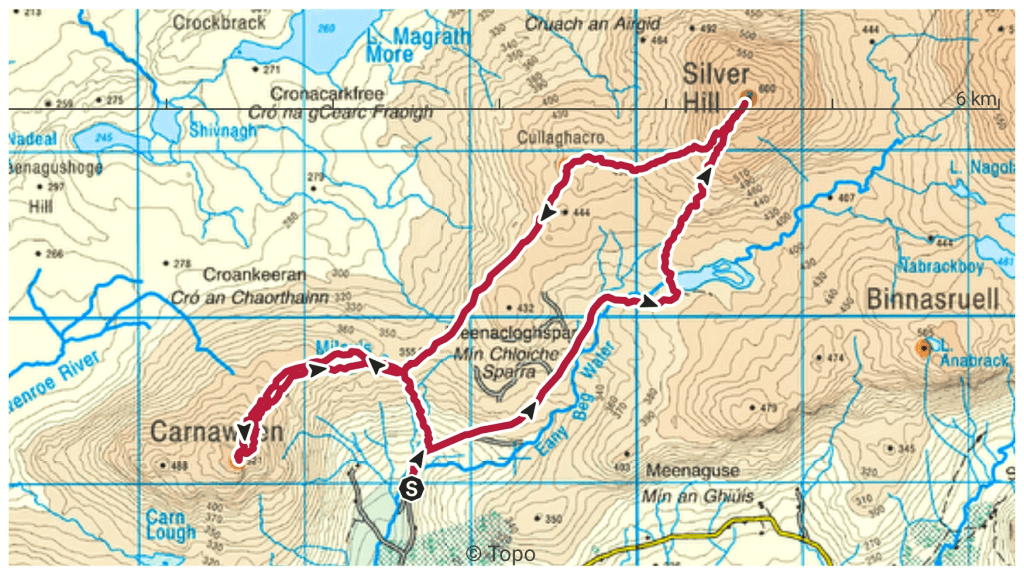
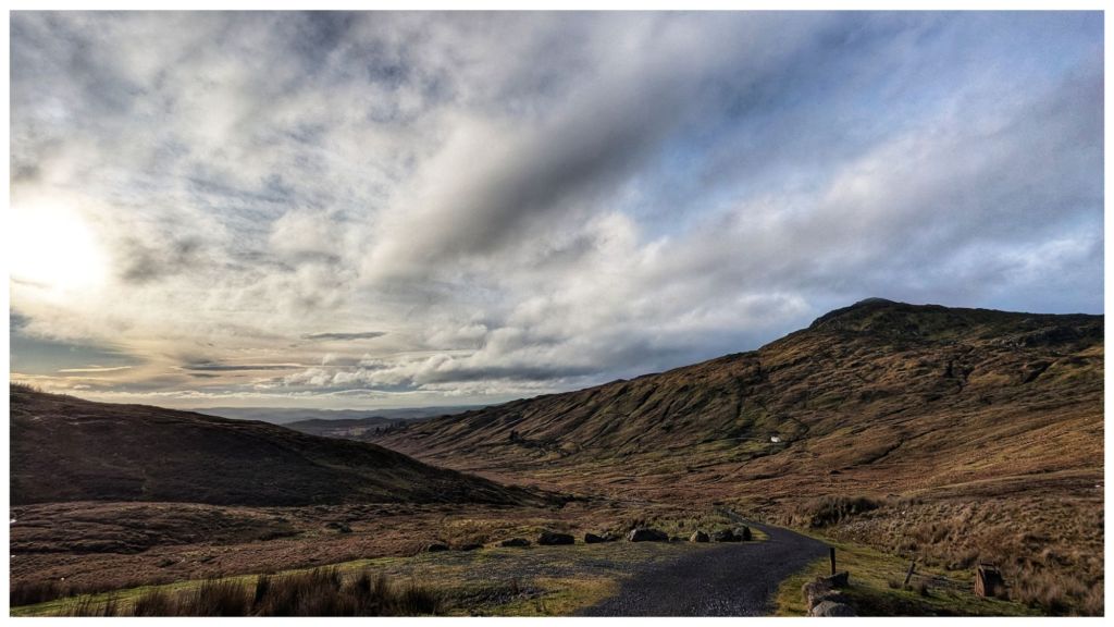
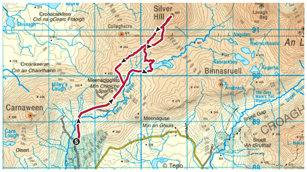
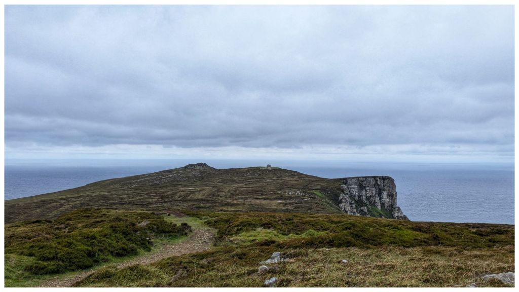
With limited daylight I wanted something relatively easy and not too long so after a trawl through my saved routes I found one that fit the bill in the Bluestack Mountains taking in two summits I haven’t been on before and at 10.5km manageable in about 4 hours.
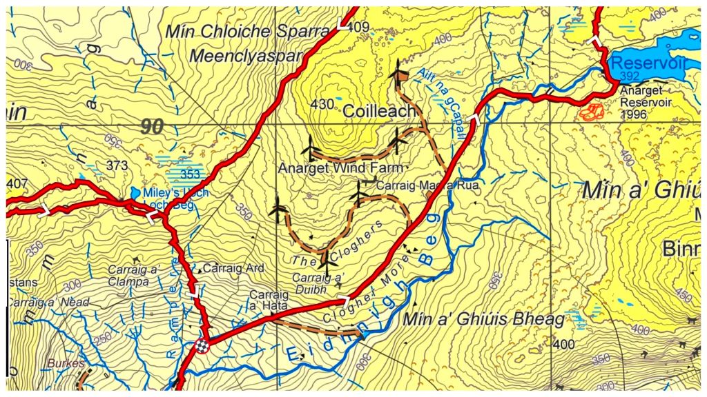
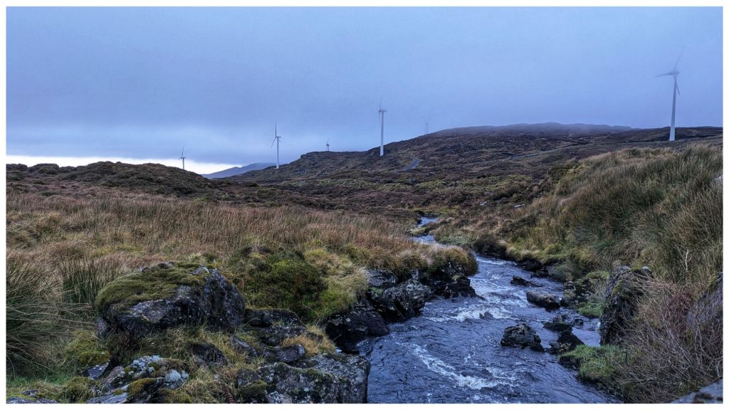
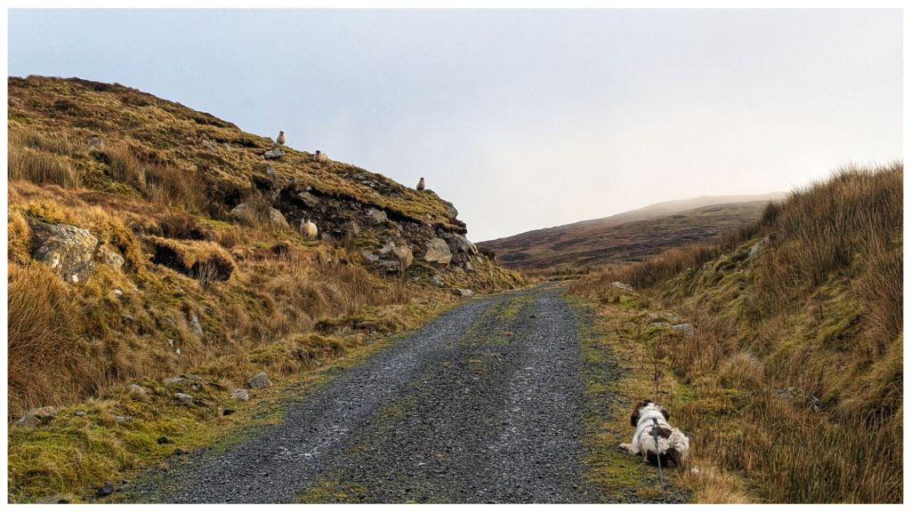
The first section is along access tracks for the windfarm that sits on the lower slopes between Silver Hill and Carnaween. It’s simple walking but steeper than I expected as it rises steeply from 200m along the Eany Beg Water to the Anarget Reservoir at just under 400m in just under 3km.
It was on this very first section that I realised I had made a bad assumption about sheep. I figured there wouldn’t be many about the hills this late in the year but I was wrong. Especially wrong here as it looks like the windfarm company have leased the land from a local sheep farmer! Also with the land sitting in a valley it’s very sheltered and a perfect location to over-winter a flock.
Cooper and sheep in a staring contest
This was Cooper’s first experience of sheep “in the wild” and he really struggled to cope. He’s hardwired to chase when something runs so it became a constant challenge to keep him under control. Thankfully I’d decided to bring my 10m long lead that allowed him to explore but also gave me the ability to restrain his exuberance!
The steep track, heavy boots that are better on hill than road and the constant stress of keeping Cooper under control meant I was glad to reach the reservoir and the main hill.
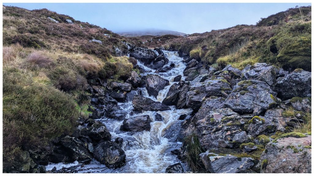
A bit OTT but the track/water interface is quite sudden!
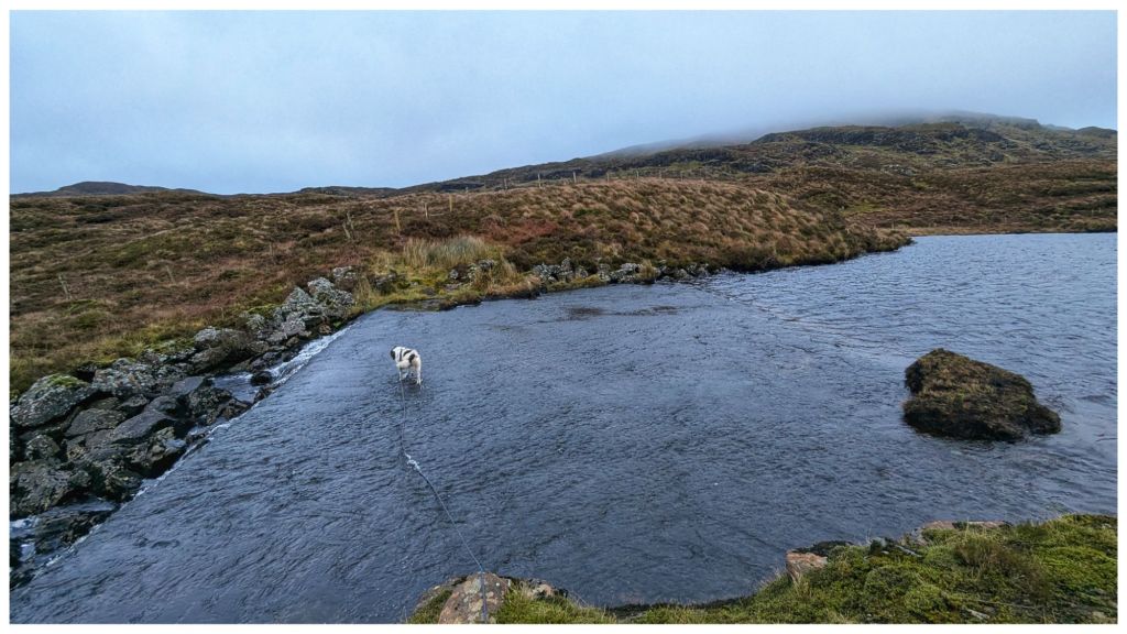
The reservoir appears to be a small lough that has been dammed at one end to create both a larger lough and a controllable stream that has a small hydro plant close to where we started. From the map I wasn’t sure how to cross the outflow end but there’s a large concrete wall that acts like a ford. I’m not sure how deep this gets but it was only a few inches deep today and easily crossed.
Cooper’s talents include the ability to walk on water
Across the lough and it was straight into open hillside. I should know better by now but I had expected better ground than what was in front of me. The Bluestacks are renowned for heavy, wet and boggy terrain but above a certain height it tends to be drier and rockier making for really nice walking. Today I had about 100m to go to get onto the good ground and in between it was some of the most difficult I’ve crossed. A constant mix of peat hags, boggy sections and cut by small steep ravines that knocked my legs for six! I was still hyper alert for wandering sheep so I’d kept Cooper on the long lead and it was a constant challenge to keep it from getting tangled in my legs and from getting caught on rocks and clumps. He had his own ideas about the best way to navigate this terrain and at 10 times the speed I was moving!
Once I made it to the drier ground it was pretty clear that I was going to need more daylight than I expected to get the full route completed. The day was quite dull with patchy low cloud rolling across from about 500m and above. Combined with my slow pace I made the decision to skip Carnaween for today and just focus on Silver Hill and getting home safe.
Looking back at Carnaween hiding in the clouds
The downside of hitting the drier ground is that it’s also steeper! Legs that were tired from the boggy bits were now complaining about the power being demanded to scramble up the rocky slope 🥵
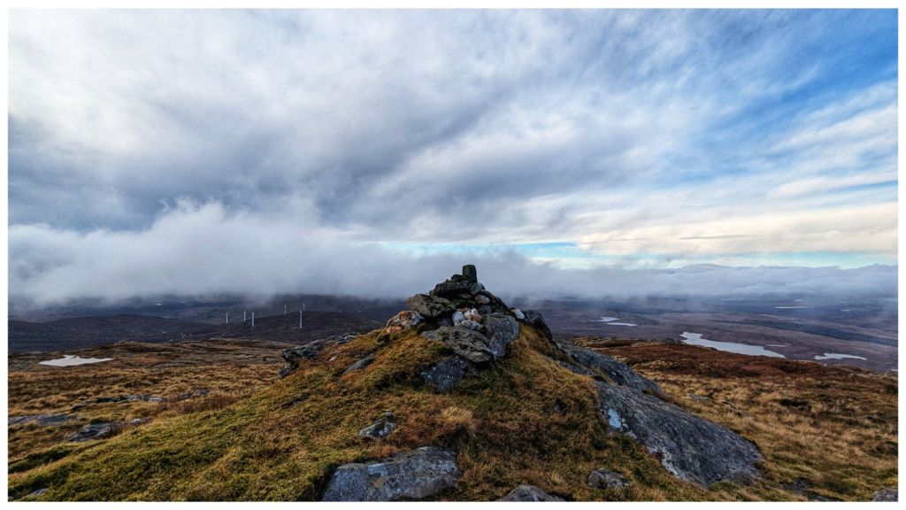
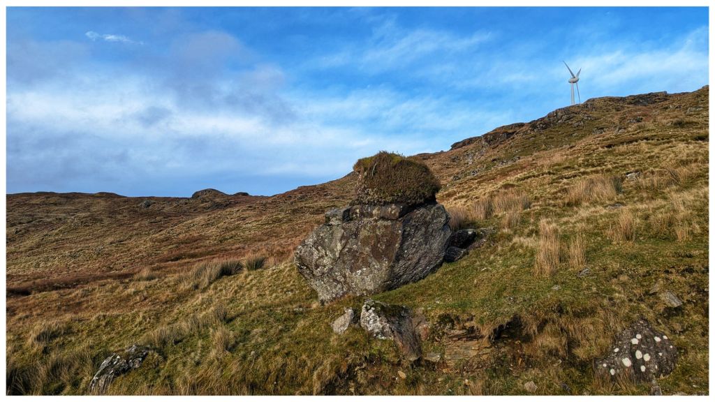
Silver Hill is a really nice mix of rocky outcrops on this side. It was a challenge to pick the best route through but it made for interesting walking and very atmospheric as wispy clouds were blowing in and out.
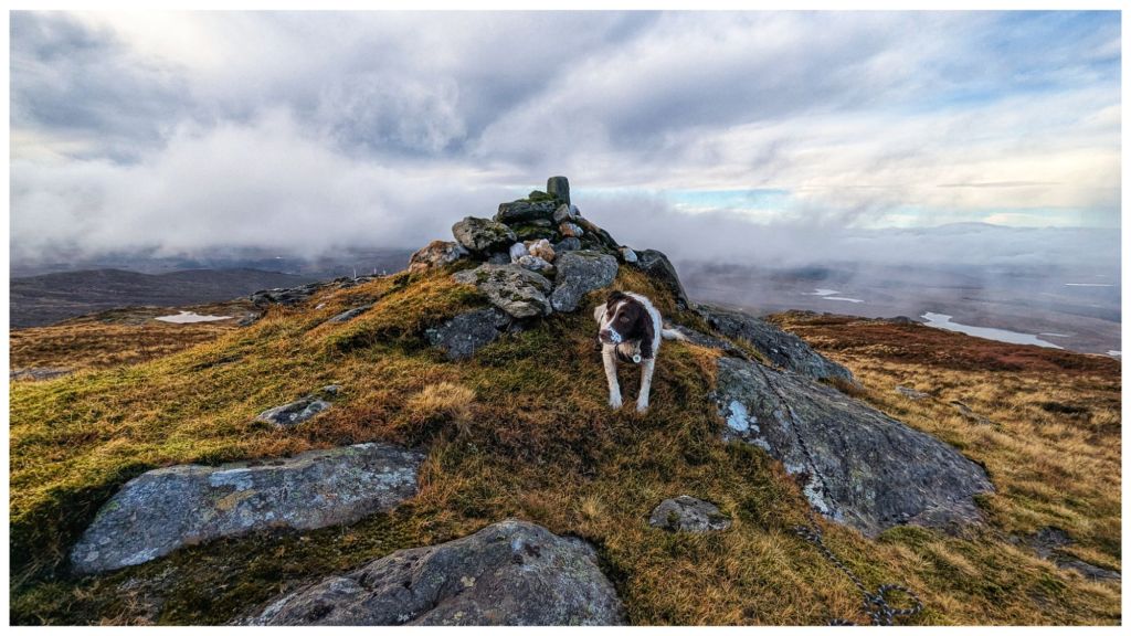
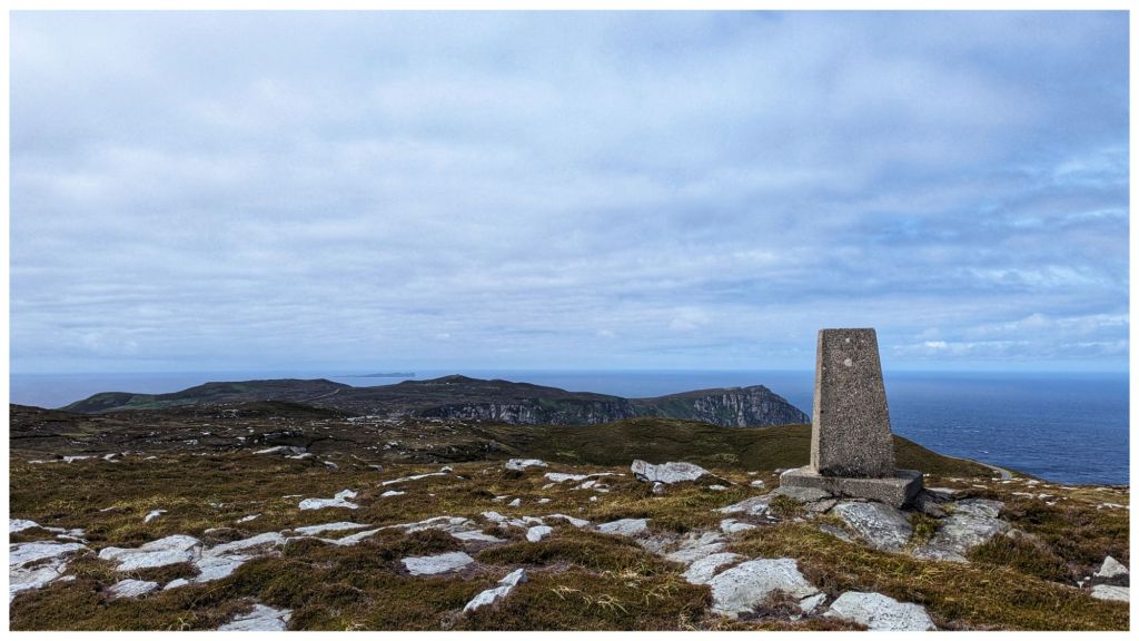
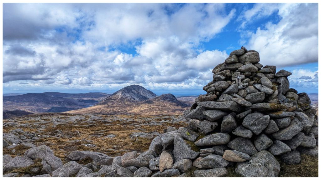
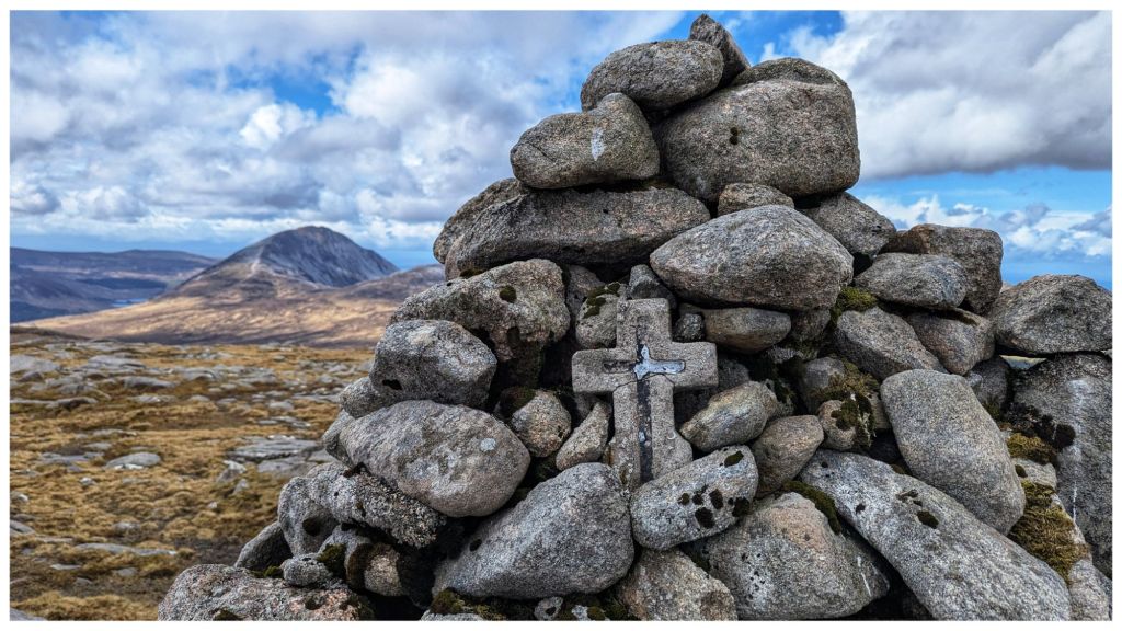
After the inevitable false summit at 550m 🙈 I got sight of the summit with a distinctive rocky cairn built on a small crag. A very regular shaped rock has been inserted into the cairn. Covered in moss, it has obviously been there for many years but gave a strong impression that it was a man made mini trig.
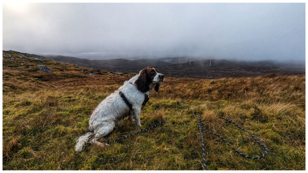
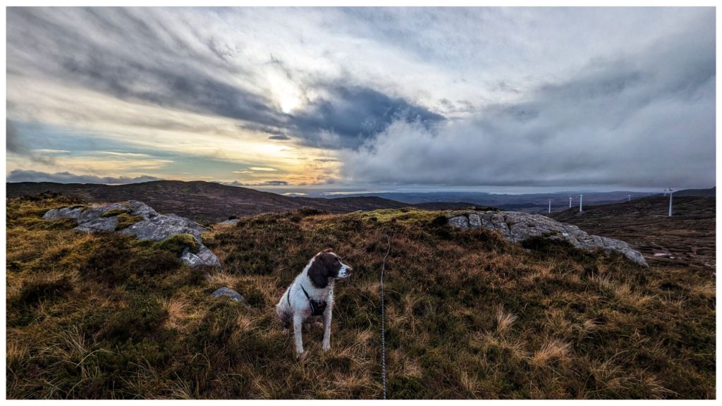
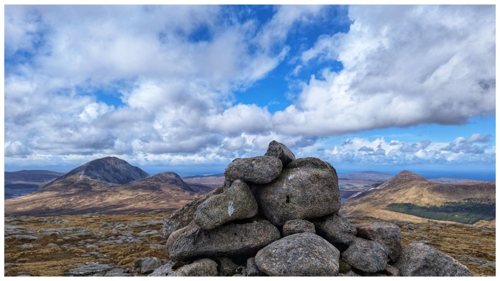
Cooper’s first summit. He wasn’t as impressed as I was! Very picturesque views all around with intermittent cloud cover.
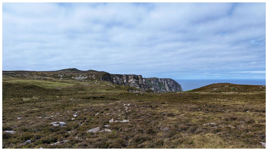
Rather than head back the way I came I decided to drop off the summit staying above the route in and heading for the highest of the windmills. This brought me roughly parallel to the planned route across to Carnaween but at a lower elevation and with an easy finish back along the windfarm tracks.
Despite improving visibility I was happy with my decision to do the shorter walk as I was once again in the same kind of ground I’d experienced just above the reservoir. Descending though was a bit easier than climbing up through it.
Descending the first section off the summit with Cooper was a challenge for the two of us. Still on the long lead Cooper was bombing on ahead in full 4×4 mode. He was happily picking his own route that usually didn’t suit me and once again at 10 times the speed I was moving. I had to keep a close eye on him to make sure he didn’t go over too steep a drop, hit the limit of the lead and jerk me off my feet. Poles were once again, unmanageable due to the lead so I was already feeling less stable than normal and was very wary of taking a tumble on slippery, steep terrain.
Pausing on the descent to admire the brightening sky
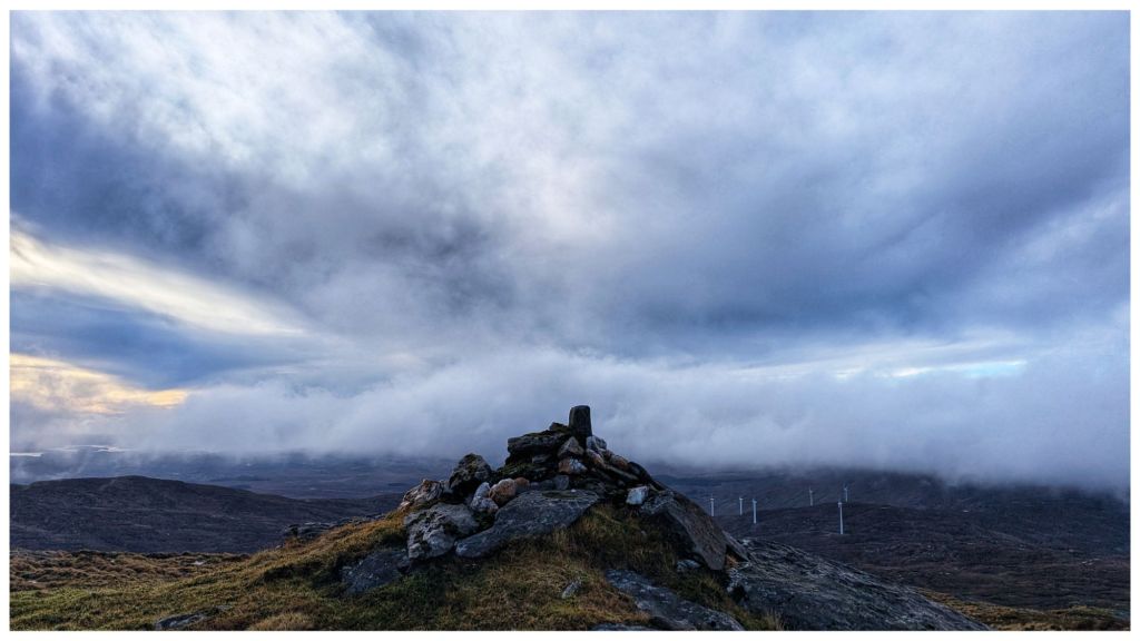
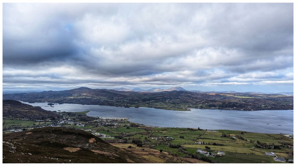
Finally reaching the windfarm again the afternoon decided to brighten up. The clouds had mostly blown away and the sun came out to give me fantastic views of Carnaween and its craggy summit. Despite this I was happy with my shorter walk and I’m looking forward to reaching Carnaween’s summit via a different approach, hopefully in the Spring.
Carnaween in the sunshine Fabulous, clear views down the Eany Beg Valley Glacial erratic with a turf top. How many years did that take to develop!
Running the final sheep gauntlet with a tired and therefore, better behaved Cooper, I was back at the car just under 3hrs after starting. I finally took the chance to have lunch and sat in pleasantly warm sunshine. You wouldn’t think it’s Xmas in 4 days!
⛰️ Silver Hill, Bluestack Mountains, Co. Donegal. 600m which qualifies it as an Arderin and also the smallest of the Vandeleur-Lynams, just sneaking over the line. Also on my Local 100 and 50 Highest in Ulster lists.
Silver Hill is definitely a summit I’d like to go back and revisit in a different season. Gerry McVeigh has a video of a wild camp on the summit as part of a longer two day hike in May this year. It’s a bit adventurous for me but I think the loop taking in Lavagh Beg and Lavagh More from Silver Hill would be manageable.
I was going to start this blog update by saying I’ve neglected it quite a bit this year but to be honest I’ve found myself stepping away from all forms of social media and at the risk of sounding very pretentious, all forms of creativity. I’ve thought about blogging and YouTube quite a bit but the drive to put something in words or on film just hasn’t been there. I’ve also been less inclined to take and post photos this year which is a big change for me. The majority of photos that I have taken have stayed on my phone only.
Last year that would have worried me as over the last couple of years I’d been struggling mentally to get the motivation to get anything done. A large part of that was that I was desperately unhappy at work and that was affecting me mentally and bleeding into my daily life. The main symptom was an increasing lethargy and lack of drive to do anything.
Having changed jobs back in August last year I’ve now had a significant turnaround. 3 years of negativity will take some work to reverse completely but I’m definitely feeling much better than I did this time last year. I’m putting the lack of social media interaction down to the fact that I’m too busy enjoying the moment to be able to document it or even feel the need to.
Cycling
One of the very first changes was a renewed interest in cycling. I hadn’t turned a pedal in over 12 months when I started back briefly in April 2024 with a spurt of 5 short rides over a 3 week period.
Self motivation was desperately lacking though and I stopped again until September following a good start to my new job. I had a few solo short spins again before reconnecting with the Club and joining the Saturday morning Stabiliser Group in mid-October for my first Club spin since February 2023!
Very quickly this became a regular Saturday fixture and I was hitting the 50km marker by the end of October having originally thought that it would be a good aim for the end of the year!
This year, despite a week here and there off the bike, I’ve made cycling a regular activity again and I’m enjoying it too. I’ve increased my distance to completing at least 100km most weeks and hitting the 100km marker at the really enjoyable Donegal Bay Sportive at Easter when a big group from the Club did various routes with many of the Stabiliser beginners completing 50km for the first time also.
For the May Bank Holiday there was an organised group spin from Ballybofey to Buncrana with the option to join depending on the distance you wanted to cycle. I joined in Raphoe for just shy of 90km.
The Club then rounded off the Summer with a fun day on Saturday last week. We bussed to Errigal and did a summit walk followed by dinner and drinks in Lettermacaward before returning to Ballybofey and more drinks before heading home at a very late (for me!) 1am. A great day of fun and laughter and a good physical challenge that was highly enjoyable.
In the last couple of years I’ve struggled to gel with the Club. It’s been mostly my own fault, being in a bad mindset and finding it difficult to connect with the other members, despite knowing some of them for a few years. Thankfully this year has been very different.
I’m not setting any massive records for the year but so far I’ve managed to clock up 2,650km for the year. It’s not a huge amount but considering 4-4,500km is average for me, that my biggest year was 8,000km and the combined total of 2022,2023 and 2024 was slightly over 2,400km I’m doing pretty well for 2025!
On Sunday the Club is running a Sportive again. There are two routes, 62km and 135km, and I’m planning for the longer route. I’ve been doing steady mileage over the last few weeks including two longer rides of 90km and 110km. I’m feeling in a good place for 135km but I’m currently in Spain for a very lazy family holiday and not sure how that will affect my fitness. We’re back home on Friday so I’ll take a short leg loosening spin on Saturday to see if that helps.
Increasing my distance like this and the subsequent increased fitness, has brought back a hunger for Audax. I’ve stayed in all the Audax Ireland WhatsApp groups so I haven’t really lost touch but it’s taken until now to really consider the daunting 200km distance once again.
The RRTY challenge (1 x 200km Audax event per month for 12 consecutive months) has had a new version launched for 2025 called RRTY 100. Basically it’s an introductory challenge for those looking to get into full-on Audax and consists of 1 x 100km Audax event per month for 12 months. I’m thinking of using that as a pathway back to Audax similar to how I used the Club Stabiliser Group to get me back cycling regularly. I’m not setting any great targets for next year but seeing as 2015 was my first ever Audax I’d quite like to get one done before the end of the year and I’m seriously considering giving the Four Provinces Challenge (see the link above) a go in 2026 as I did it previously in 2016.
To get the RRTY 100 completed I’m going to have to get at least one route published for Donegal. The nearest is currently in Sligo and the only one I’m currently aware of in development is a massive 1600m of climbing in 106km!
Hillwalking & Camping
My last solo hillwalk was in The Sperrins at Banagher Glen in the last of the Winter snow on 11th January. I’d earmarked that route for a period of snow and just managed to time it right although I did have a mild panic at the car park, deep in the Glen, when I wasn’t sure I was going to be able to get the car back back out in the compacted snow!
I haven’t given up on hillwalking though as I’ve been active with the Bluestack Ramblers Walking Club this year, completing 8 group walks from January to June with 3 in June alone. There were some great walks in there with Knockalla and the Aghlas definitely being my favourites.
I didn’t get out at all during July or August as the walks weren’t as interesting and I was busy with jobs around the house and cycling. As my cycling mileage increased my free time for hillwalking decreased and, if I’m being honest, I struggled to get enough fitness for cycling and hillwalking in the same weekend! However, I have two of interest in September that I’d like to do. They’re on the 7th and 14th which will hopefully allow me a chance to get an Audax 100 completed later in September to get the RRTY 100 started.
Another victim of cycling and the lack of solo hiking has been camping. Despite buying two new tents in the last 12 months my last wild camp was in April 2024 ! I simply haven’t had the time to give up two days for an overnighter and have had too many other things I wanted to do instead. I would like to get out and do something in the Bluestacks before the end of the year though, preferably in September or October. If nothing else I need to try out my new 2 person tent I bought specifically for Spring and Autumn camping! It was my Xmas present last year but I haven’t even managed to get it out of the box for a test pitch…
Of all my social media posting it’s YouTube that has taken the biggest hit this year. My last video release was in November last year. I did record my hike in Banagher Glen that I mentioned above, but somehow haven’t had the time or drive to get it edited and published. I’ve given it a go a couple of times and have it about 50% done so I probably will finish it eventually. However, I wasn’t really in a filming mood that day and it’s a bit disjointed. It could be a feeling that it’s not that great that’s as much to blame as lack of time for not getting it finished. I do enjoy filming and editing for YouTube though so I do see myself getting back to it, possibly with a return to solo hiking and camping but I’d like to start adding some cycling content also. That will involve some solo cycling as I don’t like to film with groups so might kick in if I start into Audax preparation…
More to come…
This is already too long so I’ll add the rest in the next couple of days.
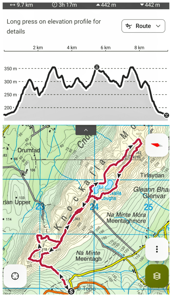
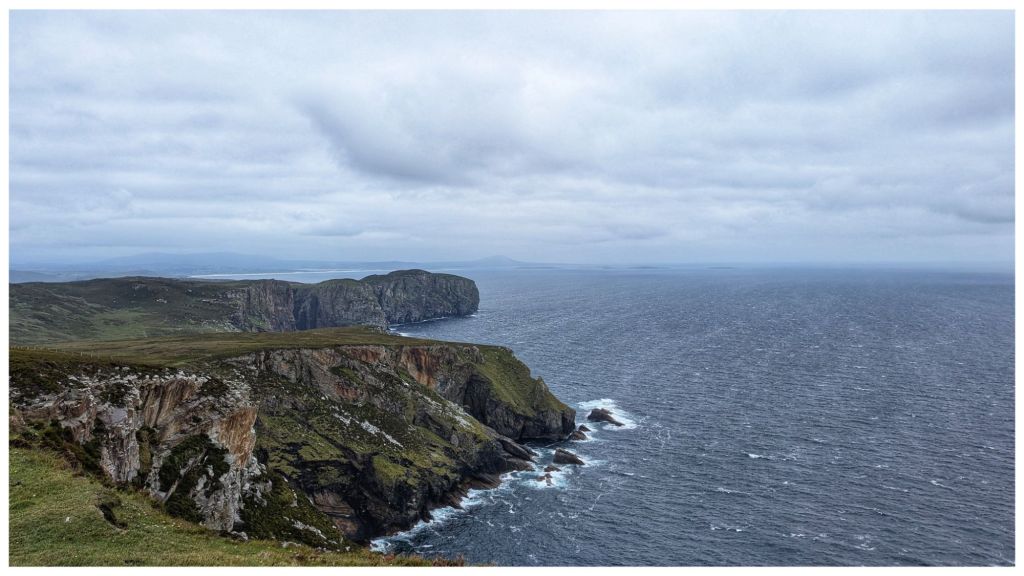
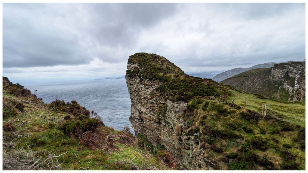
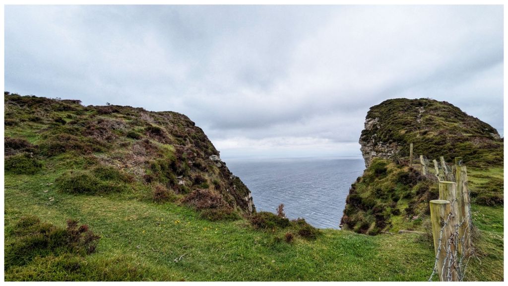
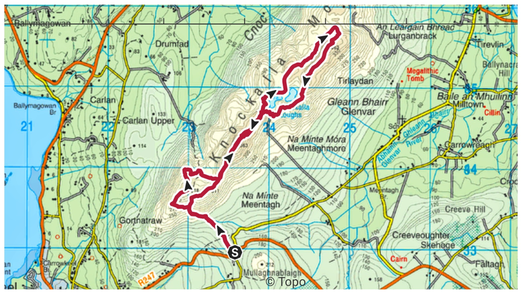
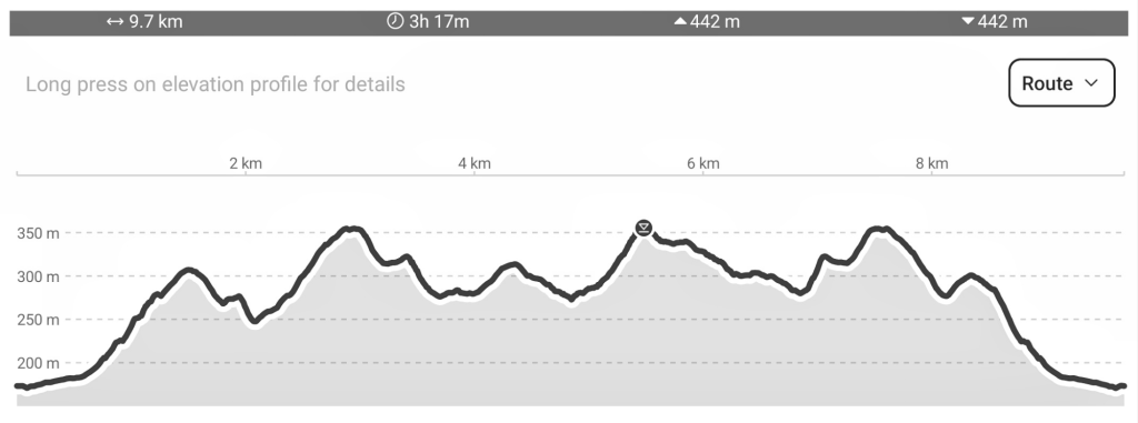
Yet another absolutely stunning walk on Donegal’s North Coast with the Bluestack Ramblers. This time on Horn Head with amazing cliff views seen from multiple angles and a trip out to the tip of the horns before heading inland to the “helicopter landing pad” (Duncap Isle) and a stiff climb back up to the highest point of Croaghnamaddy (252m) ⛰️👣
9.5km and an accumulated elevation of 734m with all the ups and downs typical of a coastal walk
What a day! A hard earned 11km climbing Dooish (651m) via Maumlack (480m) and returning via Dooish SW Top/Edenadooish (528m). We had every weather today with heavy rain showers and hail that turned to snow leaving Maumlack. Lots of sunshine between the occasional shower before more heavy rain and hail to finish.
Heavy snow leaving MaumlackLooking ahead to snow capped Dooish Errigal and Mackoght from Dooish Summit Errigal and Mackoght on the left, Aghla More on the right. From Dooish Summit. A cross in the Dooish Summit Cairn
Dooish is an Arderin and Dooish SW Top is an Arderin Beg. I’ve climbed both before but not from this side and Maumlack was a new summit for me.
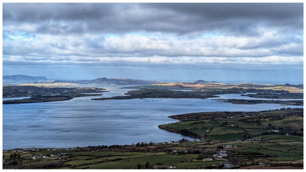
Brilliant walk up on the Knockalla ridge in North Donegal. Brilliant day and one of the most enjoyable hillwalks I’ve had for a while. Great views in all directions out over Mulroy Bay, Lough Swilly and along the coast to Horn Head, Fanad and even North East to Malin Head.
A place I’ll definitely be returning to and having identified a couple of possible camping spots I might even get up here with a tent.
I forgot to start my watch until I was almost 2hrs in so I’ve no real idea of the distance.
Edited 03.03.25 22:45
One of the other group members was tracking the walk and shared his gpx file with me. Turned out to be 9.7km with lots of up and down 🙂
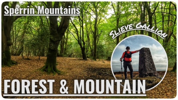
A trip to visit the two summits on Slieve Gallion in September. A repeat of a walk from 15 years ago but this time visiting both tops.
Starting from the car park at Inishcarn Forest I followed the track through the deciduous woods, back into the conifers and eventually out on to the open mountain. Two tops with a trig pillar on the main Slieve Gallion summit before following tracks and lanes back to the car park.
Back in August I went for a hike under and over Binevenagh, the most Northerly summit of the Sperrin Mountains. I managed to lose my way in the trees, follow a track that didn’t go where I expected, logged a geocache and tapped a trig. It was a mixed up day that I mostly enjoyed and the video is now live on YouTube 👣⛰️🎥
I don’t think I’ve ever written on this blog about geocaching before? It’s a hobby that I picked up in 2005 and it was my main pastime for a good few years. It suited my lifestyle perfectly at the time as it was just before Owen was born, work was very busy and it was a hobby that I could fit in with family life very easily. It was also a great way to spend more time outdoors as I had let that slide quite a lot at the time.
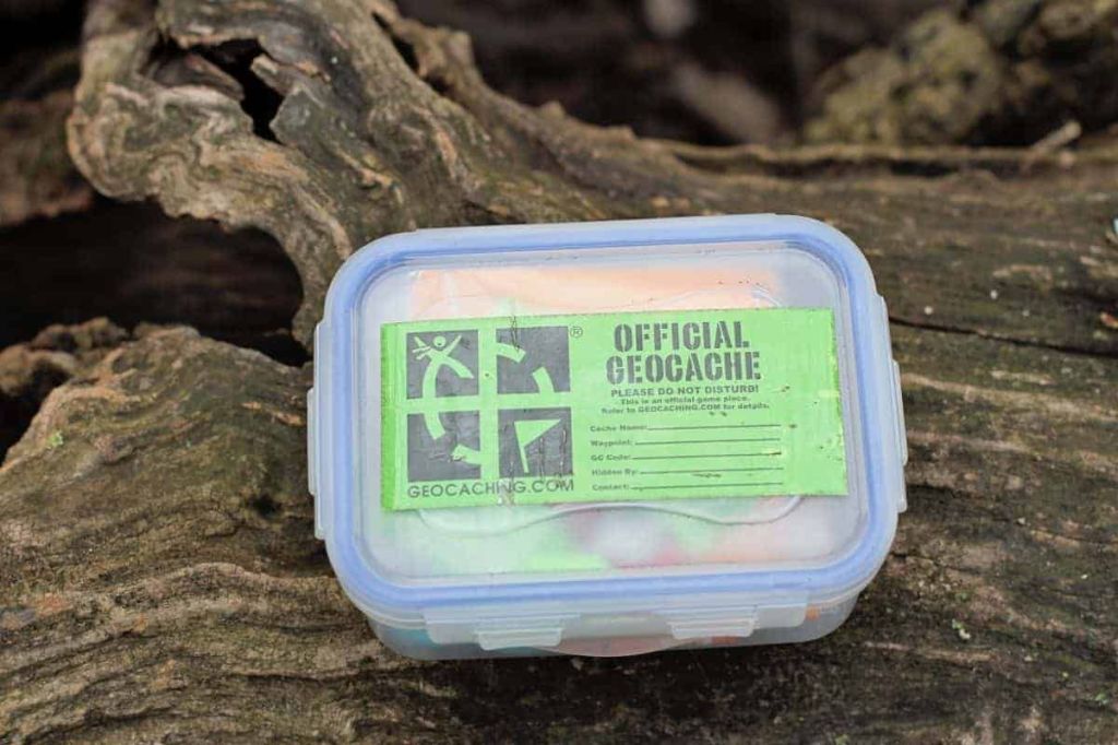
What is Geocaching? Well essentially a geocacher hides a container (sometimes large, sometimes small, often tiny), records the GPS coordinates and shares the location on Geocaching.com along with some information on the location and maybe a hint to help find it. Other geocachers then use this information to go and find the container and log their find on the website and in the physical logbook in the container.
a variety of geocache containers a lot looklike this though
In 2007 I also became a geocaching reviewer which meant I checked listing submissions to make sure they were in suitable places and not contravening any of the placement guidelines. All checks were done virtually using digital maps and asking questions of the cache owner.
The geocaching community is incredibly diverse and mostly very friendly. Through my geocaching duties and attending social events I made many good friends and a lot of them I’m still in touch with today. However, as time moved on I retired as a reviewer (2017) and gradually geocached less and less as other hobbies (mostly cycling) took over. My last physical cache find was back in 2018 and since then I’ve only logged virtual caches on holidays in Prague and Venice to add them to my list of countries.
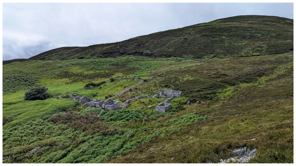
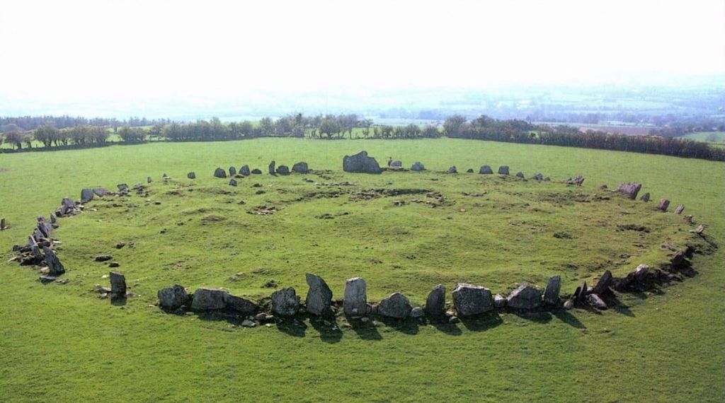
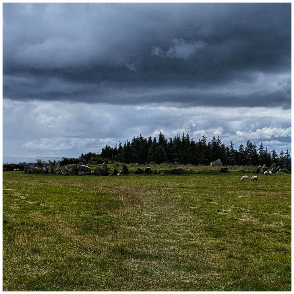
I have either removed or transferred ownership of most of my placed caches to other active geocachers but a small number still remain active under my account. One of these is at Beltany Stone Circle just outside Raphoe and a 10-15min drive from home.
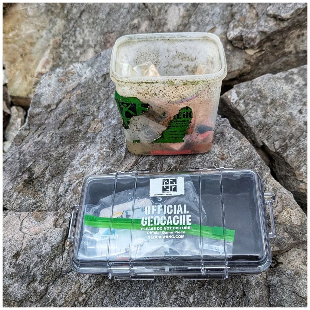
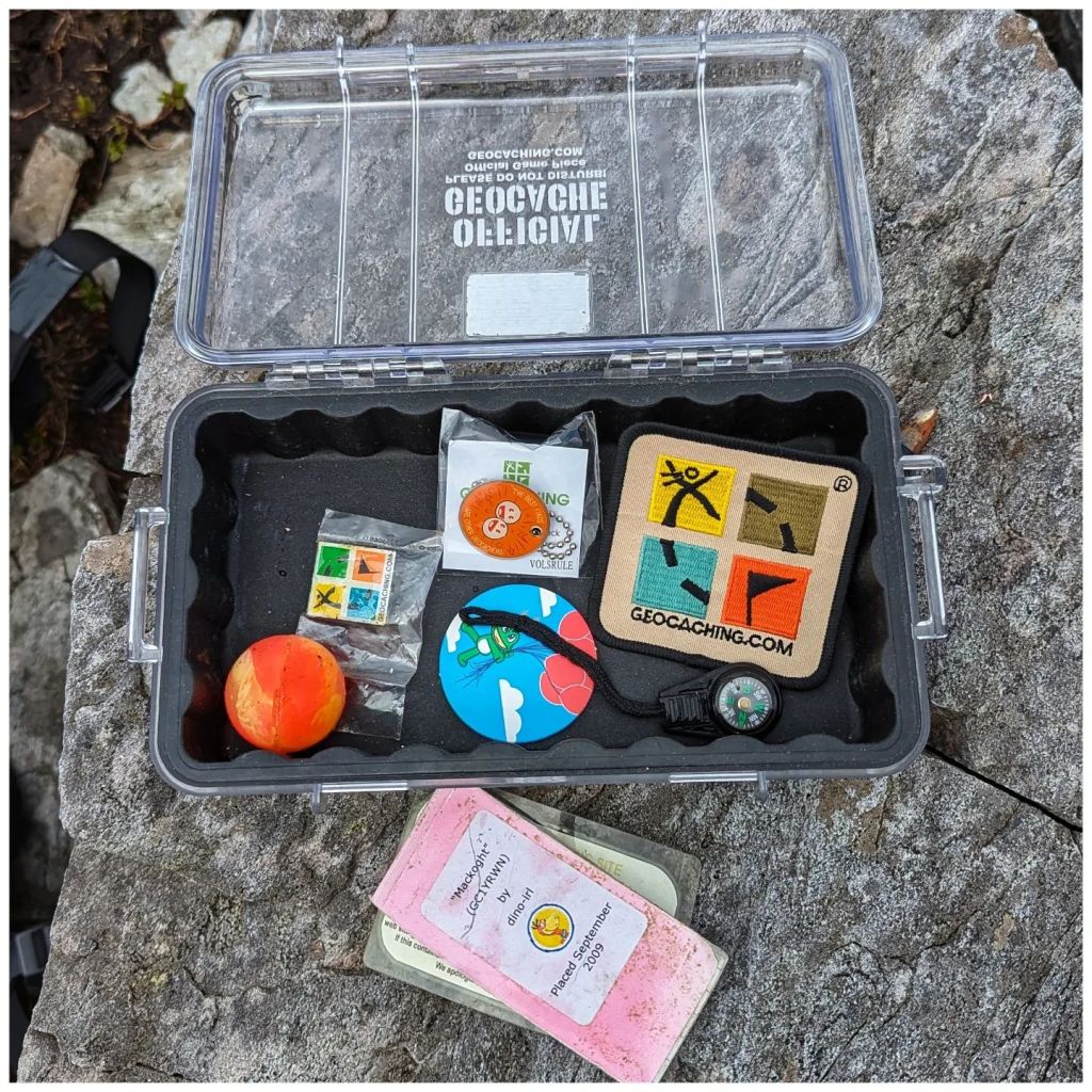
Beltany is a place I really enjoy and being so close to home this is one I hadn’t really thought of giving up. It’s not one that gets a huge amount of visitors due to it’s category of Multi-Cache so it rarely gives me any issues. In the last couple of weeks though it seems to have gone missing and I have been communicating over and back with a number of people that have been trying to find it. The weather for Sunday was a bit iffy so I dug out a box of old containers and Geocaching.com branded items and soon had a new one ready to go.
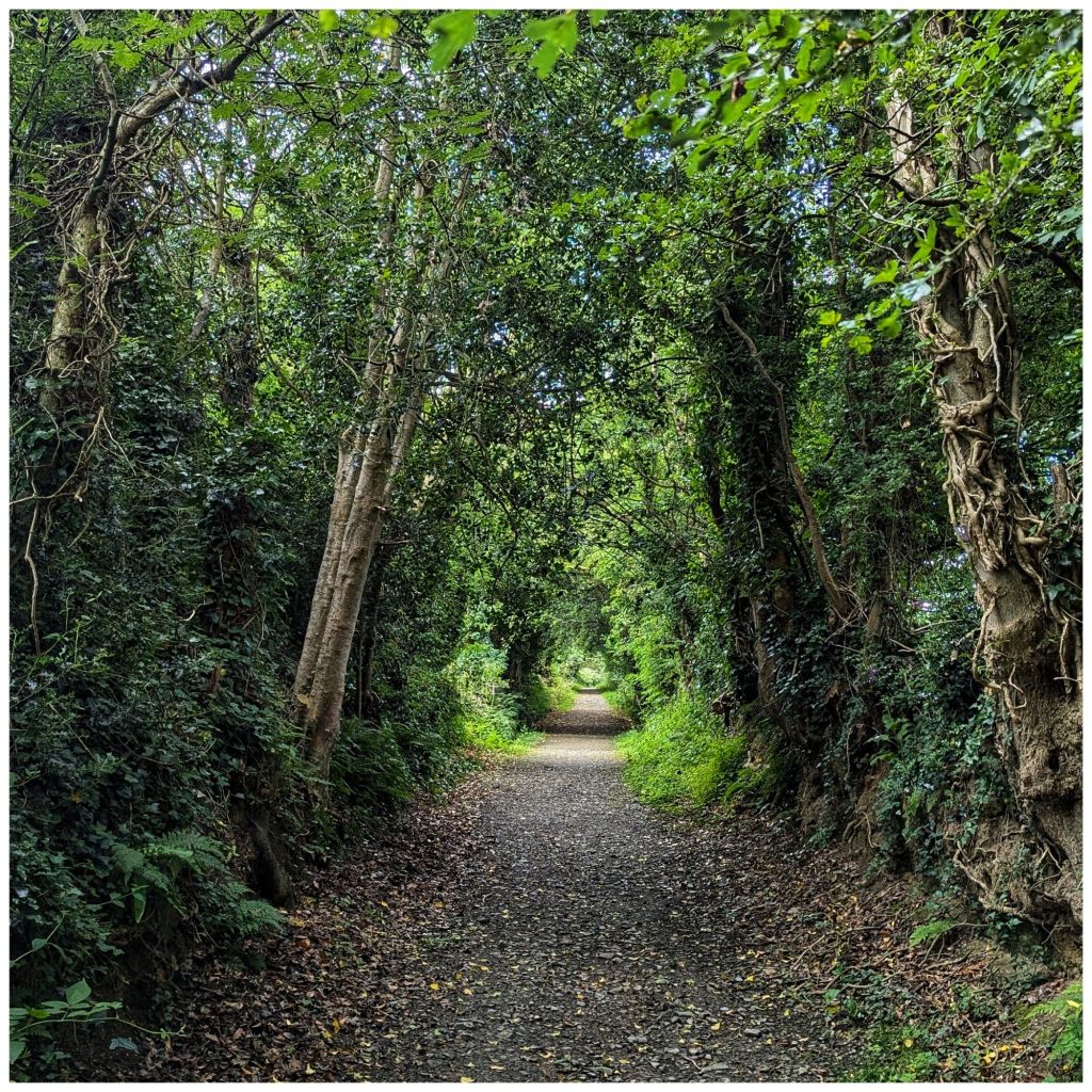
I had a very enjoyable walk up to the stone circle, replaced the cache and had a mooch around the neighbouring small stand of trees. I have a notion of bivvy camping up here at the stone circle to get the sunset and sunrise some time, getting in touch with my pagan side! I also found a couple of great spots in the small forested area for a hammock or maybe even a tent camp.
All the discussions over the last week or so must have re-ignited some dormant spark of interest as I also downloaded the geocaching app and had a quick look to see what new cache placements have been published in the last 8 years. Unsurprisingly there are a few!
My nearest one is a 5min drive from my house, on the edge of my home village and a spot I drive past at least once every day. On my way home from Raphoe I came this way, found it and logged my first geocache for 8 years. Took way longer to find it than it should have (it’s a very small hide but in the logical place, it just took a while for the penny to drop) but I put that down to being rusty.
I wouldn’t say I’m fully back into the hobby but it’s definitely sparked something again. There’s a whole new category of geocaches called Adventure Labs that sound interesting and there are two locally that I’ve highlighted to have a closer look at.
The geocaching theme continued into Monday. The weather forecast looked promising and significantly, even where showers were forecast, the cloud base was predicted to stay high. That has been a real issue for me this year! I initially had a hike in the Sperrins earmarked but instead decided to head for the Derryveagh Mountains.
I have a series of caches on two summits beside Errigal and a third at Lough Altan that are designed to be a great hike if done together. I did have one on Errigal as well but someone agreed to adopt it a while ago. All three of these caches were in need of some TLC and coincidentally I had 3 more containers left and enough Geocaching.com stuff to stock them. So my new plan was to hike the route, skipping Errigal and replace them all. This turned out to be a great decision!
9.8km with 605m of climbing
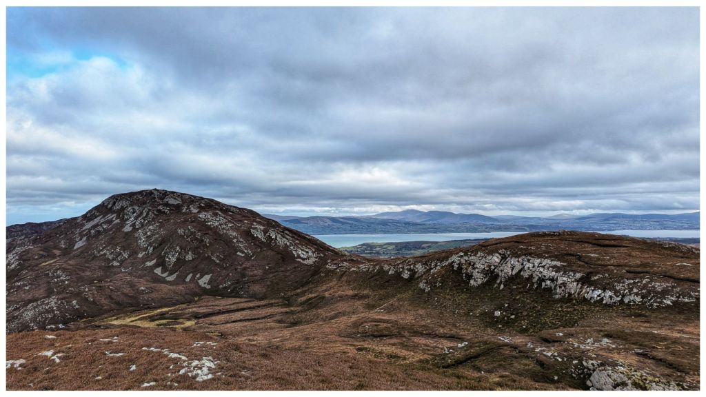
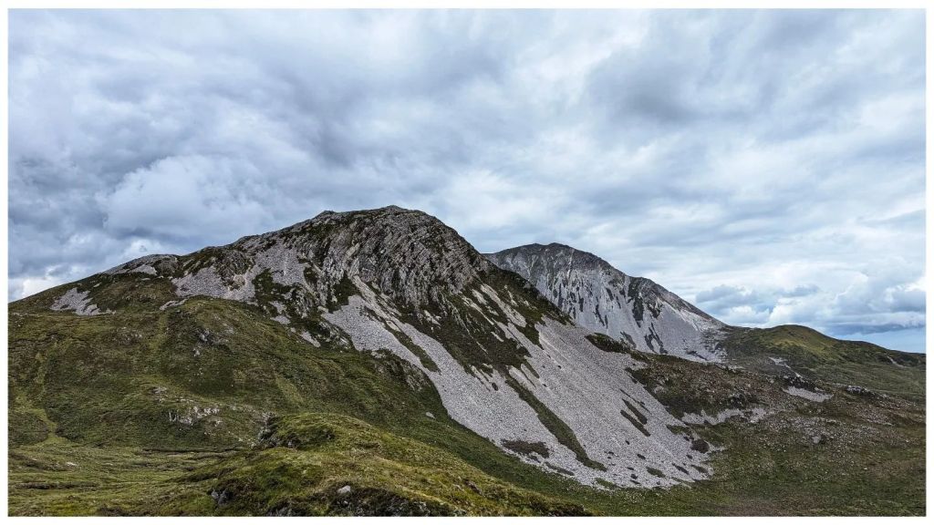
I started at the Errigal car park and followed the new path until I reached the cairn where the climb up Errigal proper starts. Here I diverted right and followed the faint track up the steep and rocky side of Mackoght (555m) which is also known as “little Errigal” or “Errigal’s little brother“.
in 100m, at the cairn, turn tight
Mackoght is a really enjoyable climb. In many ways I prefer this climb to Errigal. It’s a really satisfying mix of short grass, heather and broken rock. The summit itself is fantastically rocky with a really nice marker cairn and in my opinion the best view around of Errigal’s twin peaks.
reverse view over lough altan with the aghlas behind and muckish in the distance
I spent well over an hour on the summit of Mackoght replacing the cache container, having lunch, flying my drone and soaking in the views. The weather was perfect, lots of sunny spells and hardly any wind, a stark contrast to my last Irish mountain experience! Best of all I had it all to myself while there was a steady parade up to the summit of Errigal as the good weather drew people in. Sitting on Mackoght I could occasionally hear voices carrying across while I sat in splendid isolation.
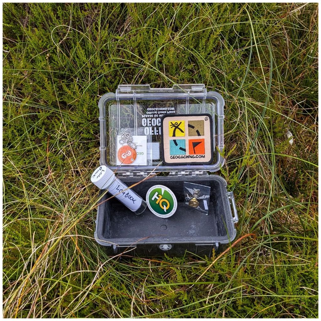
The publication date of the cache on Mackoght is 2010 but it was part of the original multi stage cache placed in 2006. That box has been up there for 18 years! The logbook was the real surprise. It’s the 2010* logbook and was still in good shape, good enough to keep using. I guess the box did a good job all things considered!
old cache, new cache still in good shape after 14 years restocked and ready to go
*I made a new logbook in September 2009 but wasn’t able to get it in place until July 2010 thanks to some help from a group of geocaching friends.
Leaving Mackoght it was a steady drop to the damp col between Mackoght and Breaghy. This descent required careful route selection to avoid the many rocky outcrops on this side of the summit that make it so impressive looking from the top of Breaghy.
little brother with big brother behind
The col wasn’t as damp as it looked from above and I was soon picking my way back up towards the top of Breaghy (392m). Some confusion set in here as there are a number of rocky outcrops. The summit always felt like it should be closer and somehow even OSI have managed to mark the wrong one as the actual summit!
actual summit with a marker cairn marked by the red circle
Anyway, after enjoying the brilliant views out over Lough Altan and towards the Aghlas I found the cache container (half full of water and contents thoroughly waterlogged) and replaced it with the brand new box and logbook.
lough altan and aghla more, breaghy summit off to the left
The final descent from Breaghy to Lough Altan was “fun“! Instead of the longer and more gentle route I decided to take the steeper, direct route. Halfway down, scratched to bits by heather and with a bum wet from sliding numerous times, I realised it wasn’t a great idea and contoured around to a much more sensible and easier descent and was soon crossing the stones on the river just before the ruined tower.
altan farm from partway down breaghy
Here I met the first people I’d seen since leaving the Errigal footpath. A Mum and Dad and 3 teenagers were just heading back to the road. They were friendly but not chatty and I did wonder if they were geocachers. I wouldn’t imagine that many people make the effort to walk out to here and they didn’t really look like hikers if that makes any sense? I haven’t had any logs on that cache yet so they probably weren’t.
As I was now alone I headed to the cache location, retrieved and replaced it. The original container was a large vitamin bottle in a hole between rocks. The issue here is that the hole is deeper than I originally thought. The first container from 2006 disappeared into the bowels of the earth as it was too small and this one replaced it in 2010. Even still this one required the full length of my arm to retrieve which wouldn’t be pleasant on a wet day! So, the replacement is much larger and is attached to a hidden external tent peg via a length of paracord that should make it simple to retrieve yet still unlikely to be discovered accidentally.
I took a while here on the edge of the lough to enjoy the view and take some photos but with time marching on I couldn’t sit too long and began the climb out along the boggy track. I was last here in August 22 and back then the track was horrible with large sections flooded with deep boggy holes. Thankfully it has dried out a lot since then and only one or two spots caused me any concerns.
neighbours at the back door compulsory photo of the tree through the front window with the lough in the background altan farm and the aghlas from the track out
I arrived back at the Errigal car park approximately 5.5 hours after starting with 9.8km hiked and 605m of climbing. It should have been quicker but I spent a lot of time enjoying the views and it was time well spent. This was the most enjoyable hike I’ve done for a long time and part of that was the good feeling from getting these caches back to the standard that the locations deserve.
I’m not sure how far my renewed geocaching interest will take me but it’s a start anyway and totally unexpected…