We’ve just been through what qualifies as a heatwave in Ireland and Sunday was the last day of mega sunshine, high temperatures and the extended period of dry weather.
Definition: A heatwave refers to a prolonged period of abnormally hot weather which may be accompanied by high humidity. While there is no generally accepted definition of a heatwave, in Ireland it’s classified as 5 consecutive days with a maximum temperature in excess of 25 degrees Celsius”.
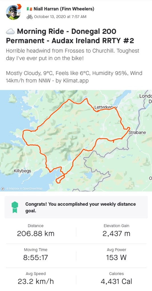
Sunday was also the last day available for me to complete a 200km ride to qualify for RRTY. It would also have to do double duty and count for my Metric Challenge ride for July. Due to various weak excuses I wasn’t able to fit it in earlier this month. Our wedding anniversary was the only other available day and the flag I attempted to run up for that date was mercilessly (and unsurprisingly) shot down.
Heat was going to be a challenge so I decided to set a 5am alarm and get on the road early. I also decided to do my own Donegal 200 Permanent so I wouldn’t have to drive to the start and therfore start cycling earlier. Due to a bit of faffing around with my Garmin I ended up wasting half an hour and getting started at 620am, but only 20min later than planned.
Even leaving at this time the temperature was still 13°C. It was 18°C at 8am, 20°C by 10am and 24-26°C in the afternoon. As a result it was a much more laid back ride than usual. I made sure to keep my power well down to keep my heart rate low and therefore my speed suffered a bit.
donegal bay from mountcharles pier
I also took plenty of breaks. I was going through water pretty quickly (at least 6L throughout the day) and made good use of the many shops along the route to stop and refill. My main break was at Ardara, at just under 100km, where I had my lunch in the sun outside a local service station. On my inaugural ride of this route back in October I missed this shop but amended the route shortly after to include it. It’s a definite route improvement as it’s a fully stocked shop with good toilets, a hot food deli and an indoor seating area. The indoor seating was unavailable on Sunday due to Covid restrictions but these should be lifted shortly and it will be an important refuge in colder, wetter months.
gweebarra bay and bridge
My most enjoyable break came just before the hardest climb. On my 100mile ride last month I’d noticed a large lough on the edge of Glenveagh National Park. I always had a plan to wear a wet buff under my helmet and down the back of my neck for the toughest climb up to Glenveagh as I’d be hitting it in the early afternoon. Leaving Ardara I remembered this lough and had the idea of stopping for a chance to cool my feet in the water.
cooling off at lough barra
This was my best idea ever! By the time I reached the lough (Lough Barra I discovered from the information board) my feet were hot and swollen and getting sore. Soaking them and my legs up to the knees was a beautiful relief. I splashed water over my head, down my back and arms. It was glorious. I was pretty soaked but cool and dried out quickly in the strong sunshine. There was a family there kayaking and if not for them (and the proximity to the public road) I’d have been tempted to strip off for a fully submerged dip! It took a real effort to dry off and leave but off I went with a soaking wet buff dribbling cooling water down the back of my neck.
lough veagh from the head of glenveagh
I ended up stopping twice more, in Churchill and Raphoe, to cool off in the shade, buy more water and eat more food. The heat impacted my average speed (24.2km/hr) with my 200km ridden in 8hr 16min. My usual target is sub 8hrs so I was still pleased. My total time was longer than usual too at 10hr 40min but I needed those extra stops and I enjoyed every one of them so it was all worthwhile.
I may have mentioned it before (🤔) but RRTY stands for Randonneur Round The Year. It’s an Audax Ireland challenge to ride at least one Audax route (minimum 200km) each month for 12 consecutive months. I’ve tried 3 times before but have quit for various different reasons. My longest streak so far was 4 starting in 2017, which derailed in December that year due to lack of motivation. My latest attempt was last year when I got frustrated by Covid restrictions and decided to park it until things had returned to normal.
My tentative plan through the first part of the year was to restart in June. I figured this would give me a number of months of decent weather and longer days to build some kind of momentum into and through the tougher winter months. It would also give me a chance to build my fitness to a level that would make this all possible.
I’ve been building my distances throughout June with an early 100km spin, a strong 165km spin and a hilly 87km ride to get the legs in shape and build my mental confidence. This, combined with work and family commitments meant it was going to be very late in the month to get this done. The weather forecast was predicting a great day for Wednesday and I took the reasonably safe gamble to leave it to the very last day of the month.
I have a choice of three nearby permanents; my own Donegal 200, the Fermanagh 200 and the Dark Hedges 200. I chose the latter as it’s an easy drive to the start, a route I’m familiar with and easy to navigate and it has the least amount of overall climbing.
The sting in the tail is that it’s very unbalanced with the climbing increasing towards the end. In the first 50km there is a total elevation gain of only 180m (the next 2km have almost 30% of that alone), 50-100km is 400m, 100-150km is 520m and the final 50km is 650m. In that last section 320m is gained between Moneyneany and Feeny alone at 150-165km.
interesting elevation profile!
The weather didn’t turn out as good as predicted but good enough. I started about 7:45am and expected a chilly start so was wearing arm warmers and my wind/waterproof gillet. This also gave me a higher degree of visibility in the early morning pre-rush hour Derry traffic. I really didn’t expect to have to wear this for the first few hours. With dull, grey skies and very low cloud it wasn’t until 1:30pm that I felt able to remove the gillet, followed by the arm warmers 20min later. It was quite warm when stopped but chilly when moving in my self created wind. The rest of the day was then a real scorcher which added a bit of extra bite to the climbs later in the day.
I changed my bag setup a little this time. For the first time I used the Podsacs frame bag I purchased back in January paired with the saddle bag and my usual top tube bag. On these longer runs I like to carry sandwiches, sweets, power pack and charging cables to keep me and my recording devices well topped up. The frame bag allowed me to carry much of this in the middle of the bike, keeping the centre of gravity low and retaining good stability. Bar bags and larger saddle bags inevitably introduce a measure of “swing” when standing but the frame bag didn’t. In addition it is very accessible on and off the bike and gave me lots of space for storing my gillet and arm warmers when I was eventually able to take them off. Well worth the slight extra hassle involved in using my water bottles.
I gave a pretty detailed route description in my September post and it hasn’t changed since. I felt a bit stronger this time though and the wind was a lot more favourable. It was very light and ended up on my back from Ballymoney to Maghera making it a lot less of a slog than normal. My 200km time was 7:56 moving and 9:50 total time bringing me home under both key time targets and giving me a huge confidence boost.
the dark hedges at 90km
Last time I took a nutritional gamble on a cowboy supper in Ballymoney at 105km. I was delighted to see this still on offer despite the renovations under way at the shop. This is now my traditional mid way feed on this route 😊
At the end of September Donegal was moved to Level 3 of the government’s “Plan for Living With Covid19“. From a cycling point of view this means I can no longer leave the county. In order to keep going with the Audax Ireland RRTY Challenge I needed a Donegal option as the Dark Hedges 200 is Co. Derry and Antrim. Taking a provisional route from a couple of years ago and some modifications I came up with a good route staying within the county boundary.
I sent the route to Audax Ireland for consideration and within a couple of days it was reviewed, accepted and published on their website. I was surprised how easy it was and I was a little bit caught out as I hadn’t put much of a route description in but getting an edit was as simple as sending a second email with my description.
Actually riding the route was the next challenge! I had ridden the majority of it before but not as one complete route and the section from Ardara to Doochary was completely unknown to me.
I had booked a couple of days off work and had planned to complete the route on one of these. Looking at the weather forecast the previous week, I’d settled on Tuesday. This worked well as it gave me Wednesday as a rest day before going back to work as well as what was predicted to be the best weather day.
Monday evening it looked like the wind was changing direction and staying strong for longer than initially expected. Getting up on Tuesday morning it had worsened further swinging around to become a N/NE breeze and up to about 24km/hr through the middle of the day. This would of course coincide with the time I’d be cycling straight into it from Donegal Town to Letterkenny!
My plan was to get up at 6:30am and get away from the house by 7:30am. I spent ages faffing about, trying to decide whether or not to go or delay until Wednesday. It was 8am before I convinced myself to go and if I’d had even the slightest encouragement from Catriona I’d have stayed put.
It was a real novelty doing an Audax without having to drive to the start. The official starting location is Ballybofey but you can start a Permanent at any point along the route. As it passes the end of our road (clever route design!) I was on the official spin within 5min of leaving the house.
My first 10km is the last 10km of the route and pre-lockdown would have been my warmup for going to a Club spin. Heading into Ballybofey I met the start of the early school/work rush hour build up and thankfully I was soon out of town and off the main road heading up the first climb of the day to the Derg Line via Meenglass. I was nicely warmed up and felt pretty good, keeping my power and heart rate low and cadence high. The road wound up the hill with high hedges forming tunnels at times and with the leaves turning there were loads of photo opportunities but I had to enjoy looking only as I didn’t want to stop on the climb.
The Derg Line meets the main road again just before Barnes Gap. This is a lot more enjoyable as it’s mostly a fast drop through the actual Gap with a good hard shoulder. The only negative was the windmill construction work part way down and the resulting muddy hard shoulder that left me spattered literally from head to toe and regretting not using mudguards.
barnes gap in january 2010
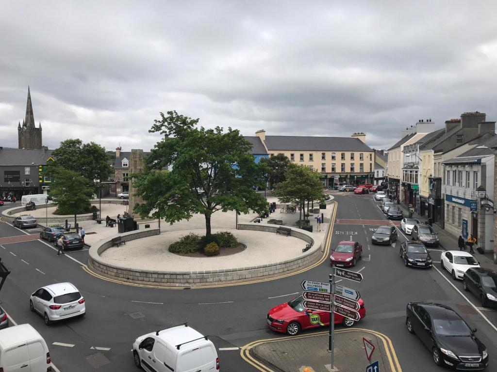
About 7km later the route leaves the main road again and heads for Laghey via back roads and eventually on to Ballintra. I rode this a couple of weeks ago as part of a Club spin so it was very familiar as well as enjoyable with a slight tailwind to make things easier. Ballintra is also the first control point. It wasn’t easy taking a selfie in this small village without getting funny looks from the few residents out and about at that time of the day.
⚠ weirdo in town ⚠
The route bends back towards Donegal Town avoiding the main road by using some of the back roads that wind around Rossnowlagh and Murvagh, both locations of beautiful beaches but both unfortunately out of sight. It eventually spits back out on the main road back at Laghey but only for a couple of KM before heading into Donegal Town centre and back out the Killybegs Road.
Dunleavys Spar on the outside of town gave me the perfect opportunity for a sandwich, tea, water top up and a toilet break at 65km. As the showers were drying up and the sun showing its face I was also finally able to remove my Sportful water resistant gillet and enjoy the weather.
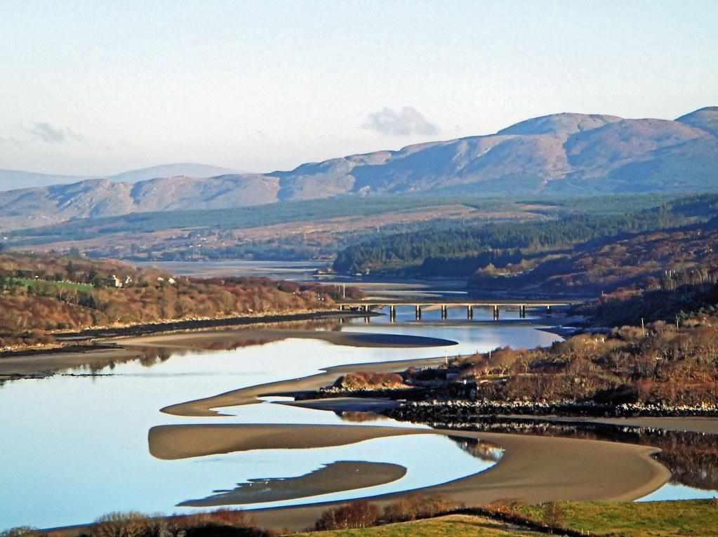
The improving weather nicely coincided with some of the more scenic sections. Heading out the main road towards Mountcharles the route takes a left down to the coast and follows a beautiful coast road around the bay. Views were fantastic across to Co. Sligo and Mayo as well as further along Donegal Bay. After a few KM the route turned more Northerly and the climbing work began.
At this stage I was climbing for most of the next 12km until reaching the top of the ridge between Frosses and Glenties. This was a bit of a test of my climbing legs and fitness but so far, so good and I was feeling happy about the day so far. I was also starting to head more into the breeze but it was still light and I was sheltered to a large extent by the very ridge I was climbing. Over the other side I was descending towards Glenties and the breeze helped cool me off after the long climb.
The road drops down to the main road between Glenties and Ardara but the route I designed turns off before the last 5km and uses small back roads to approach the outskirts of Ardara. This was my only route miscalculation but it was a bad one. I’ve never ridden these roads and relied on RideWithGPS to plot the route. Unfortunately this took me along a farm lane that was basically rock and mud with large potholes and no tarmac at all. I was extremely worried about damaging my wheels or falling off but also didn’t want to get off and try to walk for fear of soaking my feet or twisting my ankle. I didn’t want to go back and didn’t know where to detour so ended up going on, very slowly and very carefully. Eventually the lane spat me out on some poor but infinitely better tarmac and I was soon back on the road and approaching Ardara. This miscalculation has now been removed and rectified for the next time.
I didn’t enter Ardara proper as I once again used side roads to bypass the town and bring me out on the Narin/Portnoo road. I’ve also decided that this was a bad idea as the next shop isn’t until Letterkenny, almost 70km away. The new route would leave Ardara as an approximate halfway point and a good option for a hot meal or a cup of coffee/tea at the very least, especially important for the colder months.
Leaving Ardara I was now heading straight into the breeze. The sun was still out so I was feeling OK and still confident. This is a lovely scenic area with lots of views but I kept pushing on for the second control. This is at the Dolmen Centre, a community centre named after the Kilclooney Dolmen located a short walk away. As you cycle this area there is a real neolithic feel as there is an amazing amount of large exposed rocks filling the landscape. This whole area must have been deposited with rocks as the ice retreated during the Ice Age. Many of the gardens have embraced the rocks and integrated them into their gardens and landscaping.
The Dolmen Centre was the mid way point for me and I used the picnic bench outside as an opportunity for a break and unfortunately just a cold lunch. I would have loved a cup of tea at this stage as the sun had now disappeared and the wind was getting stronger and colder. It was here that I met a very chatty local lady walking her very furry whippet dog. She had a problem with her electric bike the previous night, left it propped up outside the Church and couldn’t find it today. She seemed very laid back and relaxed that it was missing despite it being her only form of transport so I hope someone just made it safe for her and that she got it back.
control 2 – 105km
Leaving the Dolmen Centre the road goes through a series of short, steep rolling hills and swings around to the NE. This is where the wind really made itself known. I always struggle with the third quarter of any Audax I’ve done. It seems to be a combination of energy levels both physical and mental. This was also a really hateful section of road. The terrain and the wind seemed to be conspiring against me, I was getting cold and tired and really questioning my decision to go out today. Somehow I dragged myself round the coast to Lettermacaward, across the really impressive Gweebarra Bridge and into Doochary. This section is beautifully scenic but my heart really wasn’t in it and I just focused on keeping the pedals turning on a bike that now seemed to weigh three times what it did earlier.
I stopped again shortly after leaving Doochary. It was simply where I could get pulled in, an unremarkable little stone bridge over a noisy stream, sheltered by some trees and out of the wind. I had some more food and a few jelly babies to try and force some motivation and energy back into me. One of the toughest sections was ahead of me and I didn’t know if I had the strength and will to keep going. I felt as battered and bedraggled as my poor bike!
The next 15km was the hardest cycling I’ve ever done. It’s through the increasingly mountainous and very steady climb to the top of Glenveagh where the Bridal Path meets the main road. Mountainous in Donegal means open and exposed, this is rural Donegal turned up to the max. There is nothing out here except sheep, blanket bog and wind. Unfortunately the wind was now very blustery and cold and straight into my face with no shelter to give respite. For what seemed like hours I ground my way very slowly up this road, head down and struggling to keep my speed above 10km/hr. I lost track of the times I talked myself out of stopping and if I hadn’t been out of network I honestly think I would have pulled the pin and called Catriona to come pick me up.
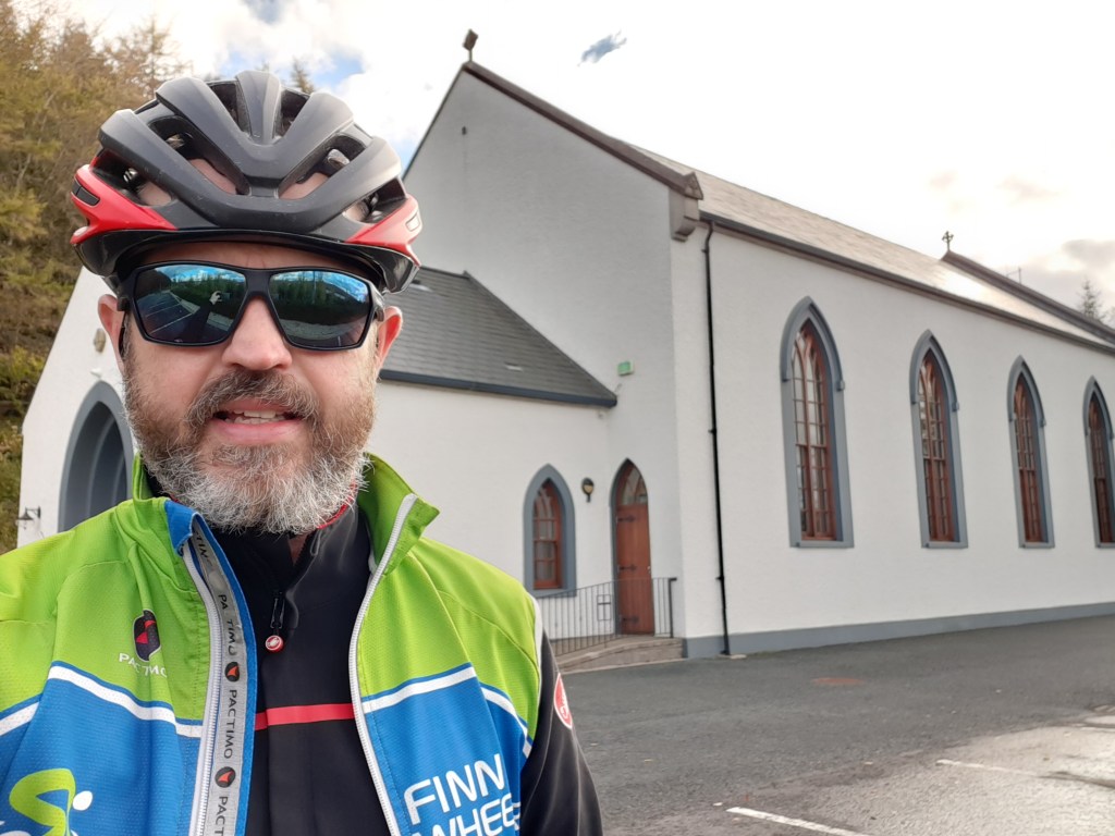
Eventually I reached the top of the climb and faced a long steep descent into Churchill and control 3. I was really looking forward to a break and a chance to recover on the descent but it wasn’t what I expected. I now had the wind buffeting me from the side and I had to concentrate really hard to stop being blown into the side of the road as I passed gaps in the hills where the wind whipped through, seemingly determined to get me yet. Finally reaching the shores of Lough Gartan I was relieved to get shelter from the trees and hedgerows and take a break at the beautiful Glendowan Church on the edge of the lake.
control 3 – 150km
Leaving Glendowan it is straight into a really steep hill that annoyingly turns into a T Junction about 3/4 of the way up. Once over this though I was dropping back down again and through the village of Churchill and heading for Letterkenny. Despite being a rural area this is quite a wide road with a good surface and one I know fairly well. The familiar landmarks of townlands and junctions lifted my spirits and I started thinking about another, final foodstop.
Passing the turn off at Newmills I ignored the irritated beeping of my Garmin and diverted off my course to the service station just under 1km up the road. I desperately needed something warm to eat and drink. Unfortunately the deli was now closed but they had a very welcome tea machine and I couldn’t resist the glazed donuts and a much needed chocolate bar. I sat outside, people watching, enjoying my tea and sugar and finished the last of my sandwiches. The sun was totally gone by now and the temperature dropping so I layered back up with some of the clothing I’d removed what seemed like a week ago in Donegal Town before heading back to the planned route and feeling more optimistic about completion.
This final 40km wasn’t easy but I was very happy that I’d decided to ride it for the first time a couple of weeks ago. I was familiar with the terrain and the junctions and could have ridden it without my Garmin. I knew where I had to conserve energy on the longer climbs and where I could push on to maximise my momentum. I could almost physically feel the miles clicking off and home getting nearer. The sugar infusion combined with an improved mental attitude put energy back into legs that seemed to have given up not that long ago.
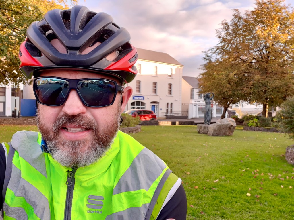
In typical Irish tradition the wind that now should have been an assisting tailwind had dropped off as I came back down to lower levels and while it was still there it wasn’t the helping push I’d hoped for. Almost before I knew it though I was over the last hill into Raphoe and dropping down the fast descent into town. I think I may even have been smiling again!
A quick stop in Raphoe to take the control photo, text Catriona to say I’d be home in less than an hour and I was away again, sugar levels topped up with a handful of jelly babies and with a reserve in my back pocket.
weary face at control 4 – 185km
This last section isn’t easy. There are a number of rolling, steep climbs and one quite long climb from Ballindrait but I could smell home. These are roads I know well and I had renewed energy now that I knew it was almost finished. As I came over the top of the hill between Ballindrait and Castlefinn the sun was setting in the distance, just below the cloud level and I had a stunning view out over the Finn Valley and towards home.
20 minutes later I was rolling up the drive to the house. I was absolutely exhausted. This was one of the toughest cycles I’d ever done, physically and mentally and it almost broke me. Importantly though it didn’t!
click on the image to view on strava
At 207km and almost 2,500m of climbing it’s also one of the most challenging I’ve done. As Donegal has now been moved to Level 4 restrictions until November 10th it looks like I’ll need it for at least one more month to keep RRTY going. Let’s hope the wind is more favourable next time.
I rode my first Audax in May 2015 at the Fermanagh 200 calendar event. On Sunday I rode my 9th but my first for almost two years.
(This developed into a very long post all about it!)
Audax is long distance endurance cycling with distances starting where most other events stop. The minimum distance is 200km with longer events typically 300km, 400km, 600km and even multi day events of 1000km and 1200km such as the best known Paris-Brest-Paris (PBP) that takes place every 4 years and requires official qualification.
The ethos of Audax is that it is non-competitive, the challenge is to finish. There is a maximum time limit depending on the length of the event but it’s set at an average speed of 15km/h. To emphasise that it’s not a race there’s also a minimum time limit set at 30km/h although this is rarely used. The golden rule is “always finish and always finish smiling”.
Audax events take two forms. Calender events are set dates with a fixed start time and location. A group will gather and set off together. There will be a random mixture of abilities and therefore groups will form naturally as people find others at a pace they are comfortable with. In addition there will be those who prefer to cycle alone and while usually friendly will stay away from groups.
The event is called a “Brevet” and attendees are called “Randonneurs“. At the start you are issued with a Brevet card showing the designated control points, their distance along the route as well as the earliest and latest times you have to pass through them. As you navigate the set course you must stop at these control points, record your time and obtain proof of your visit. This may be a stamp or signature but receipts from shops, ATM receipts and photos have become the norm. Some controls will be manned but most are not. At the end of the event you hand in your card to the organiser along with your proof (photos are emailed or sent via WhatsApp) and once checked the organiser conforms your completion of the course to the governing body of your country. In Ireland this is Audax Ireland who then also register your completion with the world governing body called “Audax Club Parisien” (ACP) who are based in France.
brevet card
The main difference between Audax and a Sportive is that Audax riders are expected to be completely self-sufficient. You must carry all your own food and water or resupply along the route using shops and cafés. If you have a puncture or other type of breakdown you are expected to be able to repair it yourself or be able to make your own way home. There are no organised food stops, no broom wagon and no roaming mechanics to get you out of trouble.
The second form of Audax event is called a Permanent. These are routes that can be ridden at any time and you can start at any point along the route. You just need to contact the organiser, register your intention to ride and pay the registration fee, usually €5. Permanents are mostly a calendar event that the organiser has agreed can be ridden as a permanent but some permanents don’t have a fixed calendar date. Also many calendar events are not available as a permanent.
There are a number of different challenges run by Audax Ireland that Irish Randonneurs can take on:
Randonneur Round the Year (RRTY): complete a minimum of one Audax event each month for 12 months in a row. These events can be a mixture of distances and calendar or permanent events.
Super Randonneur (SR): Complete a full series of at least one 200km, 300km, 400km and 600km event in the Audax calendar year that runs from Nov 1st to October 31st. Permanents cannot be used for this challenge.
Four Provinces (FP): Complete a calendar event that starts in each of the four Provinces of Ireland within the Audax calendar year. Normally permanents cannot be used but for 2020 an exemption has been made due to Covid19 restrictions.
In 2017 I completed the Four Provinces Challenge and made a start to RRTY. I made it to 4 months but missed out on December. My cycling decreased significantly during 2018 but I did get one 200km event in April and restarted RRTY in October but only managed two. 2019 saw a further reduction in cycling but this couple of months I’ve managed to jump start my cycling mojo with 31 Days of Biking and buying a new bike.
My fitness has steadily improved through the Summer and August has given me my best cycling fitness for a few years. I’ve decided to take on the RRTY challenge once again to keep me motivated and keep improving my fitness as well as justifying my bike upgrade. Sunday was my starting point.
My closest Audax route is the Dark Hedges 200 and it can be ridden as a permanent. I’ve ridden it a few times now so it’s a good choice as the route is familiar. In general it’s one of the easier Audax routes. Navigation is pretty straightforward and the first 40km is pretty flat before you have to deal with the first climb which is ironically from Downhill beach.
The day was forecast to be dry with little wind and sunny for the majority of the day. At this time of the year that means fog for the early mornings and it lasted for the first 40km before being treated to a fabulous view out to sea.
iconic mussenden temple above downhill beach
Over the hill into Articlave and the first control at a petrol station. It was also time for my first food break but unfortunately they didn’t have a tea option from the machine and I had to repack and head down to the next garage before I could eat.
The next section follows the main road through Coleraine and on to Bushmills which is famous for its whiskey distillery which is also the second control.
official selfie
After Bushmills it’s on to a variety of rural roads that eventually take you through the third control at the Dark Hedges which is how the route gets its name. This has always been a popular tourist destination but has become even more famous since it appeared in the second season of Game of Thrones.
dark hedges
At this stage I was starting to feel hungry again but being in the middle of rural farmland I decided to keep going on a mini Snickers and a few jelly babies until I could reach Ballymoney.
The last few times I’ve always had route issues with Ballymoney but not this time. Last time I figured that the route left the road and went through a riverside park using cycling paths. This spits you out on a main road in the middle of town and this time I realised how the cycle path picks up again across the road and through a small housing area. Another riverside park that conveniently brought me out close to a small retail complex including a shop deli with 105km done.
couldn’t resist the £2 cowboy supper 🤠
The third 50K is always the most difficult for me. This is when tiredness kicks in, both physically and mentally. On this route it also coincides with the least enjoyable section from Ballymoney to Maghera. It’s a combination of busy secondary and primary roads with a few diversions on to hilly rural roads. The final 15km along the busy Coleraine to Maghera road is a slog and it’s almost a pleasure to see the Maghera town limits. The fourth control is yet another petrol station but the bonus here is a large toilet open to the public that gave me a chance to use the bathroom, wash my face and reapply chamois cream before having another food break.
The final 50K is where the real work begins on this route. A rolling ride into Moneyneany is followed by a tough and steep climb up over the mountain to Feeny. The toughest part of this is a 3.2km segment rising 200m with a 6.2% average and a number of 10-14% sections. The payback is a fantastic and very fast descent before the final short climb into Feeny, the final control at the local Spar shop and a final food break at 170km.
fresh as a daisy 😆
The last 30K includes one of my favourite sections of road I’ve ridden. A few km out of Feeny the route returns to rural back roads that snake along the back of Claudy and follow the river valley into Derry. The road wends its way along the valley through wooded areas with steep slopes on both sides. The terrain is a mix of short, sharp climbs and descents that, despite tired legs, encourage a strong effort to speed through this last approach to Derry. It’s fab!
The final approach to Derry should be a chance to relax but this route has a final sting in the tail. At 190km there is a horribly steep climb up Church Brae to Glendermott. It’s not long at only 0.5km but it’s unforgiving with a 9% average and hitting 18% for one short section. With all of the day’s distance it’s one hell of a final challenge.
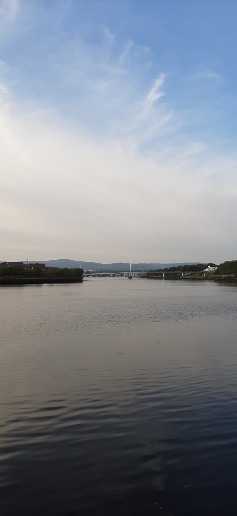
Dropping back down into Derry to the Foyle I was treated to beautiful views along the river as the sun was setting.
Arriving back at the start I was delighted to see an average speed slightly over 25km/hr meaning I was coming in just under my target time of 8hrs. I had a second target to get finished in less than 10hrs total time but I was happy to finish with such a good time!