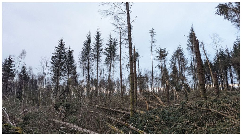
My first time in Monellan since Storm Éowyn. It’s a mess! What was started by Darragh was finished by Éowyn. Some of the trails have been at least partly cleared but judging by seemingly unplanned and random way it’s been done I’d say it’s enterprising locals with a chainsaw rather than Coillte. Based on the sign at the gate Coillte’s policy seems to be ignore it and it will go away 🙈😔
The startling evidence of the power of the storm isn’t the number of downed trees. I’ve seen footage of other forests and it was expected. What wasn’t is the number of trees simply snapped like matchsticks. A very small part of me would like to have been there to experience the sheer power of the wind but it must have been terrifying also….
The plan was to cycle this evening but when I got home it was just too blustery to be enjoyable. I find it hard enough to get motivated to go out in the dark so it needs good weather conditions as a minimum.
It was the kind of work day where I was able to sort all my emails during the day so when I got home at 5:30pm I decided to make the most of the last of the daylight, took a sneaky half hour and headed to the forest for a walk.
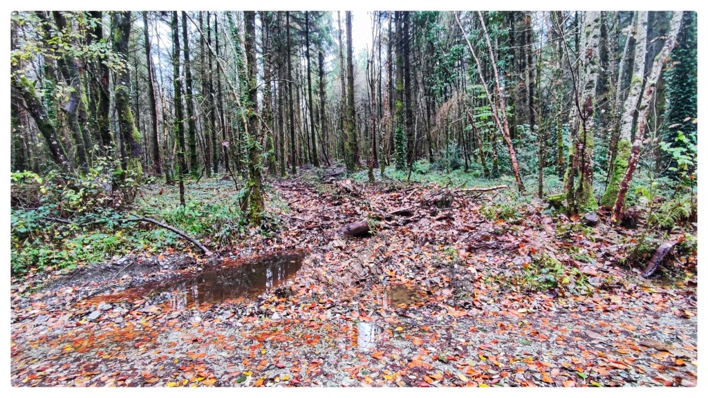
The last time I was here was just after Storm Éowyn so there were loads of fallen trees across the tracks including one track that I decided to avoid altogether as it looked bad and I’d already navigated around a few falls. As it was still fairly clear I decided to go see how bad it was in daylight.
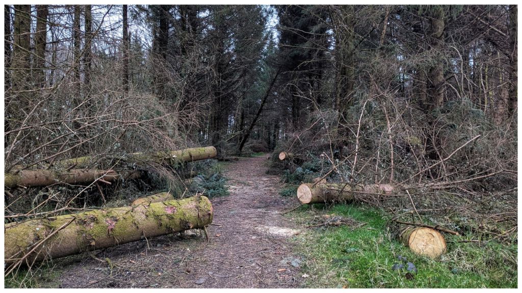
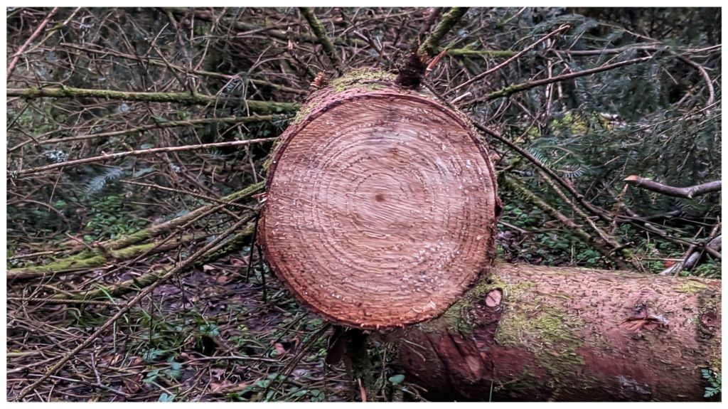
Altogether I’d say there were approximately 15 trees down in 4 different locations but I was able to divert around, through and under them to get to the junction with the main loop. This had been cleared but as the other one wasn’t I guess it was the farmers that use the main tracks to access fields rather than an organised forestry job.
I didn’t need the headtorch until approximately 6:10pm but by the time I stumbled upon a small herd of deer just before the 3km it was fully dark and all I could see were eyes glowing in the light of my headtorch as they scattered in all directions. It was cool though being able to see their eyes back in the trees as they kept a wary eye as I passed on by.
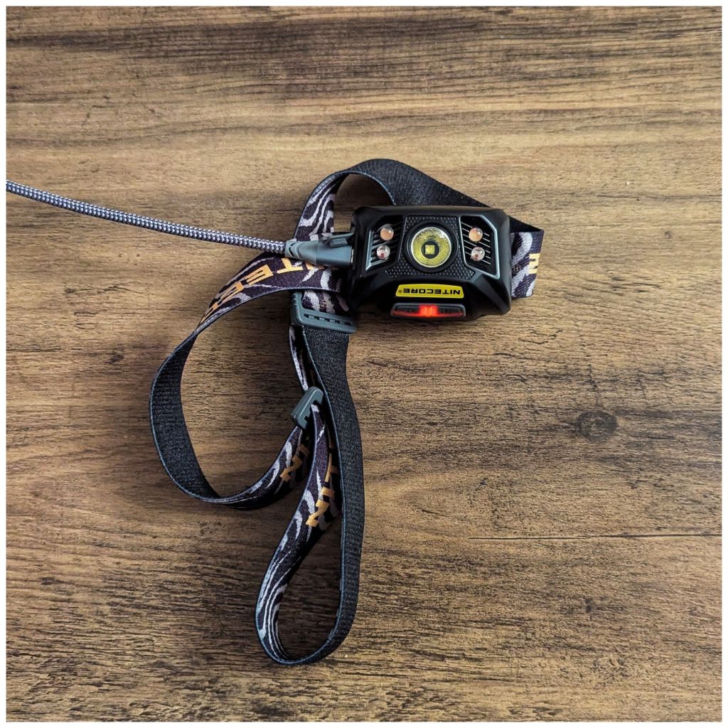
Shortly after I realised that I should have charged my headtorch last night and it was in power saving mode, on one of the dimmer settings. I decided that trying to negotiate back through the fallen trees without good light wasn’t the greatest of ideas so headed back to the car via a rough little road section.
A more eventful walk than I expected and definitely more enjoyable than fighting a blustery wind on the bike…
Better late than never… Flirting with the border again…
Back home to dinner while watching the superb American Primeval that I discovered after a recommendation from Rootchopper. He’s worth a follow for many great reasons, not least among them, his book, film and TV choices.
Evening Walk 6.28km. Wet *and* cold tonight, if I’d known it would be that bad I probably would have stayed in the house 🤣 At least I got a chance to field test my winter hat…
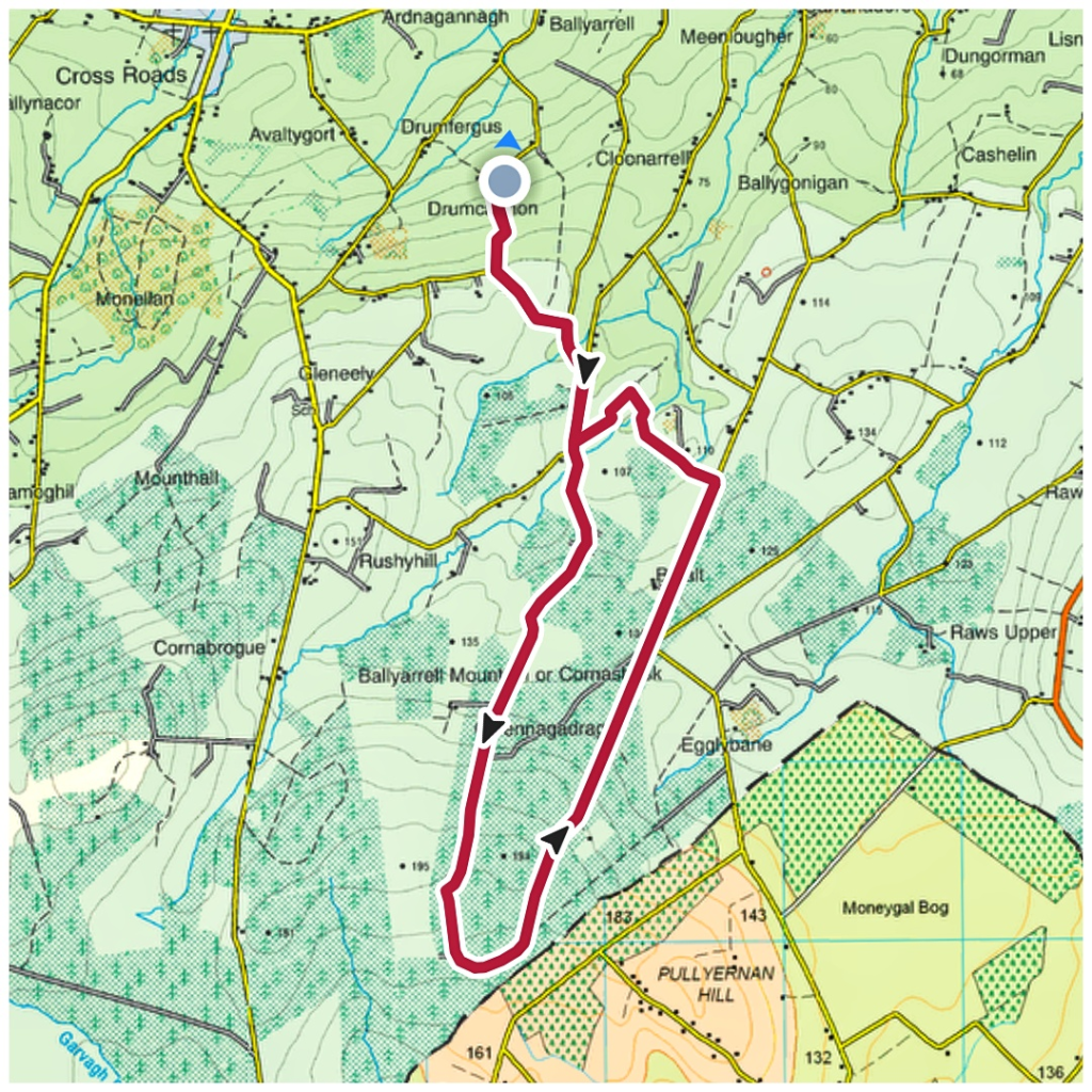
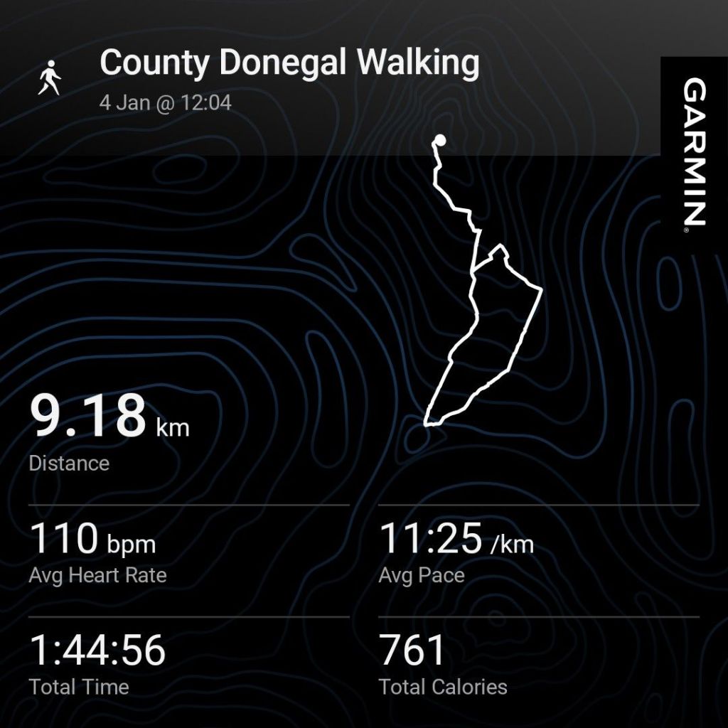
A 10K walk that turned into 11.5K. Lots of fallen trees with one trail completely blocked. I’d already navigated around four falls so decided to take the long way home.
A strange day. A very cold wind and ice still in puddles but surprisingly warm in the spells of sunshine.
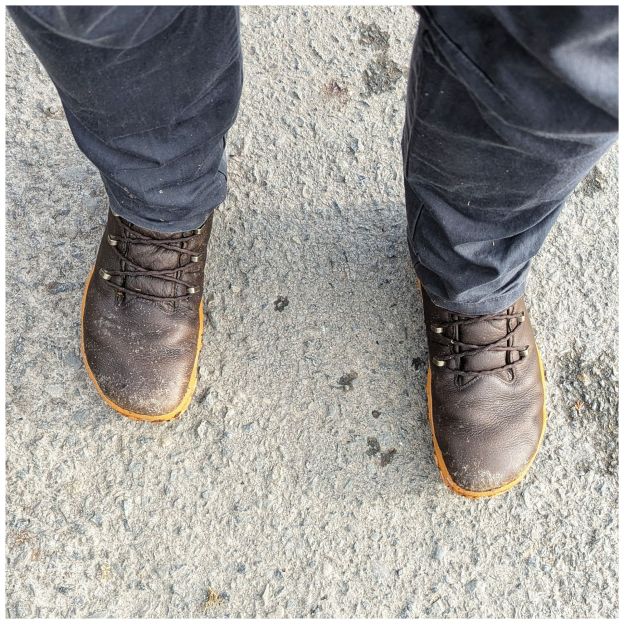
My longest walk so far in the Vivobarefoot boots on hard surfaces. My feet are feeling OK but they definitely know I was out for all that time! 👣
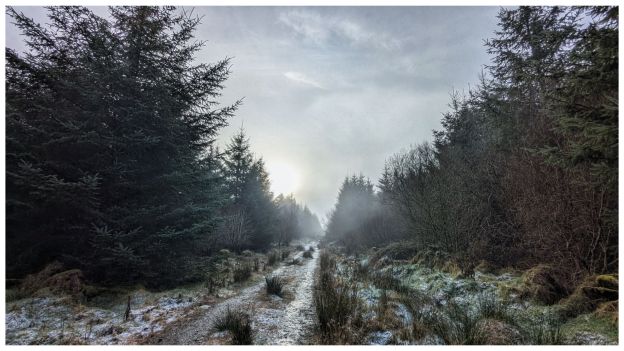
Today’s walk brought me back to the same forest but on a different loop this time. Lots of the country has been hit by heavy snow but we’ve had nothing and it’s actually milder here today than yesterday at a balmy 3°C. Above 150m though, there was quite a bit of snow and ice on the forest tracks. I was glad I brought my walking pole for the extra stability on the slippery sections.
I haven’t been down one of the tracks for a while now and found a few trees down, probably from Storm Darragh a few weeks ago…
The plan today was to leave #1 Son to work for 7am, pack a bag and go hillwalking in Inishowen. Instead I went back to bed and slept until 10! I think I may have been a bit sleep deprived 🙈
Anyway I couldn’t sit in the house all day so headed out for a 9km walk on the local roads and forest tracks. Still really cold with icy patches and a fairly dense fog above 100m. Most likely this would have spoiled any views if I had gone to the hills…
I had planned to go hillwalking today but my legs were tired from cycling yesterday. 52km and a second week of 100km+ is just a bit too much yet, I still need to get my fitness up to that level.
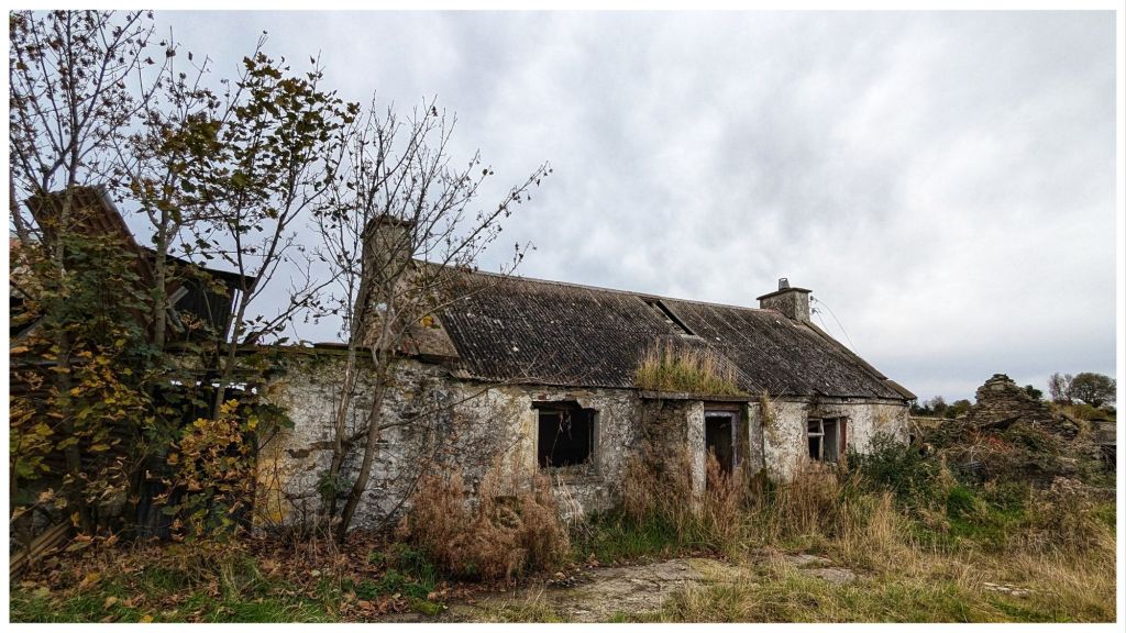
Still with a bright, sunny day for a change I couldn’t not get outside. A 5min drive from home allowed me to walk different roads and get back into a little wood that I haven’t been in for almost 2 years. I wanted to get into another but it was gated off and I felt too exposed climbing over.
This abandoned house is right on the edge of that wood and I figure they were all the one piece of land originally.
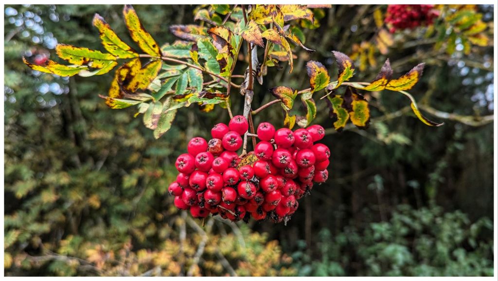
i’ve walked past this house hundreds of times but it caught my eye for some reason today those are red berries and not leaves!
Out for a walk earlier today and a few things struck me…
🔹 It’s bloody cold! 3°C when I started but warmed up to a balmy 7° by the time I finished.
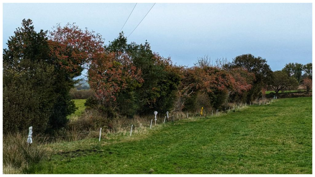
🔹 Autumn has swept in all of a sudden. All the trees are in various stages of turning and the winds of the last few days have left leaves on all the paths.
🔹 There is a bumper crop of Rowan berries this year, way more than normal. All the hedgerows are full of berries and there are far more rowan trees around than I’ve ever really noticed before. There is an old saying that a big crop of rowan berries signifies a harsh Winter ahead. To be fair I don’t think I’d mind a hard winter of dry frosts and bright days. Much preferable to damp, dreary and mild. Not such a fan of prolonged snow and black ice though.
A couple of weeks ago I had a minor medical procedure* that has taken a little while longer than I expected to heal properly. The enforced lay up has unfortunately, brought my lazyitis to the fore.
*nothing remotely serious and completelyelective
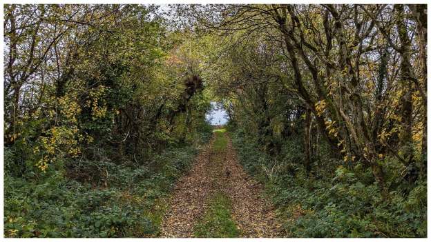
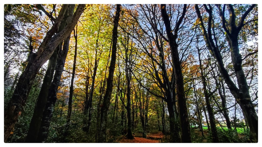
Having wasted Sunday laying around the house I managed to motivate myself to get out for a walk in the woods on Monday morning. The plan was to go and take some photos of the autumnal scenes I’ve been experiencing solely from the front seat of my van on my way to work each morning.
I’m far from an expert photographer but what I enjoy about doing this is that it forces me to slow down and look at my surroundings in a completely different way.
Monellan certainly didn’t disappoint 😍
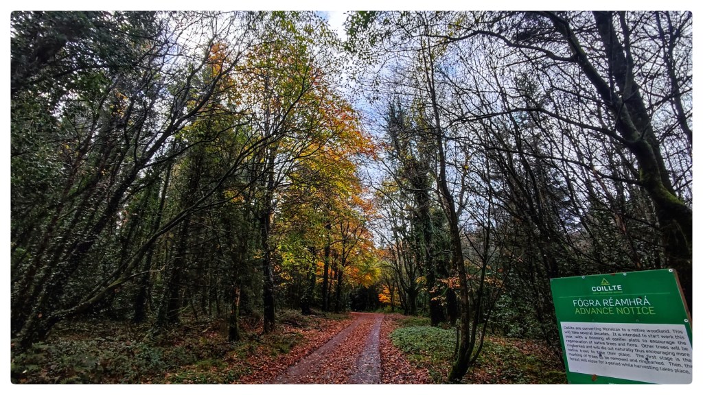
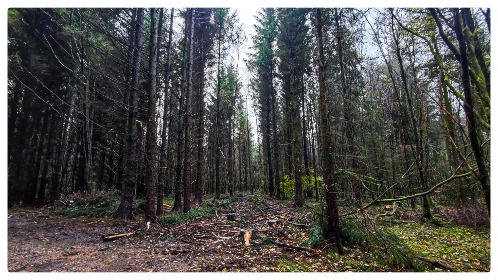
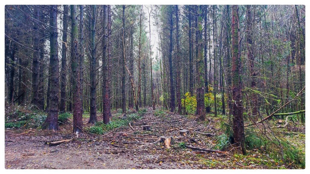
Last year Coillte upgraded the forest roads in Monellan. I was concerned that we were going to lose another large section of trees as that’s usually the reason for any money being spent in an Irish forest. A couple of months ago I spotted spray markings scattered throughout the edges of the stands and I was sure I was correct.
When I returned about 5 weeks ago there was evidence of selective felling with wide swathes of trees removed, timber stacks on the trails and machinery still sitting around.
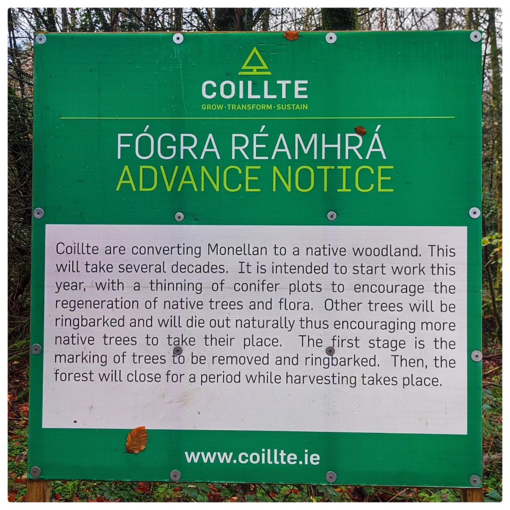
In typical Irish fashion this notice appeared after the work was pretty much completed 🤦🏻At least now I know what is the reason behind the strange pattern of felling!
It will be interesting to watch how this project develops over the years and see how the forest changes into a woodland. I have to say I’m relieved that we’re not going to see the whole thing just cut down even if this first stage is a bit barbaric.