Monthly Archives: September 2022

Mournes Daytrip Part II

Part II of my daytrip to The Mournes. Part I can be found here.

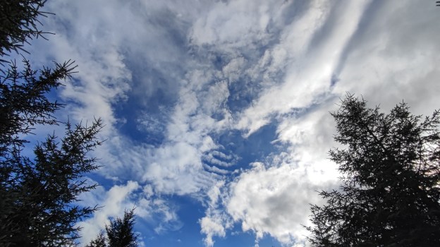
Leaving my lunch spot was a bit of a wrench. Despite the slightly chilly low breeze I was comfortable in a light shell jacket and the views were fantastic. I could see right down into Hare’s Gap and see people climbing up along the Trassey Track with some just aiming for a picnic at the top of the Gap with others heading on along The Brandy Pad, or turning up to Slieve Bearnagh, or towards me and Slievenaglogh. Watching people climb up towards me I could see that I was in for a steep descent but I’d rather be going down than up!

When I did finally push myself to leave this lovely spot and pack my gear back in the bag I soon dropped down to Hare’s Gap. The path was steep and seems to have suffered badly with erosion over the years. However, grounds work has been done to remedy this with rocks placed on the worst sections. It’s unavoidable that some of these now resemble steps but I was impressed how well the work has been done to blend in with the natural environment.

The Brandy Pad 

Hare’s Gap was a busy spot. It marks a crossroads of sorts in The Mournes and the meeting of The Trassey Track and The Brandy Pad at The Mourne Wall. These two paths have their origins as old smuggling routes over The Mournes from the coast. Smugglers used ponies to carry goods across the mountains to avoid revenue and coast guard officers. Today it was walkers with a couple of groups using the Gap as a convenient lunch spot while a couple of families with young kids were having a picnic. It was a nice spot but busy having spent the morning alone and I was happy to move on once I’d had a look around and enjoyed the views down the Trassey Track.

With such a long history it will be no surprise that the Brandy Pad was a very clear and well defined path. I was pleasantly surprised to find that it was managed to only a very low level and left as natural as possible. There were a number of small streams flowing down from the hills I’d walked earlier and as I came close to the path up Slieve Beg, I was accompanied by the sound of the river in the low ground below as it rushed its way down to eventually reach Ben Crom Reservoir.

The track feels mostly level but looking forward from Hare’s Gap it was obvious that there is a bit of a climb towards the end as it rises towards the base of Slieve Beg before dropping again slightly. It is in this area that I had my best view of the rocky cliffs below Commedagh known as The Castles.

The track drops down to a small area that has the feel of a gorge about it as a small stream cuts across the path. I barely got my soles wet today but I have a feeling this would be a more impressive crossing after a period of heavy rain. 

If you follow The Brandy Pad to its end you will come out on the coast at the gruesomely named Bloody Bridge. However, my path veered to the left heading around the side of Commedagh and making for the col between it and Slieve Donard. This section of path gave me a brief but scenic view down Annalong Valley with a very different feel to the one I’d just climbed out of. Annalong isn’t dammed like its neighbour and the river has been left to wind its way gently down the valley.

Donard

Rounding the shoulder of Commedagh the path rises gently again and back towards The Mourne Wall. The Wall passes over both Donard and Commedagh and drops down into the col between the two. A large stile marked the spot where my path crossed and as I got closer I could hear the steady murmur of voices. Climbing over there were a lot of people around, I only thought Hare’s Gap was busy. There were all sorts here from young kids to senior citizens, all shapes and sizes and everything from trainers and shorts to the likes of myself in full hiking gear. The col is at approximately 550m and the large flat area with the wall to break any breeze is the perfect spot to gather your breath after the climb up from Newcastle before the big push to the top of Donard. For others it was a chance to revel in a climb completed and to rest aching knees having scrambled back down. For me the number of people and the constant murmur of voices was jarring and unwelcome. I should have known better on such a good day and a public holiday.

Standing in the col the top of Donard is visible. The summit cairn is out of sight but close by there is one of the towers that are sprinkled along the length of The Mourne Wall. The top of this was clear to see from below as a slow chain of people dotted the way up the side of the mountain. It’s an intimidating sight with a climb of approximately 300m in just 1km. I somehow managed to coax my tired and achy legs into one last climb to the top of Ulster. 

The climb to the top of Donard is a real slog! It’s relentless and with 11.5km in my legs before starting I really felt it. In an ideal world I would have left my bag at the col and retrieved it on the way back down but this wasn’t an option with so many people around. The path is simple to follow and despite the high traffic this mountain gets I was surprised again how low impact the path management is. There are some sections that have been eroded more than others but once again the measures in place blend well with the natural environment. 

I had hoped for one long last push to the top of Donard but in the end it was a series of smaller efforts while I paused to allow other walkers to descend – nothing to do with needing a breather myself of course! The one advantage of such a steep climb is that every step gains you quite a bit of height and before too long the summit was coming into view. The weather was a little breezier up top at 849m. A bank of mist was sitting just off the coast and at times clumps were drifting across to Donard before dissipating leaving it cooler than expected. Like the col below, the summit was also busy with everyone, including myself, wanting the all important summit selfie. A Dad was trying to get two little boys to sit still on the cairn for a photo but they were more interested in building a little tower on the top by balancing stones. I couldn’t help but feel that the day would have been more memorable if he had helped them instead of worrying about the Instagram moment! I gave them a bit of space and then had my own 30secs of fame as the highest person on Ulster.

It was only when I looked back at these photos at home that I realised someone had plonked an empty water bottle in the middle of the cairn! I’d already lifted another out of a nook in the wall. It never fails to amaze and annoy me how someone can carry a full bottle all the way up here but suddenly find that it’s too heavy to carry back empty! I was encouraged to hear another man making sure his young kids were being responsible with wrappers and rubbish as they had lunch in the lee of the wall out of the wind.

I spent a few minutes enjoying the views from the wide top of Donard and had a good look at the tower before heading back down. It was pretty cool on top and too busy to make it an enjoyable spot for lunch. I decided to go back to the col and head away from the bulk of the people and find a quieter spot just off the trail with a nice view across the Pot of Pulgarve, down the Glen River and into Newcastle, the last bit of my journey and the reverse of the view I had just a few hours earlier.

While sitting enjoying my lunch a very friendly but completely random American lady came up and asked me if I wanted her to take my photo. I’ve no idea what prompted this offer but I politely declined and she carried on, still smiling. It was nice to see that there are still people around that make an effort to speak to strangers and engage. I was surprised on the climb up and down Donard how few people wanted to make eye contact or even just return a smile or nod but this woman restored my faith. 

The Last Stretch

Leaving the col the path drops quite steeply to where it crosses the upper reaches of the Glen River. On the way down there are a number of smaller streams and mini waterfalls burbling beside and across the path. It was nice to cross the river on simple stepping stones as much of the upper reaches of this path are graded and gravelled due to the volume of traffic it gets. I was really surprised by the numbers of people I was still meeting on this path between 3 and 4pm, all heading in the direction of Donard and lots of them seriously under dressed for any change in conditions. For some of them they were looking at a minimum of 2-3 hours just to get back to where I met them which would have been close to sunset at this time of year. The one that most shocked me though was the guy with his arm in plaster to well above his elbow. His arm was in a fixed position with his thumb sticking out straight – bonkers!

Dropping steadily the path eventually meets the edge of the forest and the river really picks up speed and strength in the ravine below and multiple waterfalls catch the eye as you descend. Walking here was relatively easy, allowing me time to reflect on the day. As well as a sense of achievement having completed this mini adventure I was also a bit sad. While the day had been incredibly tough I’d really enjoyed it and I was sad that it was almost over.

For a brief period the path diverts slightly into the trees before bending back to the banks of the river. Coming down here there was a bit of evidence in the forest below the trees of illegal dumping and abandoned rubbish and a couple of old fire rings left by people either camping or drinking in the forest. Sickening to see in such a beautiful spot and disheartening that there hasn’t been more of an attempt to remove it. I’ve just finished listening to an audiobook that features park rangers from american state parks and part of their role is dismantling illegal fire pits and camps and disposing of rubbish. Ideally it wouldn’t be there at all but I wish someone would remove it.

For the final stretch there is a choice of path going either side of the river. I decided to go the opposite side than the one I came up by and took the right bank crossing the river by the bridge. Part way down I was treated to a beautiful waterfall as the river came over the edge of a massive round rockface. 

This path definitely hasn’t been graded! It was very rough with large rocks and exposed roots ready to trip a weary and unwary hiker. Thankfully I and the other walkers nearby passed through with no mishaps and before I knew it I was back in Donard Park walking on the edge of the grass to get some respite from the sharp gravelled path for my poor battered feet. 

My GPS told the same tale as Paddy Dillon with an 18km trip versus the estimated 16km and I definitely felt it. The original estimation was for 6-7hrs walking but according to Strava my moving time was 5hr33min which I was very pleased to see. I had allowed 8-10hrs and was complete in 8hrs03min which was way better than I expected. In fact I passed the original 16km marker at 7hr33min. 

Overall a fantastic walk, one that really challenged me and most likely my hardest hike so far but incredibly rewarding. I can see why so many people return to the Mournes time and again and this definitely won’t be my only visit. Since the day of the hike I already have two other similar routes planned and mapped out!

Mournes Daytrip Part I

This is a long walk and I’ve decided to break it up into two posts. The first is below and the second will follow in a day or two.

A few weeks ago I came up with an idea to head to the Mourne Mountains for a day hike. Up until now the closest I’d gotten to this was an aborted plan from at least 5 years ago, to do the same, that was cancelled due to poor weather and never revisited. In fact it may have been this event appearing in my Facebook memories that triggered a renewed interest.

I reached out to a couple of friends for advice and did a bit of research on Mountainviews.ie and came up with a route that was 16km in length and with an intimidating 1200m of elevation gain. By complete coincidence I found out afterwards that this is one of Paddy Dillion’s recommended Mournes routes! It was probably good that I found this out after, rather than before, as the actual distance was 18km which might have put me off! 

The route can be viewed on Outdoor Active but essentially takes in 5 summits including Slieve Donard (849m), the highest summit in Ulster, and Slieve Commedagh (767m) the second highest summit in the Mourne Mountains range.

From home to the start of the walk is approximately 2.5hrs driving and the estimated time for the walk was 6-7hrs. Allowing for breaks I estimated 8-10hrs so decided it made more sense to drive up the night before and sleep in the back of the van overnight to get a decent sleep and still get an early start to get home at a decent time. This made even more sense as my original plan for the walk was on a Sunday so I’d be finishing work in Omagh on the Saturday night and already 40min closer to Newcastle. In the end up that date was cancelled due to a bad storm on the Sunday. With the sudden death of Queen Elizabeth I ended up having a two-day weekend due to the Bank Holiday on Monday for her funeral. This worked really well as I was able to organise and pack on Sunday, leave home about 4:30pm and get to the parking spot before dark.

Vanlife

My initial idea was to try and park up in Newcastle at Donard Park which is where the route starts. However, advice from some friends was not to park in the centre of town and instead to use one of the actual camping spots. The two recommended were Meelmore Lodge and Tollymore Forest. The former came recommended by a number of people but £10 for a simple park up seemed a little bit expensive and reviews on TripAdvisor about a pushy owner, dirty facilities and noisy groups put me off. The latter was £20 for a night  and at 20mins away didn’t seem like good value this time. The last recommendation was the one I went with. It was a car park in Kilbroney Forest, on the outskirts of Rostrevor, and only 25 min from Newcastle according to Google. My friend stayed there a couple of times in a car and had no problems so I figured that was good enough for me. 

I arrived just before dark and only one other car was there, at the far end of a very large car park totally surrounded by a mature forest plantation and with a nice view out over Rostrevor town. Loads of picnic benches made it an ideal spot for parking and cooking my dinner.

As darkness fell a number of cars came and went and one car stayed around while a few others came to speak with him for a period of time. I have a feeling it may have been the local dealer but they were well away from me and paid me no heed so I ignored them also.

Despite nerves in the days leading up to the weekend I slept well. A noisy car woke me briefly at 1:30am and my bladder again at 3am but I had a good night’s sleep despite parking on a bit of a slope! There is a good surface in the back of the van, plenty of space and my sleeping mat and sleeping bags were plenty warm enough. The alarm woke me at 6am and I decided to head for Newcastle, have breakfast in the car park there and use the toilet facilities before starting my walk.

For some reason Google decided to send me by the coastal road which took almost 45min but I was fed, changed and ready to go by 7:30am. Unfortunately I had to delay my start until 8am for the timer locks on the toilet block to open and allow me in.

On the way over I passed another car park at a place called Bloody Bridge. I was specifically warned against using this place to overnight but passing by there were at least 3 campers there and the toilets seemed to be open at 7am. If I go back again I may consider using this spot as it is much more convenient but not as quiet, being on a busy road. In Donard Park there were also a couple of tents pitched up but I don’t know if this is officially permitted and chargeable as there were no signs either way. 

While waiting for the toilets to open a few other vehicles arrived and some people were heading up the trail to the hills already which didn’t help my natural impatience. When I eventually got started the trail headed along the edge of Donard Park (past the aforementioned tents) and straight into the forest. The trail follows the noisy Glen River all the way to the col between Commedagh and Donard and this is a very picturesque scene with multiple waterfalls, narrow ravines and bridges. The trail is heavily travelled with many tree roots visible above ground, polished and hardened by thousands of feet. Exposed rocks combine with the roots to make footing tricky as the trail starts to rise pretty much straight away.

Commedagh

At the first large bridge the main trail crosses and heads up the left side of the river towards Donard but I took the right side into the trees and towards Commedagh and the trail gradually becomes a track. At a tumble down wall in the woods the track bears right and steepens considerably, showing evidence of bicycle tracks from what must be maniac MTB riders descending through the trees. At the edge of the trees an old wall is climbed by a rickety looking stile. Thankfully the gate was gone and I didn’t have to risk my neck climbing over it.

Out of the trees and I was on the side of the hill proper climbing along fairly clear tracks that headed straight up draining energy from my legs, leaving me breathless and my heart rate rocketing. The climb to the fairly flat Shan Slieve at just over 670m was brutal. It was approximately 2km with 400m of climbing and took me the best part of an hour. Climbing up this slope was a real shock. I knew the day was going to be hard but I didn’t really expect it to be that tough and definitely not so soon. I was seriously worried about my fitness and ability to continue the rest of the day. I’d only come 4km and it had taken me almost an hour and a half! Resting at the top and trying to bring my heart rate to something more reasonable it suddenly dawned on me to check the elevation on my GPS. It sounds stupid now but I had forgotten that I was climbing from sea level to that height of 670m and that this first 4km was over 50% of my total elevation gain for the whole day. As my heart rate slowly dropped below the red line and I sat enjoying the view out over Newcastle I began to feel better about the rest of the day.

The approach from the flat top of Shan Slieve to Commedagh was amazing. It’s another 100m of elevation but on a much more gentle incline and along a narrow feeling ridge with views across to Donard on one side and deeper into the Mournes on the other. The ridge curves around gently before rising to the large dome of Commedagh and is known as the Pot of Pulgarve. The Glen River and the trail to Donard is clear to be seen and on such a still day I could hear walkers on this path as they talked to each other over the sound of the rushing river.

As you climb the side of the hill the large cairn (reportedly an ancient burial cairn) slowly appears on the top of Commedagh and I also got my first real view of The Mourne Wall and a clear view of the top of Donard across the col. Time for a proper rest and a chance to soak in the views.

Walking the Wall

I’ve heard a lot about the Mourne Wall and seen plenty of photos of it but I wasn’t prepared for just how amazing it was in real life – it’s huge! I was aware of the length (31km) but wasn’t prepared for just how substantial it is. It’s 1.5m tall and almost 1m wide. It’s constructed from large square cut granite stones, crosses 15 of the highest summits in the area and took approximately 18 years to build from 1923! It’s mind boggling to be truthful.

The wall was now to be my handrail for the rest of my journey as far as Hare’s Gap. As I approached from the cairn on Commedagh there was a large crossing stile but seeing a group of walkers this side of the wall I decided not to cross and followed it along and off the steep side of Commedagh. Along the way I passed some amazing rock features above the Pot of Legawherry and the sun started to appear.

After the steep descent there was a short climb back up along the wall leading towards Slieve Corragh. Trying to locate the summit on the ground from the location on my GPS I realised that I should have crossed the wall back on Commedagh! With my toe wedged in a nook in the wall I was able to peer over and see the summit cairn about 30m away. Thankfully nobody was around to see my undignified scramble up, and over the 1.5m wall. It wasn’t pretty and that granite is unforgiving on bare skin! After all that, the summit cairn was simple. No burial site this time as it was a much smaller collection of stones to mark this 640m summit that seemed small with its bigger neighbours looming all around. The top of Corragh gave me my first views of the mirror calm Ben Crom Reservoir that I’ve seen many a time in a Gerry McVeigh YouTube video as well as a good impression of the rest of the circuit around to my destination above Hare’s Gap. Off in the distance was the hugely impressive and craggy summit tors of Slieve Bearnagh

Leaving Corragh the clear path undulated along the wall before dropping down into a small col. The ground remained dry but significantly eroded in sections with the odd damp spot but nothing like what I’m used to at home. Climbing back out of the col I came to the first of two summits – Slievenaglogh East Top (575m). This is a reasonably undistinguished rock outcrop just beside the wall. Unfortunately it was once again on the other side of the wall! Not being a purist I decided that at less than 10m away and on the same elevation I was close enough as it was obvious that if I crossed the wall I would need to cross back again for the main summit. Mentally I ticked the box and mosied on.

One last small push was to bring me to the top of the main summit of Slievenaglogh at 586m and marked by another substantial cairn where two other walkers were having a lunch break. The summit of Slievenaglogh is covered with extensive rocky areas which give the mountain its Irish name of Sliabh na gCloch ‘mountain of the stones/rocks’. In one of these rocky areas I got enough shelter from the slight breeze that had appeared to set up my stove for tea and a much deserved lunch break at what I figured was almost the halfway point. Sitting looking across at craggy Slieve Bearnagh I couldn’t imagine a better spot.

Part II to follow….

summer slips quietly away…

The last 4-6 weeks have been a bit strange for me. Plenty has been happening and none of it bad but life has kind of just been ticking by. It’s like being a passenger on a boat that is drifting along in the current of a slow wide river. I’m not complaining about this as unlike other times I’ve been kind of enjoying it. I haven’t been idle through this time but for anyone reading this blog it would appear that I may have fallen asleep for the Summer!

As I say I haven’t been idle but neither have I been committed to anything in particular. I have been reading a lot, watching far too much YouTube, watching a reasonable amount of TV (probably too much of that too!), cycling a bit, walking a bit and making a couple of YouTube videos all around the normal rhythm of work and family life. I’ve been posting a bit on Instagram and Facebook but what I haven’t been doing is writing anything. Something about the last month or more hasn’t given me an urge to write, maybe it’s a seasonal thing and I’ve been too busy just getting on with stuff to write about it?

I’ve come up with an Audax challenge for 2023 that is motivating me to get back out on the bike on an almost regular basis. While still not at the level l need to be, I’ve cycled more in the last two months than the rest of the year to date and I’m still pedalling and even better I’m enjoying it again. I’m (im)patiently waiting for the 2023 Audax Ireland events calendar to be published to make my concrete plans and then I’ll have the details to share. In the meantime I’m enjoying being back on two wheels although it’s sobering when I ride through what used to be a regular training area and realise just how long it’s been since my last visit!

Despite a sustained period of dry and mostly settled weather I’ve had a messy start to my new membership of the walking club. I’d highlighted two walks I was keen to do and that fitted in among all the rest of my life perfectly. However, both of these ended up being hit by a short sharp weather warning and ended up postponed to a later date. However, the new calendar is now published and I have high hopes for October. Yellow warnings in that month are just regular Irish weather! In the meantime I’ve been occupying myself with some walks on the local roads and forest trails as well a trip to Killeter Forest to complete the second trail that caught my eye back in April of last year.

As well as working in between these more interesting activities I managed to get across to Scotland at the end of August for a long weekend to visit my best friend Jim and family. The last time we saw each other was March 2020 when we were in Switzerland and travelled home just before the start of the very first Covid lockdown. It’s been 2.5 years but feels like a lifetime. Like every good friendship it was as if it was just yesterday. I flew over on the Friday morning and left on the Monday morning and in between we had a very relaxing few days of catching up, meeting his new pup, walking and talking, eating and drinking. It was a great weekend and already seems like a year ago!

Heading towards the end of the month I’m full of plans – some fully formed and some still rattling around in Beta phase. This weekend I’m off for a long weekend due to the Queen’s funeral so I’m heading to the Mournes on Sunday evening for a long hike on Monday. I was planning to do this last weekend but again was smited by the weather gods who sent the tail-end of a hurricane across the country for the day! This has worked out for the better anyway, having two full days to use rather than a dash across the country after work on a Saturday evening. This will be a 16km walk with 1200m of climbing and I’m a bit nervous about that level of challenge in a day walk. To be honest I’m sleeping in the van on Sunday night and that also makes me nervous, much more so than sleeping in a tent in the mountains! However, it is an adventure, I’ve never walked in the Mournes before and I get to climb Slieve Donard, the highest summit in Ulster and one of the Irish Four Peaks.

I hope to film the walk as well as walk the walk but in the meantime here are two videos I published on YouTube recently

find them dead

Find Them Dead (Roy Grace #16) by Peter James

This post may contain spoilers.

This is not a Roy Grace novel! He is in it but very much a secondary character. The main character is Meg. She is a widow with one daughter who is heading off on a back packing trip to South America. The two of them are still grieving the loss of Meg’s husband and son in a car crash five years ago.

Having just taken redundancy from one job and searching for another Meg is selected for jury duty in the trial of a solicitor hiding a life as a major head of a criminal organisation. Meg is selected by an associate of the crime boss to influence the rest of the jury to deliver a “not guilty” verdict. Her daughter Laura is under surveillance in Ecuador and Meg is blackmailed into complying with the criminal gang who have threatened to harm and kill Laura. They break into her home, leave her threatening messages and photos of Laura and gradually escalate the level of pressure to make sure Meg delivers the jury and doesn’t go to the police.

This was a very good idea for a novel but unfortunately the court case itself was dull and boring. The evidence against the crime boss was mostly circumstantial and presented in great detail. The author talks about the jury getting lost in the detail and unfortunately so was I as the reader. Both the defence and prosecution cases were drawn out then repeated in the summing up – totally unnecessary.

MAJOR SPOILER

I also have issues with the ending. It’s as if the author suddenly decided he couldn’t repeat the evidence a third time, threw in a juror that discovers evidence the police missed and suddenly it’s all over. It’s all wrapped up far too nicely for Meg and Laura despite the nasty threats. I find the compassionate treatment of Meg at the end of the wrong verdict out of character for someone who would cook a pet Guinea pig!

My major problem though is the depiction of this as a Roy Grace story. He’s there at the start and through the book but has little to no influence on the story. He has a murder to investigate but turns up barely any evidence and almost discovers the culprit by accident. The author is also still beating to death this terrible storyline of Bruno who seems to be the perfect depiction of a young psychopath and serial killer in training but the hunter of serial killers can’t see it despite actually calling him an anti-christ in this book. I really wish the author would bring this particular story to a conclusion. The relationship between Grace and his superior, Cassian Pewe, is also getting very old. I’d like to see both these storylines wrapped up in the next novel and something fresh introduced.

Unless you are a diehard Grace fan and desperately need to read the entire series I’d probably skip this one. It’s OK but disappointing in general. Definitely feels like the author is cashing in on the fact that this series is now also going to TV.

My Rating: ⭐⭐⭐

More on Goodreads and Amazon.

Header image by Kaboompics .com from Pexels