Sunday’s run went very well. Everyone had a great time, we raised a lot of money and I managed to run my 5K with no issues. In fact I ran my fastest 1K (5:41) and 1mile (9:08). It was too fast though and I had very sore spasms in my shins that afternoon and I haven’t run all week. I decided to rest them and start back at it next week again.
Sunday evening we all met up in Buncrana again for a night out. It was great fun and the entire staff was there (bar one guy away at a birthday party) plus a good few partners. My initial plan was a couple of drinks early on, 0/0 for the rest of the night and sober to drive home by midnight. That plan soon went down the pan and especially when Catriona agreed to come over and join us to drive me home. That turned into my first drunken night out for probably 3 years.
Monday was a Bank Holiday and I spent most of the day recovering from a bad hangover. In the evening we went back to Buncrana to collect my car, took the opportunity for a lovely walk on the beach just as it got dark and a fast food dinner.
That night I couldn’t seem to switch my brain off and was awake until well after 5am. Catriona was up for work before 7 which woke me again so I figure I had less than 2 hours sleep wiping out most of my Tuesday. Thankfully I’d booked the day off work as an extended long weekend. I did manageto summon enough energy in the afternoon to tidy and clean up the garage though which was long overdue.
I had a few errands to do on Wednesday morning and early afternoon but decided I needed to do something constructive with my days off before returning to work on Thursday. I decided to head for Monellan Woods for a walk with Rosie. I also took my new Trangia alcohol stove and made a hot chocolate drink. I sat and enjoyed that as the last of the daylight faded before heading back to the car in the dark and off home again. It was the perfect mindfulness way to finish my few days off.
I also took my camera and made another YouTube video. I was pushed for time as the light was fading quickly and my phone camera doesn’t cope well with low light (very rushed so didn’t think about a light) but I enjoyed making and editing it. The second half is very poor light quality but I recently watched a YouTube video that contained the advice not to strive for perfection, just make and create and if you enjoy the process then that is good enough. If you want to have a watch the link below will take you there.
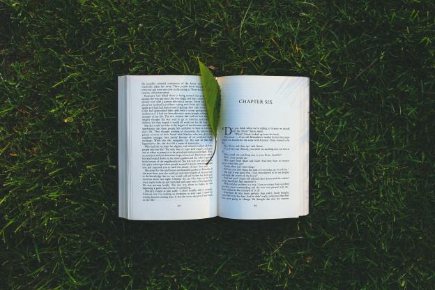
When a murdered prostitute is found in a Glasgow train station, DCI Lorimer is perplexed by the ritualistic arrangement of her body. It isn’t long before there is another murder and he realises there’s no time to waste if he is to stop Glasgow’s latest serial killer.
A taut, suspense-filled thriller, A Small Weeping takes the reader on a gripping journey from the inner city to the wilds of the Scottish Isles, and far into the darkest depths of human nature.
My Rating: ⭐⭐⭐
Much better than the first book by this author but still has a long way to go to live up to the prolific glowing critiques of how good this author is. The storyline is pretty predictable although I did like the introduction of Phyllis and the background of the clinic, that was very original.
I think I will stick with her as the story does show promise. I do hope Lorimer’s marriage doesn’t become a distraction though, it’s a bit odd how it’s being dealt with.
For Durzo Blint, assassination is an art-and he is the city’s most accomplished artist.
For Azoth, survival is precarious. Something you never take for granted. As a guild rat, he’s grown up in the slums, and learned to judge people quickly – and to take risks. Risks like apprenticing himself to Durzo Blint.
But to be accepted, Azoth must turn his back on his old life and embrace a new identity and name. As Kylar Stern, he must learn to navigate the assassins’ world of dangerous politics and strange magics – and cultivate a flair for death.
My Rating: ⭐⭐⭐
This is the author’s debut novel and it feels like one. The characters and storylines are good but they just don’t have the flow and polish of an experienced author. However, it is definitely worth a read and shows promise for more to come.
The genre is fantasy but it’s definitely modern fantasy. There’s a real dark edge with poverty, hardship and abuse and not much of it softened. We also join the story in a lull between conflicts between Cenaria (the country the story is set in) and its stronger and bloodthirsty neighbours. Not much background is given up front so you are finding stuff out as you go along. This very much reminded me of Stella Gemmell’s The City and Stephen Erikson’s series Malazan Book of the Fallen.
The author has received a number of awards for this and a second series so looking forward to seeing how his talent develops and how the rest of the story progresses.
On Sunday the full team from work (Hegartys Home Interiors) will be completing a sponsored run to raise funds for Pieta.ie
Pieta provide a professional one-to-one therapeutic service to people who are in suicidal distress, those who engage in self-harm, and those bereaved by suicide. All of their services are provided free of charge and no referral is needed.
3 of the team will be running a half marathon starting at the Peace Bridge in Derry and finishing outside Hegartys in Buncrana. The rest of us will be running 5 and 10K stages to support the half marathon runners. I will be running a 5K stage.
If you would like to support us in our fundraiser you can donate at the following link.
Last Wednesday I decided to head west of Ballybofey and up into the outer reaches of the Bluestack Mountains. There are a lot of big walks there in my closest 50 summits but also some shorter ones for days like today when I’m short on time.
Cuillagh SE Top (369m)
There is so much choice in this area that it took me a long time to decide but this looked like a nice walk. The page on MountainViews also had a track to download. I initially thought it was about 5km and would take about an hour to an hour and a half but I had it mixed up with one of the many others I looked at!
There is a good parking spot close to a house that is literally in the middle of nowhere. A number of scrap cars are parked in a layby area with ample space to add another.
The first section of the walk heads along a farm lane passing through two gates before taking a left turn and heading straight uphill across the grazed grassland. Navigation is easy as you are basically heading straight for the summit over some rolling hilly sections. Ground underfoot was soggy but not too boggy. The area was heavily grazed and the very wary sheep had kept the heather and grass short which made the walking much easier.
I reached the top much quicker than expected. There is no cairn or summit marker and there were a number of potential high spots. I stood on them all but my favourite was the rocky outcrop on the far side of the fence. The views from here were more than worth the effort of climbing over the fence twice.
views southeast to the bluestacks
north with errigal and muckish in the far background
towards inishowen
summit selfie
Having wandered around for a while I headed back to the start by a slightly different route taking me across two other grazed but empty fields. On the way I spotted this lad crawling through the grass. Seems late in the year but I’m sure he knows what he’s at.
The final section before the track involved scrambling down into and back out of a surprisingly deep gully formed by a stream running off the hill.
At only just over 3km this was a very enjoyable walk with great views of the Bluestack Mountains and North towards the Derryveagh Mountains. Definitely worth a visit.
This was a short drive away which involved skirting around Cuillagh and approaching the summit through a windfarm. This area is full of windfarms. I’m pretty neutral about windfarms but this kind of proliferation feels wrong. It also makes for a pretty dull walk!
I managed to park at the wrong gate (full of over the top and intimidating signs) so had a 400m walk along the quiet road before entering the correct gate.
you shall not pass. wtf!
a bit friendlier
Heading in the main gate I simply followed the windfarm tracks. They quickly ascend the steep climb but after the first few hundred metres tend to dip down below the surface of the bog meaning the views are pretty non existent. By the time I reached the end of the track and the final couple of hundred metres of grassland to the summit I was sick of the sight and sound of the windmills.
The final approach is once again straightforward and typical mixture of eroded boggy hags, grass and heather of this area. Once again the summit was unmarked but had decent views for all its height. I couldn’t help but feel though that the landscape was so much more beautiful before they started building the hundreds of windmills that filled every direction.
errigal and muckish again
summit selfie with the least amount of windmills possible
The trip back to the car was simply the approach in reverse. However, I somehow managed to get disorientated and took a wrong turn. Coming back to the junction I’ve no idea how I missed this sign!
My original plan was to go for a 3rd nearby hill called Ballystrang but it was another windfarm and I couldn’t gather enough motivation for it. I’ve also decided that I would be better keeping these short, easier walks for the winter when I have an urge to get out but only have a short weather window.
For maverick LAPD homicide detective Harry Bosch, the body in the drainpipe at Mulholland Dam is more than another anonymous statistic. This one is personal…because the murdered man was a fellow Vietnam “tunnel rat” who had fought side by side with him in a hellish underground war. Now Bosch is about to relive the horror of Nam. From a dangerous maze of blind alleys to a daring criminal heist beneath the city, his survival instincts will once again be tested to their limit. Pitted against enemies inside his own department and forced to make the agonizing choice between justice and vengeance, Bosch goes on the hunt for a killer whose true face will shock him.
My Rating: ⭐⭐⭐⭐
Yet another series of books that I’ve decided to read a second time. I’ve recently finished watching the TV series and it has given me the appetite to go back and enjoy the original character and stories. The TV show is very good but the books are fantastic. However, there’s now an added dimension to the books, the character I had imagined in my head has now been replaced by the onscreen actor. Thankfully it fits.
Harry Bosch is a great character. His drive to do the right thing makes for great reading. He’s not afraid to do what needs done and that includes putting himself in the firing line. The stories are pretty grim, there’s a definite dark side and not much happy stuff. However, it’s gritty and realistic rather than depressing.
With the books now being quite old (this one was published in 1992) I really enjoy the much less technological setting and the need for so much grind in the investigation process. There’s no Google, no GPS/mobile phone tracking and forensics is much more basic. Catching the killer involves traditional police work and it’s a great read.
I’d given over today to getting some chores done. A couple of household jobs I’d been putting off for a while and giving my MTB a good clean and lube as well as changing the seat. I’m planning to MTB at least once a week with the club group but needed to make sure the bike was in good shape.
I’d everything sorted by 4:30pm and with a lovely mild and bright afternoon I felt the need to get some fresh air and stretch my legs. Croaghan Hill was my target as it’s a decent effort, less than an hour and not too far from home.
croaghan hill
I’ve climbed Croaghan before and when I checked my records I was shocked to see it was almost 9 years ago!
a very young rosie at the summit trig nov 2012
The start location is up a very minor road off the main N15 close to Lifford. The road surface deteriorates considerably for the last 400m but it’s manageable with care. The suggested parking location is beside a field entrance gate where the verge widens enough to squeeze in a single car.
The route to the summit crosses a number of fields and fences requiring careful navigation of barbed wire and considerable flexibility. Once over the final fence the route goes through a section of scrub thick with brambles and gorse along the line of one more fence. Last time I went along the downhill side of the fence but this looked more overgrown now and I decided to go uphill today. This was a mistake as the downhill side quickly thinned out whereas I continued to work through knee high heather, brambles and gorse. Eventually I was able to cut left and make for the summit.
The top of the hill is an ancient hillfort and the unmapped trigpoint is built slap bang on top of what is believed to be a burial tomb. It’s believed to be the tomb of no lesser being than Ithe who was the uncle of Milesius, the first of the country’s legendary invaders. He was killed in the Battle of Mag Itha (Finn Valley), the first recorded battle in Ireland, against the Tuatha De Danaan and buried inside the Bronze age hill fort on top of Croaghan Hill. He was buried in the highest point in this area so that even in death people would still have to raise their heads to look at him. His tomb is known as the Foyde.
It’s also believed that one of the stones of nearby Beltany Stone Circle was sourced from Croaghan Hill and transported the 5km to Beltany.
For such a short walk (approximately 20min) and a modest height of 217m this hill has fantastic views in all directions. I could see across Strabane to Knockavoe where I was last week and further into the Sperrins, west to Barnes Gap and the Bluestack Mountains with the sun setting behind them, north west to Mongorry Hill sitting above Raphoe with Beltany Top and stone circle in between and finally north to Inishowen. The weather this evening was perfect for enjoying this beautiful view of my local area.
summit selfie
strabane, knockavoe and sperrins
mongorry hill and beltany top
bluestacks and the setting sun
On the way down I followed the surprisingly obvious track off the summit to the fenceline. I was able to cross easily and follow the fence back to the fields. The track also seemed to go left and down a different route but I didn’t want to waste time exploring as I had another plan in mind.
The path back downhill was much better but care was required as there’s only a thin layer of soil over rock and it was very slippery in sections. The last 20m was a jungle of brambles and gorse making me regret the thin leggings I was wearing.
On my last visit I managed to partly dislocate my left knee when crossing one of the fences (previously dislocated and weakened and still gives me problems). I was relieved to get across this hurdle and back to the car in one piece today. At just under 2km and 45min in total it was a great mini hike to cap the day.
My initial plan was to head straight home but with more time than expected I decided to make a slight diversion on the way home and tick another small hill off the list.
Fearns Hill is only 231m, a short walk from the road and the second closest hill to home on the MountainViews list.
Although it’s had a good few visits only one other member has written a log. Not having much daylight left I decided to follow his directions rather than trying to plot my own route. These directions brought me to a very minor road and a tiny parking spot at yet another field gate just 275m from the summit coordinates.
I climbed over the gate, which is part of a cattle holding pen and headed across the field following the GPS arrow and bringing back memories of my geocaching days. I soon encountered the field boundary with a single strand barbed wire fence and a second fence higher up. I soon discovered that the first fence was electrified as the mild tingle kicked up my fingers and into my lower arm so I decided it was prudent to duck under rather than step over!
The second fence sits atop an embankment with a dry ditch on the other side. The hill rounds off above this. It brought to mind a hillfort and looking at the OS map at home it’s marked as an ancient Rath.
The top of the hill is now a farmer’s field with a few nondescript humps, one of which is the highest point. Close by on an exposed rocky outcrop is the remains of what appears to be a small concrete building. It’s unclear what it was but it may have been a forerunner of the nearby communication masts.
watch altitude is pretty accurate
Just like Croaghan there are brilliant views despite the low elevation. These include a cracker view back towards Croaghan itself. However, I felt uncomfortably like I was on private property and didn’t want to hang around very long. I was back at the car less than 20min after leaving and home in time to make dinner.
I’m fairly rattling through the closest 50 hills but it’s misleading as most of them so far are short and easy and the closest to home. It will soon get more difficult and hopefully more interesting too.
Today started a bit weird by being interviewed live on our local radio station (Highland Radio). It’s National Road Safety Week and as our club had a member knocked off his bike last week and are now campaigning for a hard shoulder on that section of the road, it was decided to go on the radio to highlight the vulnerability of cyclists and try to get across why we ride the roads the way we do. As PRO this job fell to me! I was expecting a 10min conversation with the show host but it turned into about 25min and I was arguing with a local road haulier. It was way more than what I expected but it’s had a good reception with the club members and I’ve decided not to waste time on the expected comments after the interview. Link below if you are interested in listening. I start at 12min.
The main plan for today was to go walking and to take in 3 of the summits on my 50for50 list. To the east of Strabane there are 3 summits on the edge of the Sperrin Mountains range. Neither of them is particularly challenging or that long of a walk but combined they make a decent day out. The first of these is Knockavoe, sitting above Strabane itself. Its not that big a hill but it pretty much dominates the town and is visible on all approaches.
I’ve been up here a few times before and it’s a simple but steep walk along a farm access lane to within 100m of the summit, before crossing a gate and into the field where the trigpoint sits. This time I went slightly shorter. There’s a second lane further up the hill that connects with the road and is much closer to the top. I hadn’t really planned to go this way but I couldn’t get parked on the way up the road and ended up coming back down and decided to stop and start here instead.
The lane way starts right beside a house and despite being completely fenced off from the fields it kind of felt like I was in private property. Halfway along the two lanes meet and head for the top. It would be possible to construct a mini loop starting at the lower end and returning via the lane I used today and finishing along the tarmac road. Today though was just up and down.
This way isn’t a long walk (only 1.5km total) but surprisingly steep with no warm up and straight up from the car. There are fantastic 360° views from the top including the next target of the day. There is a particularly good view out over Strabane town and the way down is probably better than the climb as you get to see what was at your back earlier.
The second summit is a little bit higher but feels less as the starting point is almost as high as the summit of Knockavoe! There are two options but I decided for the slightly more mountainous SW of the summit. The initial approach is along a concrete access road to what looked like a Water Service pumping station having left my car optimistically parked on the junction verge of two minor roads. The concrete soon runs out and it’s a bit of a slog up a wet, boggy, overgrown track between two ancient fences and bordering a small forestry plantation. This track is a mixture of heather, grass and rushes, mostly knee height and hiding wet holes likely to swamp the top of your boots if you step wrong. The first 100m is particularly bad as it also seems to be a sheep highway on and off the hill. In fact I met one individual who had a tougher experience on the track than I hoped to have.
medic! 🚑
I wasn’t long on this path before I was wishing for my gaiters and walking poles and revising my earlier “easy walk” assessment.
The forecasted rain had started as a light drizzle shortly after leaving the car but steadily increased until it was raining quite heavily at the top and I was well in to the clouds. Visibility was very poor and views non existent. The nearby windfarm was clear to be heard and the appearance and disappearance of the turbines as the cloud thickened and thinned was quite eerie.
turbines in the mist
The actual summit was also quite difficult to find. The top of the hill is quite flat and there is no summit cairn or trigpoint. The poor visibility and lack of a proper GPS made this worse. I was reduced to using Google Maps and the phone GPS was struggling with the conditions. I eventually spotted an attempt to mark the summit but not where I figured the high point actually was. However, I was pretty wet and cold by now and decided to take it for what it was.
i honestly was trying to smile!
Looking on my mapping software at home I seemed to have wandered over the summit without realising it and the cairn is approximately 45m from the mapped coordinates but that’s good enough for me.
Return to the car was by the same boggy track and once again I cursed my lack of poles. I was muddy to the knees and soaked by the time I reached the end and with the cloud base sitting below 250m I decided to give the 3rd hill the skip for today. Instead I cranked up the heater and headed for home.
I’ve written already about finding it difficult to get motivated. In particular I’m finding it difficult to get motivated to go out cycling. In order to distract myself from this and maybe create a new desire to go cycling I’m doing two things. The first is to start back on the MTB with the Club group for the winter evenings. I used to do this a few years ago until the rest of the guys switched to Zwift instead. I need to do a little bit of TLC to my MTB and get over this head cold so it will probably be another week before I get organised for that.
My second plan is to get out and do some hillwalking again. Once I started cycling I pretty much stopped hillwalking but I’ve always enjoyed both the planning and execution of walking trips. I’ve also included some hillwalking challenges in my 50for50 list.
I was off Wednesday last week* as usual so decided to start straight away. I wanted something reasonably easy in terms of both planning and navigation to get me started so I chose a small enough hill called Bolaght Mountain (345m) South of Castlederg and approximately 40min drive from home.
I’m not a fan of “there and back” routes so devised a circular route based on the comments of other MountainViews members starting and finishing at the Sloughan Glen car park. Just under half the route was forest trails, a couple of kilometres was across the upland moorland and the rest on quiet country roads. The route was 14km plus the diversion to and from the actual summit of Bolaght giving a total of 15.5km.
Getting out of the car there is an immediate awareness of the local windmills. The steady breeze had the windfarm operating at full capacity and the noisy whoosh of the blades was very evident. Windmills are a constant companion on this route and if you aren’t a fan then this walk is definitely not for you!
Turning left out of the car park you then take the first road on the left marked as a dead end. It’s immediately uphill on a short, steep gradient through trees and high hedges. After a few hundred meters it levels off and opens out slightly to give views of the surrounding countryside. For the first 1-2km the road is tarred but soon turns into a gravel track but not too badly worn. One of the member comments on MV must have been here at the same time of year as he mentions the rowan trees and the berries. They were laden down for my visit too and lining both sides of the track.
Keep following the track past the entrances to the windfarm. Eventually you reach a farm gate. Cross this into a rougher track and follow this, above the river glen, over the bridge and into the forest by crossing a second gate. Don’t be tempted to take any of the windmill tracks as they will veer off in the wrong direction or dead end leaving you with rough, boggy ground to cross.
In the forest follow the forest roads and signs for Bin Mountain Windfarm.
On my visit the forest was misty and moody with the trees heavily draped with thick, green moss. I’d say this is a pretty wet location and I doubt if The Forestry Service will get much timber yield from here. Near the top of the hill make sure you veer left, still following the signs. The track takes a big dip and ahead it looks like a wall to be climbed!
Near the top I caught the flash of a deer darting into the trees. I’d say it had plenty of warning as I puffed my way uphill!
At the top of the ridge the track opens out of the forest and on to the open moorland mix of heather and coarse grass. You’re now in the windfarm proper, once you pass through one final gate, and suddenly Lough Lee appears in the hidden depression.
At the Eastern end of the lough the Ulster Way meets (or leaves depending on your perspective) the windfarm tracks. I started off following this but I should have headed straight for the summit at the signposted junction.
I was a few hundred metres along the Ulster Way trail before I realised my mistake and that I was moving away from the summit. I left the trail and headed straight up the ridge towards two small conifers. This was tough, knee-breaker ground and it took concentration and a good eye to avoid stepping in a hole hidden beneath the deep heather and grass. Thankfully the ground was well drained and pretty dry despite the recent rains. Once on the ridge it was a simple matter of heading West to the summit coordinates. The mapped summit is just beside a low, worn down fence and despite there being no markings it’s a fairly clear grassy patch, slightly raised above the surrounding heather. There’s a clear view down to Lough Lee and great views North over the countryside towards Castlederg.
summit pose
summit360
Standing at the summit and taking a bearing back to the Ulster Way trail I could see what looked for all the world like a road sign. It looked to be in the right location and was a perfect marker so I headed in that direction across the ridge. I was expecting this to be a real slog but once again the ground was much drier than expected and there were faint trails (probably from sheep) that made the going much easier. Before long I met the trail and chuckled to myself that the road sign was just that even if it was a bit the worse for wear!
The next few kilometres followed the Ulster Way to the alternative starting point at the head of a very minor rural road. The trail is reasonably well marked with a variety of very old, weathered and sometimes broken wooden posts and metal posts (about 25mm thick and knee high). The markers are every 100-200m but the metal posts are sometimes difficult to spot. I only had difficulty spotting the next one on one occasion where it looked like one marker post had disappeared completely. The next one was just about visible in the distance but took me a few minutes to spot. I don’t think this would be a great trail in poor visibility unless your navigation skills were particularly good. There seems to be recent quad activity along the trail which helps with route finding. So far it hasn’t torn up the ground too badly and hopefully it’s just local farmers getting access to the high ground and doesn’t deteriorate any further.
At the end of the Ulster Way the trail returns to tarmac roads and stays on them for the remaining 8km of the route. It’s not all bad though as this is a very sparsely populated area with only the occasional isolated house or farm. The roads are very minor rural roads and I only encountered one car the whole way and that was the postman. The scenery for the first few kilometres is really good with lovely views out over the valley below in the triangle between Castlederg, Drumquin and Newtownstewart. Clouds were low with incoming rain but on a clear day there should be a good view towards the highlands of Donegal and also the Sperrins.
The first section of road was very nicely lined on but sides with a fantastic display of fuchsia bushes. They’re a common sight on the North Coast, especially around Ballycastle and The Glens of Antrim but I haven’t seen them this far West like this before.
Lunch was had about a kilometer later in the shelter of a stand of conifers just past Slieveglass (in Irish: Green Hill) Windfarm. The trees gave a pleasant break from the strong, blustery breeze and allowed me to set up the gas stove and make a welcome cup of tea to accompany my sandwiches.
Heading off again I soon realised that the trees had protected me from more than just the wind. The cloud had closed in obliterating the view and bringing a steady, heavy drizzle that soon turned to proper rain. Hunkered down in a bit of a hollow for lunch I’d been blissfully unaware.
Although the area is now very sparsely populated there is ample evidence that it wasn’t always so. There are quite a number of old buildings. Some are almost ruins while others have been repurposed to shelter animals or to provide farm storage. There was even an old, abandoned schoolhouse. The inscription above the door was just about visible and suggested it was built in the mid 19th century. With so many buildings being abandoned it was nice to see one, close to the car park, being renovated and extended.
huge fireplace about all that’s left
schoolhouse
A few kilometres later the road turns back towards Sloughan Glen. The terrain changes again and the roads are now protected by high hedges and small wooded areas. Some of these areas were grazed by sheep or cattle but most seemed abandoned, another sign of the decline of the local population.
quiet roads
The final approach to the car park is along the banks of a small river. Its seems to flow from the main glen and is most likely the same river followed and crossed near the beginning of the walk. This area is the hunting grounds of a large adult grey heron who didn’t seem overly impressed to have me plodding through. He kept rising up and circling around. He was a bit worked up but giving me a great display.
15.5km brought me full circle and back to the car. However, I decided to go into the actual Sloughan Glen to walk the path and view the waterfall. The steep paths and many steps were a challenge for tired legs and achy knees but more than worth it. The area is an ASSI and absolutely beautiful. Two of the waterfalls were in good flow but I was surprised to see one of them dry despite the recent rain.
In total I finished with almost 17km and a thoroughly enjoyable day despite the constant rain for the second half. The road walking may not suit everyone but I enjoyed the variety of the route.