Altnapaste is 364m high and located on the Eastern edge of the Bluestack Mountains just a few kilometres west of Ballybofey. It’s a hill I’ve had on my radar since I first started looking at my Local 50 peaks on Mountainviews.ie a couple of months ago. A number of cycling routes pass near Altnapaste and although it’s not that high it is fairly distinct.
At the time I climbed it there wasn’t a specific GPS track but there were a number of logs giving good descriptions and waypoints and I managed to create my own track quite easily.
The first section of the walk is along a farm/forestry access lane so there was a good wide area for parking at the start. The first few kilometres on the track gave me a good chance to warm up the legs before I turned off track and onto the rough grass/heather hillside along the edge of a small pine plantation.
The hillside soon turned steep and the going was pretty tough with no track and deep grass and heather. After a few hundred metres the ground eased off a little and continued climbing until I reached a fenceline that was easily crossed. With a bright clear day I was easily able to plot the route ahead and crossed a flatter area before hitting a grassy ramp that climbed between two sections of the hill. Although the ground steepened the grass made the going a lot easier to manage and I soon reached a second fenceline. I knew this one went all the way to the summit and that I was only a few hundred metres from the top.
The final climb was once again through steep, rough ground, heavily overgrown with knee deep heather before levelling off on a rocky flat summit with a short walk to the summit cairn. The views were fabulous in all directions, especially to the west where the sun was starting to set and appearing below ominous grey clouds but creating one hell of an atmosphere.
The breeze was bone chilling and relentless so I didn’t hang around too long before I started to retrace my steps and returned the way I’d ascended, this time enjoying the great views that were mostly behind me on the way up.
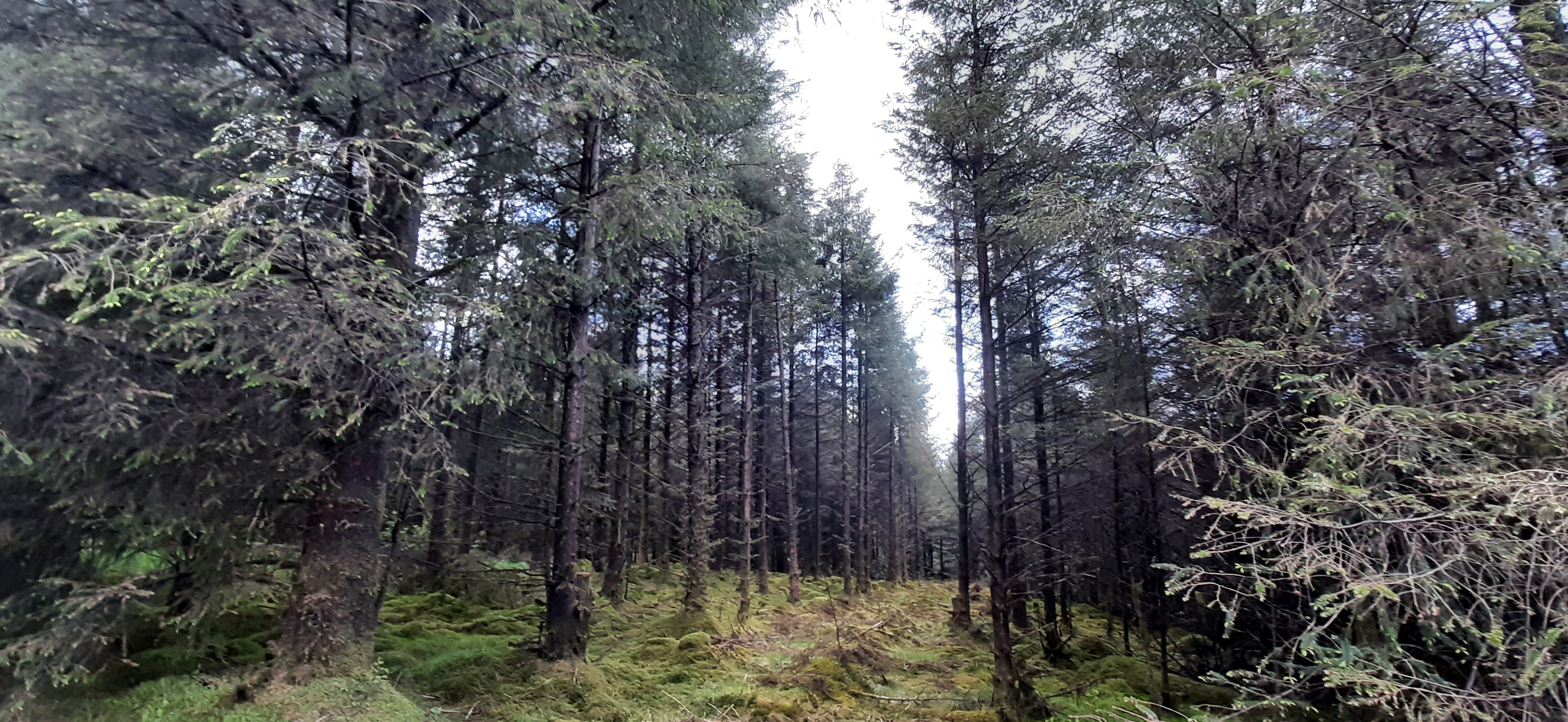
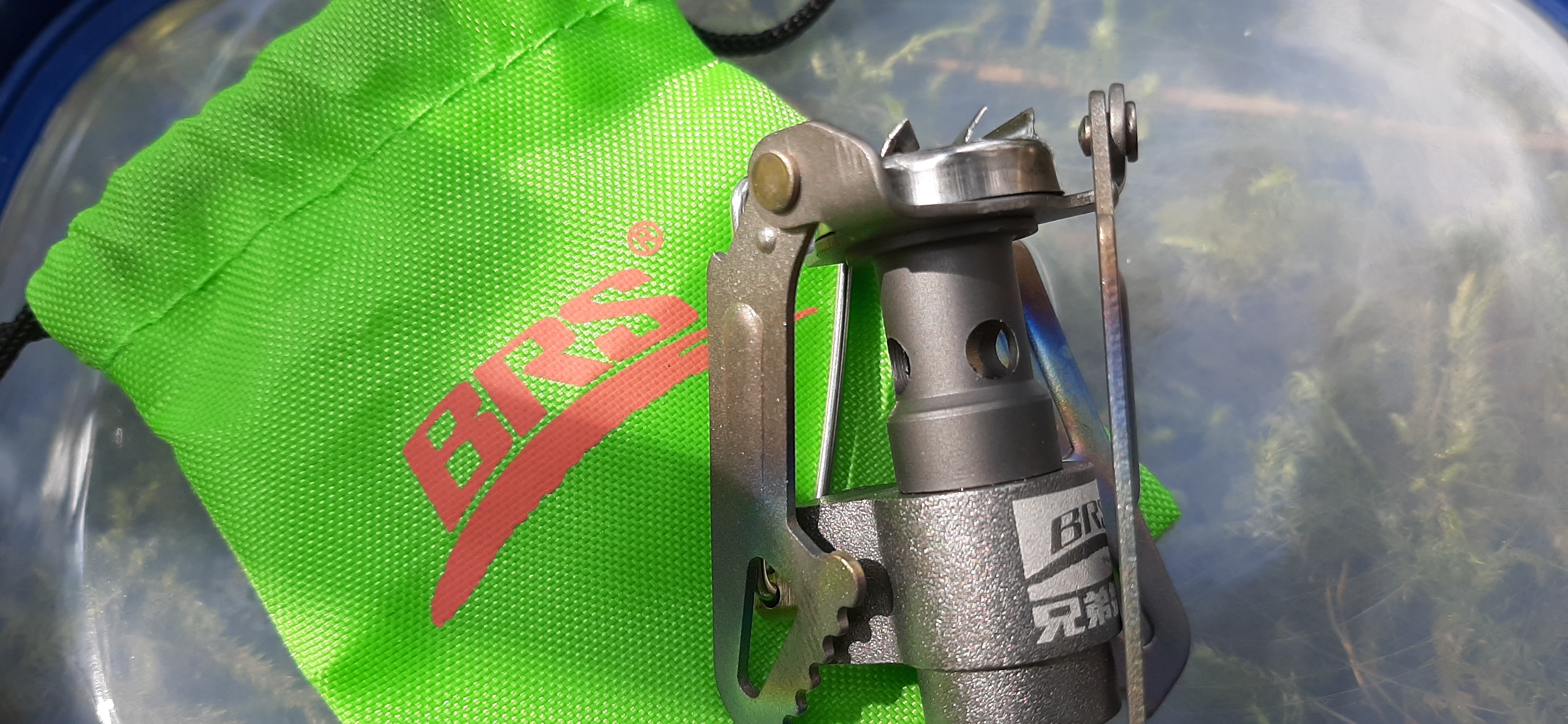
At the bottom of the hill I diverted into the pine plantation to have lunch and some peace and quiet. I’d brought my gas stove to heat water for a fresh cup of tea. This is a recent change for me and one of the best things I’ve started doing out walking this year. A fresh cup of tea beats a flask any day of the week and is more than worth the little bit of extra weight in the rucksack.
This spot turned out far nicer than I expected from my very brief glance on the way up. Once through the branches at the edge the space opened out nicely with lots of deadfall allowing loads of light in and enough space to feel surprisingly open for a plantation. It was so peaceful out of the wind and I could have stayed there for hours. I didn’t think my mind needed clearing but that half hour definitely did.
The last couple of kilometres, back along the lane again, were a perfect finish with great views again of the sun setting behind the main Bluestacks. What a cracker of a day!
The reason I have delayed so long in writing this post is that I also filmed the walk. I finally got around to editing the footage yesterday to be able to add it to this post. Link below as usual.
I’m struggling to get the audio to align with the video. It’s out of sync on the original, synced up fine in the app and then seems out of sync again once finalised. I’m not sure if it’s my camera, the app or me but it’s very frustrating! I may try a different app next time to see if that works better.
edit (29.12.21): I think I’ve now worked out how to correct the out of sync audio and keep it in sync during the finalisation process. At least the morning commute was useful for something 😆
Last Wednesday I decided to head west of Ballybofey and up into the outer reaches of the Bluestack Mountains. There are a lot of big walks there in my closest 50 summits but also some shorter ones for days like today when I’m short on time.
Cuillagh SE Top (369m)
There is so much choice in this area that it took me a long time to decide but this looked like a nice walk. The page on MountainViews also had a track to download. I initially thought it was about 5km and would take about an hour to an hour and a half but I had it mixed up with one of the many others I looked at!
There is a good parking spot close to a house that is literally in the middle of nowhere. A number of scrap cars are parked in a layby area with ample space to add another.
The first section of the walk heads along a farm lane passing through two gates before taking a left turn and heading straight uphill across the grazed grassland. Navigation is easy as you are basically heading straight for the summit over some rolling hilly sections. Ground underfoot was soggy but not too boggy. The area was heavily grazed and the very wary sheep had kept the heather and grass short which made the walking much easier.
I reached the top much quicker than expected. There is no cairn or summit marker and there were a number of potential high spots. I stood on them all but my favourite was the rocky outcrop on the far side of the fence. The views from here were more than worth the effort of climbing over the fence twice.
views southeast to the bluestacks
north with errigal and muckish in the far background
towards inishowen
summit selfie
Having wandered around for a while I headed back to the start by a slightly different route taking me across two other grazed but empty fields. On the way I spotted this lad crawling through the grass. Seems late in the year but I’m sure he knows what he’s at.
The final section before the track involved scrambling down into and back out of a surprisingly deep gully formed by a stream running off the hill.
At only just over 3km this was a very enjoyable walk with great views of the Bluestack Mountains and North towards the Derryveagh Mountains. Definitely worth a visit.
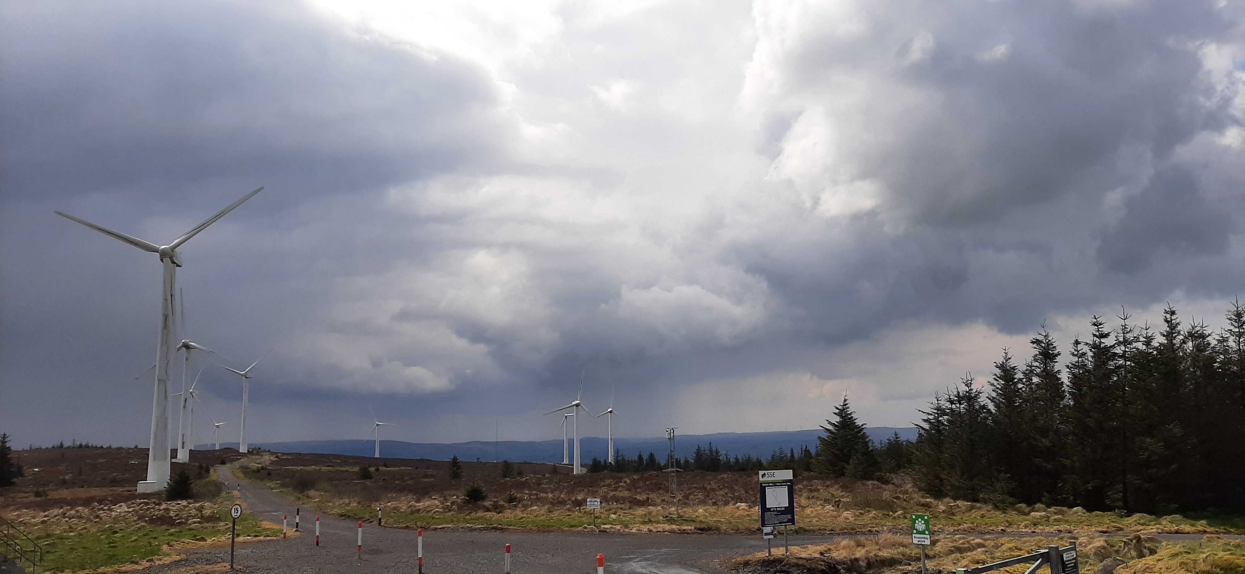
This was a short drive away which involved skirting around Cuillagh and approaching the summit through a windfarm. This area is full of windfarms. I’m pretty neutral about windfarms but this kind of proliferation feels wrong. It also makes for a pretty dull walk!
I managed to park at the wrong gate (full of over the top and intimidating signs) so had a 400m walk along the quiet road before entering the correct gate.
you shall not pass. wtf!
a bit friendlier
Heading in the main gate I simply followed the windfarm tracks. They quickly ascend the steep climb but after the first few hundred metres tend to dip down below the surface of the bog meaning the views are pretty non existent. By the time I reached the end of the track and the final couple of hundred metres of grassland to the summit I was sick of the sight and sound of the windmills.
The final approach is once again straightforward and typical mixture of eroded boggy hags, grass and heather of this area. Once again the summit was unmarked but had decent views for all its height. I couldn’t help but feel though that the landscape was so much more beautiful before they started building the hundreds of windmills that filled every direction.
errigal and muckish again
summit selfie with the least amount of windmills possible
The trip back to the car was simply the approach in reverse. However, I somehow managed to get disorientated and took a wrong turn. Coming back to the junction I’ve no idea how I missed this sign!
My original plan was to go for a 3rd nearby hill called Ballystrang but it was another windfarm and I couldn’t gather enough motivation for it. I’ve also decided that I would be better keeping these short, easier walks for the winter when I have an urge to get out but only have a short weather window.
I’d given over today to getting some chores done. A couple of household jobs I’d been putting off for a while and giving my MTB a good clean and lube as well as changing the seat. I’m planning to MTB at least once a week with the club group but needed to make sure the bike was in good shape.
I’d everything sorted by 4:30pm and with a lovely mild and bright afternoon I felt the need to get some fresh air and stretch my legs. Croaghan Hill was my target as it’s a decent effort, less than an hour and not too far from home.
croaghan hill
I’ve climbed Croaghan before and when I checked my records I was shocked to see it was almost 9 years ago!
a very young rosie at the summit trig nov 2012
The start location is up a very minor road off the main N15 close to Lifford. The road surface deteriorates considerably for the last 400m but it’s manageable with care. The suggested parking location is beside a field entrance gate where the verge widens enough to squeeze in a single car.
The route to the summit crosses a number of fields and fences requiring careful navigation of barbed wire and considerable flexibility. Once over the final fence the route goes through a section of scrub thick with brambles and gorse along the line of one more fence. Last time I went along the downhill side of the fence but this looked more overgrown now and I decided to go uphill today. This was a mistake as the downhill side quickly thinned out whereas I continued to work through knee high heather, brambles and gorse. Eventually I was able to cut left and make for the summit.
The top of the hill is an ancient hillfort and the unmapped trigpoint is built slap bang on top of what is believed to be a burial tomb. It’s believed to be the tomb of no lesser being than Ithe who was the uncle of Milesius, the first of the country’s legendary invaders. He was killed in the Battle of Mag Itha (Finn Valley), the first recorded battle in Ireland, against the Tuatha De Danaan and buried inside the Bronze age hill fort on top of Croaghan Hill. He was buried in the highest point in this area so that even in death people would still have to raise their heads to look at him. His tomb is known as the Foyde.
It’s also believed that one of the stones of nearby Beltany Stone Circle was sourced from Croaghan Hill and transported the 5km to Beltany.
For such a short walk (approximately 20min) and a modest height of 217m this hill has fantastic views in all directions. I could see across Strabane to Knockavoe where I was last week and further into the Sperrins, west to Barnes Gap and the Bluestack Mountains with the sun setting behind them, north west to Mongorry Hill sitting above Raphoe with Beltany Top and stone circle in between and finally north to Inishowen. The weather this evening was perfect for enjoying this beautiful view of my local area.
summit selfie
strabane, knockavoe and sperrins
mongorry hill and beltany top
bluestacks and the setting sun
On the way down I followed the surprisingly obvious track off the summit to the fenceline. I was able to cross easily and follow the fence back to the fields. The track also seemed to go left and down a different route but I didn’t want to waste time exploring as I had another plan in mind.
The path back downhill was much better but care was required as there’s only a thin layer of soil over rock and it was very slippery in sections. The last 20m was a jungle of brambles and gorse making me regret the thin leggings I was wearing.
On my last visit I managed to partly dislocate my left knee when crossing one of the fences (previously dislocated and weakened and still gives me problems). I was relieved to get across this hurdle and back to the car in one piece today. At just under 2km and 45min in total it was a great mini hike to cap the day.
My initial plan was to head straight home but with more time than expected I decided to make a slight diversion on the way home and tick another small hill off the list.
Fearns Hill is only 231m, a short walk from the road and the second closest hill to home on the MountainViews list.
Although it’s had a good few visits only one other member has written a log. Not having much daylight left I decided to follow his directions rather than trying to plot my own route. These directions brought me to a very minor road and a tiny parking spot at yet another field gate just 275m from the summit coordinates.
I climbed over the gate, which is part of a cattle holding pen and headed across the field following the GPS arrow and bringing back memories of my geocaching days. I soon encountered the field boundary with a single strand barbed wire fence and a second fence higher up. I soon discovered that the first fence was electrified as the mild tingle kicked up my fingers and into my lower arm so I decided it was prudent to duck under rather than step over!
The second fence sits atop an embankment with a dry ditch on the other side. The hill rounds off above this. It brought to mind a hillfort and looking at the OS map at home it’s marked as an ancient Rath.
The top of the hill is now a farmer’s field with a few nondescript humps, one of which is the highest point. Close by on an exposed rocky outcrop is the remains of what appears to be a small concrete building. It’s unclear what it was but it may have been a forerunner of the nearby communication masts.
watch altitude is pretty accurate
Just like Croaghan there are brilliant views despite the low elevation. These include a cracker view back towards Croaghan itself. However, I felt uncomfortably like I was on private property and didn’t want to hang around very long. I was back at the car less than 20min after leaving and home in time to make dinner.
I’m fairly rattling through the closest 50 hills but it’s misleading as most of them so far are short and easy and the closest to home. It will soon get more difficult and hopefully more interesting too.
Today started a bit weird by being interviewed live on our local radio station (Highland Radio). It’s National Road Safety Week and as our club had a member knocked off his bike last week and are now campaigning for a hard shoulder on that section of the road, it was decided to go on the radio to highlight the vulnerability of cyclists and try to get across why we ride the roads the way we do. As PRO this job fell to me! I was expecting a 10min conversation with the show host but it turned into about 25min and I was arguing with a local road haulier. It was way more than what I expected but it’s had a good reception with the club members and I’ve decided not to waste time on the expected comments after the interview. Link below if you are interested in listening. I start at 12min.
The main plan for today was to go walking and to take in 3 of the summits on my 50for50 list. To the east of Strabane there are 3 summits on the edge of the Sperrin Mountains range. Neither of them is particularly challenging or that long of a walk but combined they make a decent day out. The first of these is Knockavoe, sitting above Strabane itself. Its not that big a hill but it pretty much dominates the town and is visible on all approaches.
I’ve been up here a few times before and it’s a simple but steep walk along a farm access lane to within 100m of the summit, before crossing a gate and into the field where the trigpoint sits. This time I went slightly shorter. There’s a second lane further up the hill that connects with the road and is much closer to the top. I hadn’t really planned to go this way but I couldn’t get parked on the way up the road and ended up coming back down and decided to stop and start here instead.
The lane way starts right beside a house and despite being completely fenced off from the fields it kind of felt like I was in private property. Halfway along the two lanes meet and head for the top. It would be possible to construct a mini loop starting at the lower end and returning via the lane I used today and finishing along the tarmac road. Today though was just up and down.
This way isn’t a long walk (only 1.5km total) but surprisingly steep with no warm up and straight up from the car. There are fantastic 360° views from the top including the next target of the day. There is a particularly good view out over Strabane town and the way down is probably better than the climb as you get to see what was at your back earlier.
The second summit is a little bit higher but feels less as the starting point is almost as high as the summit of Knockavoe! There are two options but I decided for the slightly more mountainous SW of the summit. The initial approach is along a concrete access road to what looked like a Water Service pumping station having left my car optimistically parked on the junction verge of two minor roads. The concrete soon runs out and it’s a bit of a slog up a wet, boggy, overgrown track between two ancient fences and bordering a small forestry plantation. This track is a mixture of heather, grass and rushes, mostly knee height and hiding wet holes likely to swamp the top of your boots if you step wrong. The first 100m is particularly bad as it also seems to be a sheep highway on and off the hill. In fact I met one individual who had a tougher experience on the track than I hoped to have.
medic! 🚑
I wasn’t long on this path before I was wishing for my gaiters and walking poles and revising my earlier “easy walk” assessment.
The forecasted rain had started as a light drizzle shortly after leaving the car but steadily increased until it was raining quite heavily at the top and I was well in to the clouds. Visibility was very poor and views non existent. The nearby windfarm was clear to be heard and the appearance and disappearance of the turbines as the cloud thickened and thinned was quite eerie.
turbines in the mist
The actual summit was also quite difficult to find. The top of the hill is quite flat and there is no summit cairn or trigpoint. The poor visibility and lack of a proper GPS made this worse. I was reduced to using Google Maps and the phone GPS was struggling with the conditions. I eventually spotted an attempt to mark the summit but not where I figured the high point actually was. However, I was pretty wet and cold by now and decided to take it for what it was.
i honestly was trying to smile!
Looking on my mapping software at home I seemed to have wandered over the summit without realising it and the cairn is approximately 45m from the mapped coordinates but that’s good enough for me.
Return to the car was by the same boggy track and once again I cursed my lack of poles. I was muddy to the knees and soaked by the time I reached the end and with the cloud base sitting below 250m I decided to give the 3rd hill the skip for today. Instead I cranked up the heater and headed for home.
I’ve written already about finding it difficult to get motivated. In particular I’m finding it difficult to get motivated to go out cycling. In order to distract myself from this and maybe create a new desire to go cycling I’m doing two things. The first is to start back on the MTB with the Club group for the winter evenings. I used to do this a few years ago until the rest of the guys switched to Zwift instead. I need to do a little bit of TLC to my MTB and get over this head cold so it will probably be another week before I get organised for that.
My second plan is to get out and do some hillwalking again. Once I started cycling I pretty much stopped hillwalking but I’ve always enjoyed both the planning and execution of walking trips. I’ve also included some hillwalking challenges in my 50for50 list.
I was off Wednesday last week* as usual so decided to start straight away. I wanted something reasonably easy in terms of both planning and navigation to get me started so I chose a small enough hill called Bolaght Mountain (345m) South of Castlederg and approximately 40min drive from home.
I’m not a fan of “there and back” routes so devised a circular route based on the comments of other MountainViews members starting and finishing at the Sloughan Glen car park. Just under half the route was forest trails, a couple of kilometres was across the upland moorland and the rest on quiet country roads. The route was 14km plus the diversion to and from the actual summit of Bolaght giving a total of 15.5km.
Getting out of the car there is an immediate awareness of the local windmills. The steady breeze had the windfarm operating at full capacity and the noisy whoosh of the blades was very evident. Windmills are a constant companion on this route and if you aren’t a fan then this walk is definitely not for you!
Turning left out of the car park you then take the first road on the left marked as a dead end. It’s immediately uphill on a short, steep gradient through trees and high hedges. After a few hundred meters it levels off and opens out slightly to give views of the surrounding countryside. For the first 1-2km the road is tarred but soon turns into a gravel track but not too badly worn. One of the member comments on MV must have been here at the same time of year as he mentions the rowan trees and the berries. They were laden down for my visit too and lining both sides of the track.
Keep following the track past the entrances to the windfarm. Eventually you reach a farm gate. Cross this into a rougher track and follow this, above the river glen, over the bridge and into the forest by crossing a second gate. Don’t be tempted to take any of the windmill tracks as they will veer off in the wrong direction or dead end leaving you with rough, boggy ground to cross.
In the forest follow the forest roads and signs for Bin Mountain Windfarm.
On my visit the forest was misty and moody with the trees heavily draped with thick, green moss. I’d say this is a pretty wet location and I doubt if The Forestry Service will get much timber yield from here. Near the top of the hill make sure you veer left, still following the signs. The track takes a big dip and ahead it looks like a wall to be climbed!
Near the top I caught the flash of a deer darting into the trees. I’d say it had plenty of warning as I puffed my way uphill!
At the top of the ridge the track opens out of the forest and on to the open moorland mix of heather and coarse grass. You’re now in the windfarm proper, once you pass through one final gate, and suddenly Lough Lee appears in the hidden depression.
At the Eastern end of the lough the Ulster Way meets (or leaves depending on your perspective) the windfarm tracks. I started off following this but I should have headed straight for the summit at the signposted junction.
I was a few hundred metres along the Ulster Way trail before I realised my mistake and that I was moving away from the summit. I left the trail and headed straight up the ridge towards two small conifers. This was tough, knee-breaker ground and it took concentration and a good eye to avoid stepping in a hole hidden beneath the deep heather and grass. Thankfully the ground was well drained and pretty dry despite the recent rains. Once on the ridge it was a simple matter of heading West to the summit coordinates. The mapped summit is just beside a low, worn down fence and despite there being no markings it’s a fairly clear grassy patch, slightly raised above the surrounding heather. There’s a clear view down to Lough Lee and great views North over the countryside towards Castlederg.
summit pose
summit360
Standing at the summit and taking a bearing back to the Ulster Way trail I could see what looked for all the world like a road sign. It looked to be in the right location and was a perfect marker so I headed in that direction across the ridge. I was expecting this to be a real slog but once again the ground was much drier than expected and there were faint trails (probably from sheep) that made the going much easier. Before long I met the trail and chuckled to myself that the road sign was just that even if it was a bit the worse for wear!
The next few kilometres followed the Ulster Way to the alternative starting point at the head of a very minor rural road. The trail is reasonably well marked with a variety of very old, weathered and sometimes broken wooden posts and metal posts (about 25mm thick and knee high). The markers are every 100-200m but the metal posts are sometimes difficult to spot. I only had difficulty spotting the next one on one occasion where it looked like one marker post had disappeared completely. The next one was just about visible in the distance but took me a few minutes to spot. I don’t think this would be a great trail in poor visibility unless your navigation skills were particularly good. There seems to be recent quad activity along the trail which helps with route finding. So far it hasn’t torn up the ground too badly and hopefully it’s just local farmers getting access to the high ground and doesn’t deteriorate any further.
At the end of the Ulster Way the trail returns to tarmac roads and stays on them for the remaining 8km of the route. It’s not all bad though as this is a very sparsely populated area with only the occasional isolated house or farm. The roads are very minor rural roads and I only encountered one car the whole way and that was the postman. The scenery for the first few kilometres is really good with lovely views out over the valley below in the triangle between Castlederg, Drumquin and Newtownstewart. Clouds were low with incoming rain but on a clear day there should be a good view towards the highlands of Donegal and also the Sperrins.
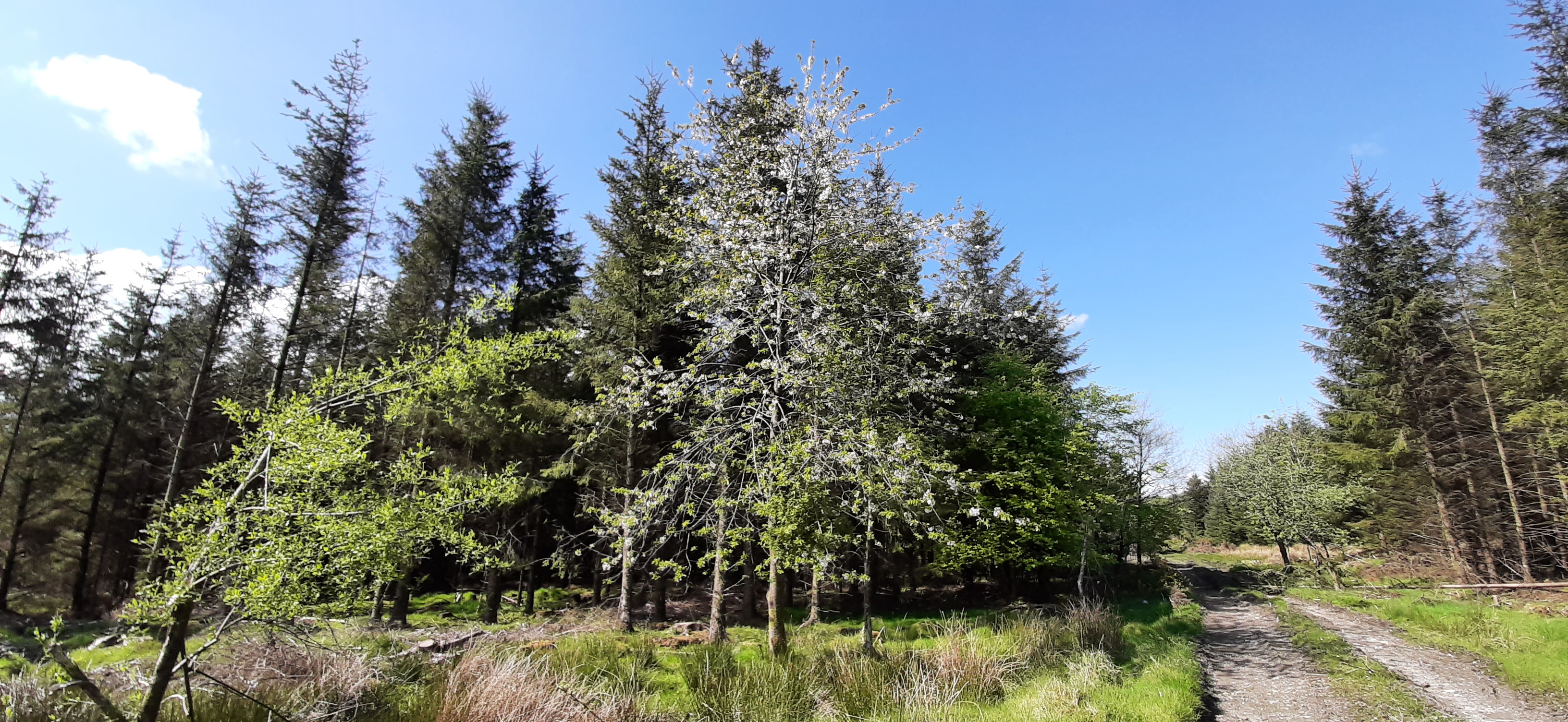
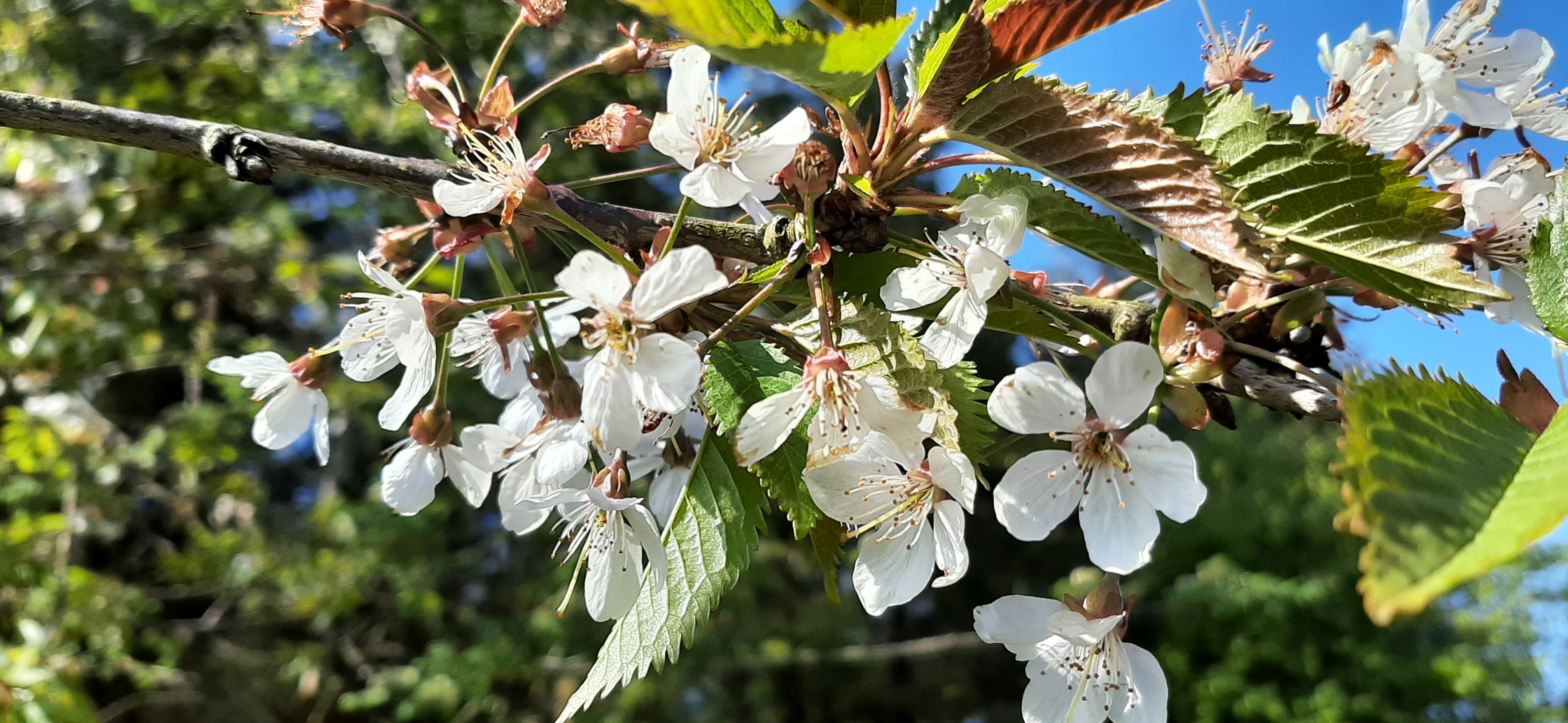
The first section of road was very nicely lined on but sides with a fantastic display of fuchsia bushes. They’re a common sight on the North Coast, especially around Ballycastle and The Glens of Antrim but I haven’t seen them this far West like this before.
Lunch was had about a kilometer later in the shelter of a stand of conifers just past Slieveglass (in Irish: Green Hill) Windfarm. The trees gave a pleasant break from the strong, blustery breeze and allowed me to set up the gas stove and make a welcome cup of tea to accompany my sandwiches.
Heading off again I soon realised that the trees had protected me from more than just the wind. The cloud had closed in obliterating the view and bringing a steady, heavy drizzle that soon turned to proper rain. Hunkered down in a bit of a hollow for lunch I’d been blissfully unaware.
Although the area is now very sparsely populated there is ample evidence that it wasn’t always so. There are quite a number of old buildings. Some are almost ruins while others have been repurposed to shelter animals or to provide farm storage. There was even an old, abandoned schoolhouse. The inscription above the door was just about visible and suggested it was built in the mid 19th century. With so many buildings being abandoned it was nice to see one, close to the car park, being renovated and extended.
huge fireplace about all that’s left
schoolhouse
A few kilometres later the road turns back towards Sloughan Glen. The terrain changes again and the roads are now protected by high hedges and small wooded areas. Some of these areas were grazed by sheep or cattle but most seemed abandoned, another sign of the decline of the local population.
quiet roads
The final approach to the car park is along the banks of a small river. Its seems to flow from the main glen and is most likely the same river followed and crossed near the beginning of the walk. This area is the hunting grounds of a large adult grey heron who didn’t seem overly impressed to have me plodding through. He kept rising up and circling around. He was a bit worked up but giving me a great display.
15.5km brought me full circle and back to the car. However, I decided to go into the actual Sloughan Glen to walk the path and view the waterfall. The steep paths and many steps were a challenge for tired legs and achy knees but more than worth it. The area is an ASSI and absolutely beautiful. Two of the waterfalls were in good flow but I was surprised to see one of them dry despite the recent rain.
In total I finished with almost 17km and a thoroughly enjoyable day despite the constant rain for the second half. The road walking may not suit everyone but I enjoyed the variety of the route.
Over the last 6 months or so I’ve been watching progressively more on YouTube. I’ve become a regular follower of quite a few channels, some cycling but mostly outdoor – hiking, wild camping and bushcraft. A while back I made my first YouTube video and shared it here. Since then the idea of making this a more frequent thing has been rattling around in my head.
One thing that has held me back is the worry of ridicule. Putting myself out there in film feels pretty pretentious and there is the fear that I could be making a complete arse of myself. However, on my Bessy Bell walk this week I took along a tripod and did some filming as well as photography.
I have to say I did enjoy the filming. Looking for shots and compositions as well as sharing the sights and sounds brought a different dimension to the day. I also enjoyed the post filming editing and production, finding the right footage and mixing in music, commentary and photos. It’s a bit like writing this blog, just a different medium.
Below is the finished article. It’s far from perfect and I learned a lot from this first proper attempt but at least I’m happy to share it.
I haven’t been on the bike since the 100km spin for April. The following Bank Holiday weekend was pretty grim weather wise and the Wednesday after I managed to hurt my back doing some clearing out of the attic and garage. I’ve had problems with my lower back for a good number of years with a slightly bulging disc that causes sciatica when irritated. Nothing major but it flares up from time to time. I’ve had various physio treatments for it but I have a weak core and a terrible lazy streak that means I never totally get rid of it.
This time I strained my left side which resulted in pain and inflammation on both sides of my lower back. I’ve had to start on a course of pain killers and wear a back support to work to allow me to stay on my feet all day. I’ve been able to keep working and walking but had to stop cycling to allow it to heal. It had improved towards the end of last week so I decided that a hike was in order to get me out in the fresh air for a few hours and to test the limits of my back in a situation where I could easily bail if I was in too much discomfort.
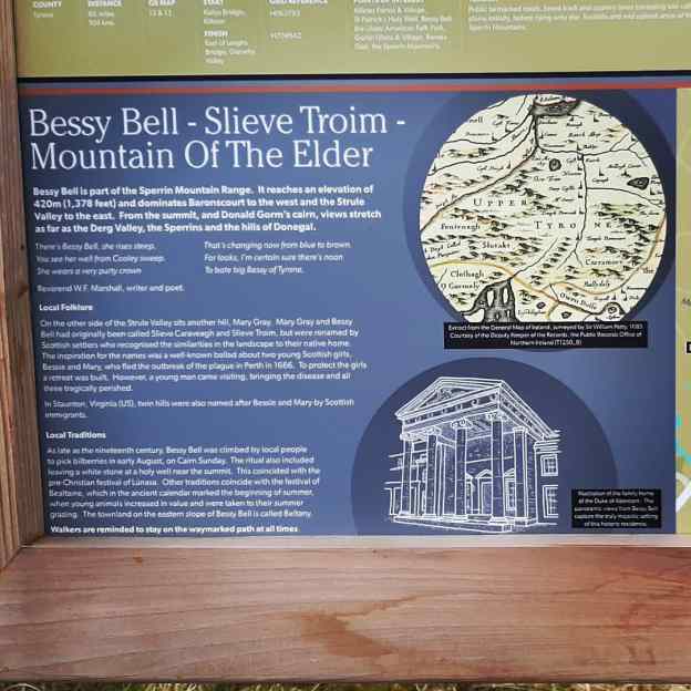
Bessy Bell is a large hill/small mountain just outside Newtownstewart and approximately 25min from home. I was last up here about 5 years ago and figured this would be a good time for a revisit. The 12km loop is completely on stone forest roads and easy for navigation. The climb to the summit isn’t too taxing (maximum height 420m) and the views are very rewarding.
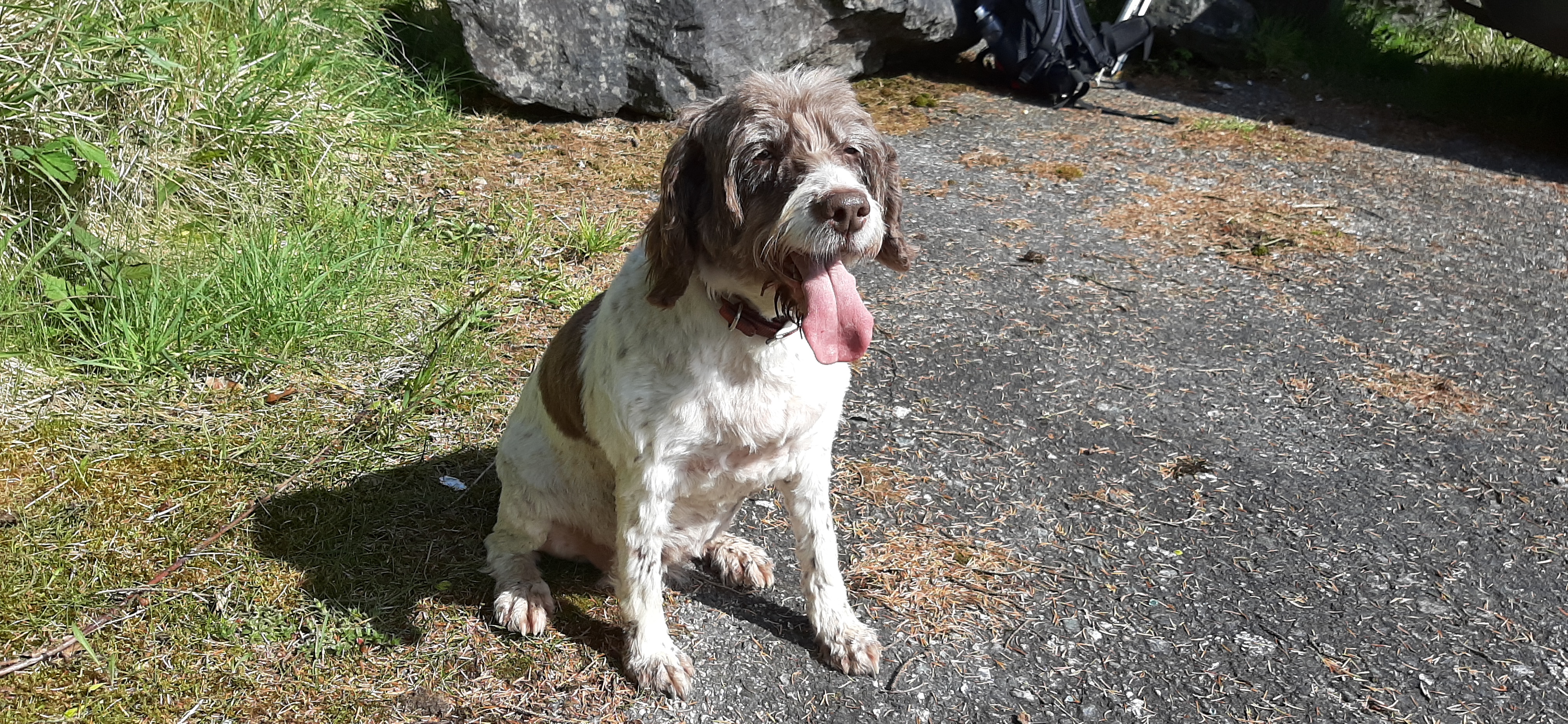
Rosie isn’t a good traveller, she gets car sick, but at only a 25min journey I decided she could come too. She’s getting on at 10 1/2 now but has been full of energy all week so I figured she would manage better than me!
After the summit you descend most of the way by the same track before branching off to follow the Ulster Way most of the way back to the start. This is pretty level all the way with a mix of forest and clearfell areas, very easy and pleasant walking.
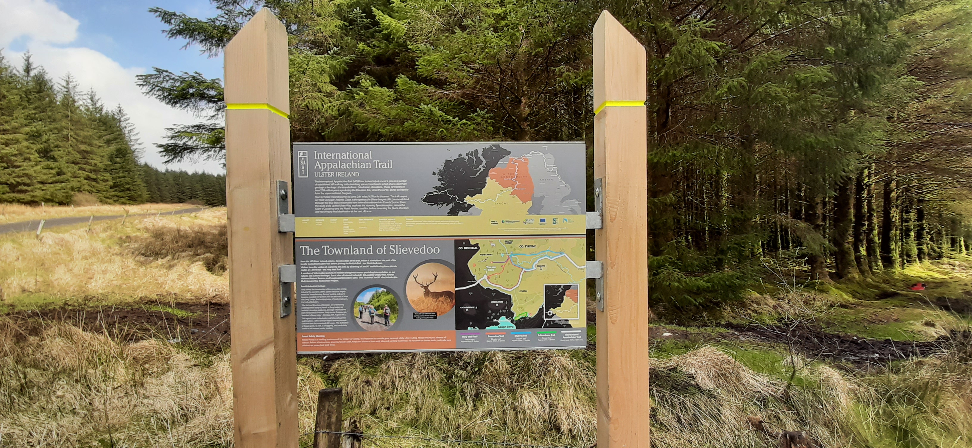
The Ulster Way is overlapped in this region by the International Appalachian Trail. New signage has been installed in the last 6 months or so and this is a later section than my previous walk in Killeter Forest a few weeks ago.
For food I took the usual packed lunch but also decided to take a gas cannister and stove for the first time ever. Normally I carry a flask of tea which usually results in a sub standard, stale tasting and lukewarm drink for lunch. Using the stove provided a very refreshing cup to accompany my sandwiches and definitely worth the slight extra weight.
The final 1.5-2km section is along a stretch of rural road. It’s a busy enough road but quieter than I expected this time. Also there was still lots of flowers to admire and nice scenery to enjoy along the way.
tired but happy 🐶
Despite the rest of the country being under a thunderstorm warning it managed to stay dry, warm and mostly sunny for the day. My back coped well and has continued to improve slightly every day since. I hope to get back on the bike for short spins this week.
Yesterday morning was fabulous. Very calm and sunny and despite an early frost it was lovely. After the school run I came home and organised my bike and kit all ready for a late morning spin. First though I had to wait for the guy to come and replace one of our worn out electric showers. With two teenage boys back at school and both of us working one working shower is no longer enough in the morning!
The shower man came about 10 and left about 1130. I don’t know if it was spending the morning making small talk and listening to his stories or if it was the change of weather from sunny and calm to overcast, cool and breezy but my cycling desire had totally evaporated and the thought of dealing with traffic was totally unappealing all of a sudden.
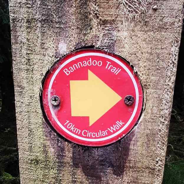
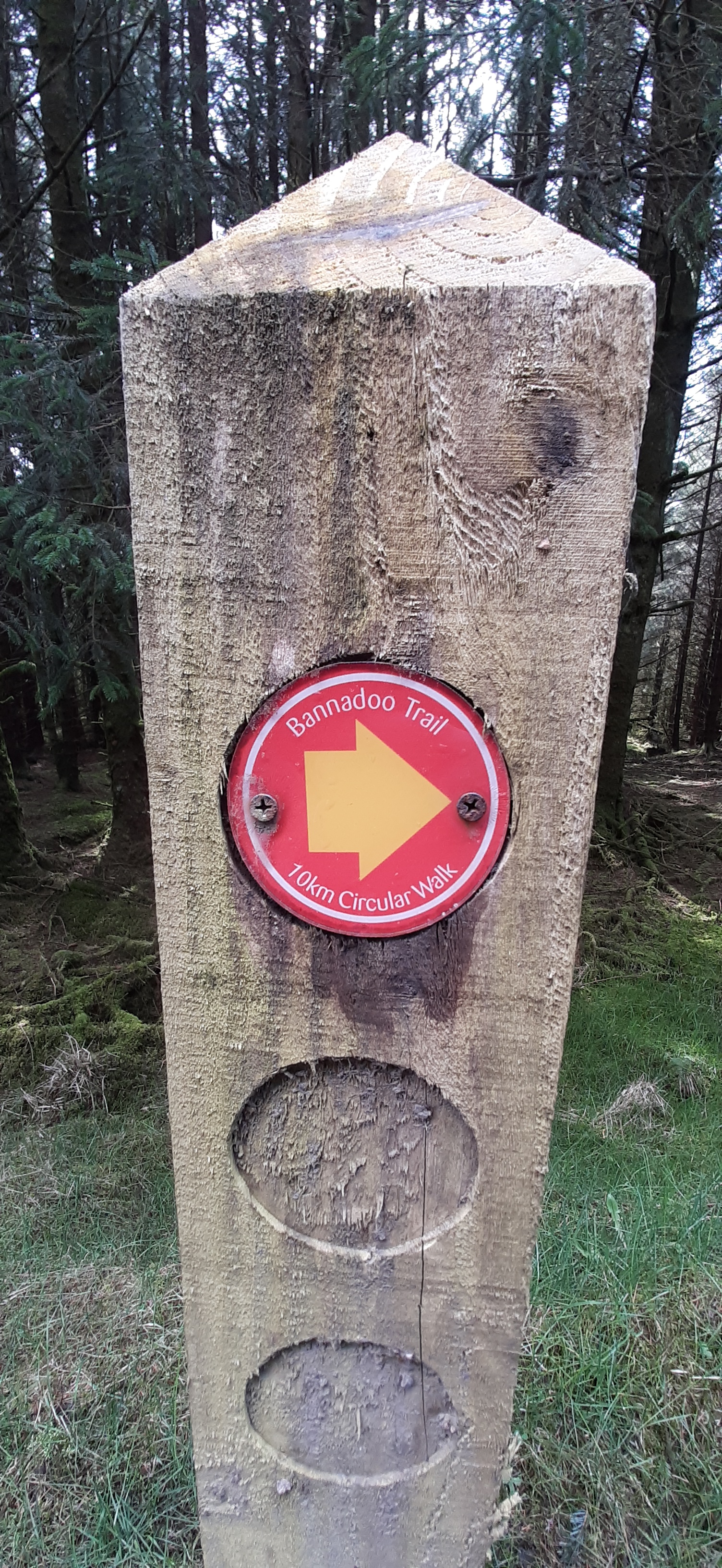
I was rattling around the house trying to think of something to do when a flash of inspiration brought to mind Killeter Forest and the marked trails. A quick perusal of the pdf established that the 10km Bannadoo Trail was the best option.
Over the last number of weeks I’ve been drawn more and more to the woods. Something about woods and forests and being in the trees is helping me mentally, a form of forest bathing as referenced above. My go-to place for many years has been Monellan Woods. It’s local and relatively quiet until the last year or so. Over the years I’d rarely meet anyone else while walking there, occasionally another walker or runner. Since Covid and an explosion in outdoors activity word has obviously spread and now it’s a lot busier. Tuesday evening for example I met at least 6 other groups/solo walkers and runners. It’s still a beautiful spot but it’s lost a lot of it’s calm and solitude.
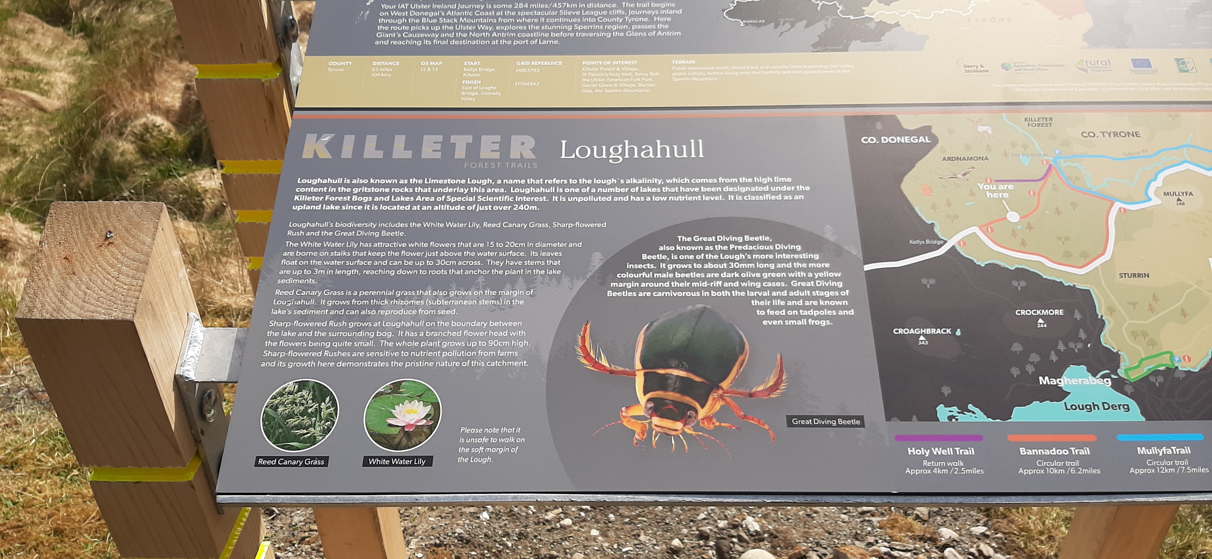
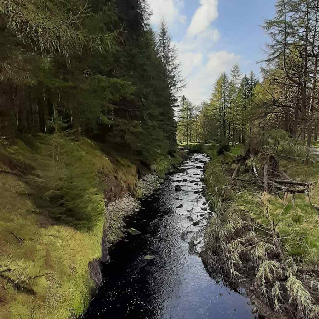
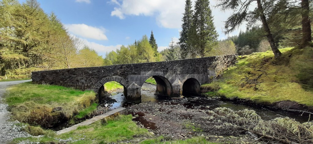
I didn’t have this problem in Killeter. Almost 7.5km is on forest roads with the rest on a very rural road. Apart from the surface there isn’t much difference between the road and the forest tracks as the road also runs through the same mix of mature Spruce plantation and clearfell. The only company I had for almost two and a half hours was the trees, hundreds of singing birds and insects. Not another person or car the whole time.
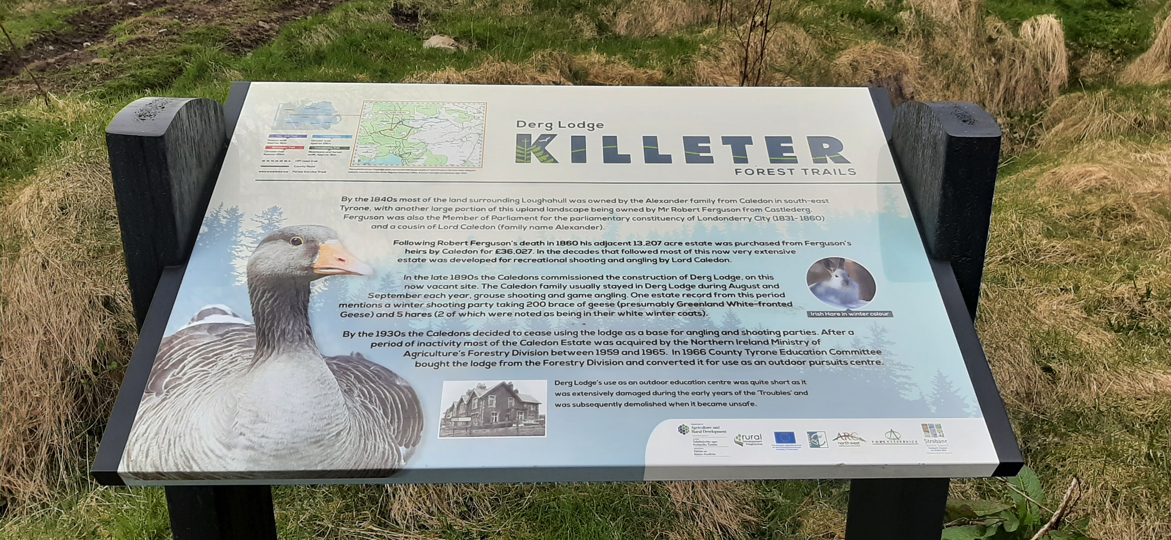
The walk turned out to be almost 11km including the short walk from the car park area to the start of the loop. Most of it is through mature plantation so the views are minimal but there’s a beautiful lake in the last couple of kilometres as well as the site of the former Derg Lodge. Although I missed out on a cycle it was a worthwhile change of plan.
international appalachian way
damaged during the “troubles” = blown up by the ira
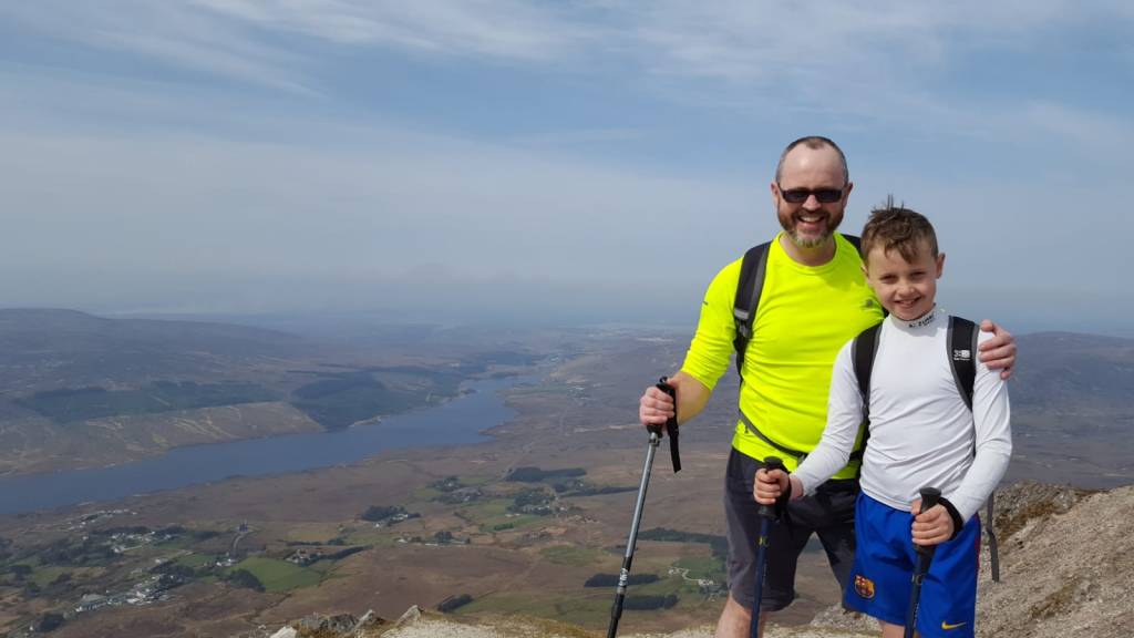
Mt Errigal is the highest point of Co. Donegal. I’ve climbed it a number of times over the years. Last time was April 2019 with Jim, his grandson Veli and Conor.
summit photo
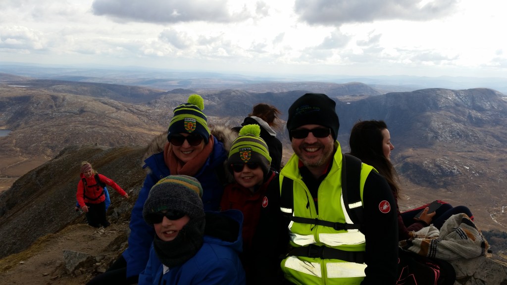
Before that we climbed it as a family on Easter Sunday 2018. This day also marked the 20th Anniversary of the day Catriona and I met for the first time.
a little cooler looking
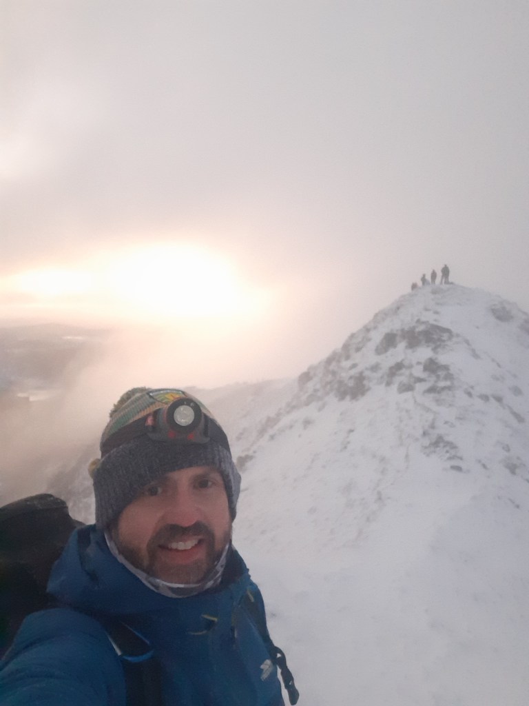
This morning I started 2021 by climbing Errigal once again to witness the dawn of the new year.
2021
The idea for this started as a joke on Xmas Day when I told the boys we were going to camp out on Errigal to witness the dawn. I’d no intention of camping but the idea of a dawn hike was rattling around in my brain ever since. I kept an eye on the weather all week and it looked like it was going to work out.
The alarm woke me at 4:10am and after just one snooze and my first attempt to talk myself out of the idea I was dressed, fed and out the door shortly after 4:45am having tried to talk myself out of it for the second time!
Driving over to Letterkenny I suddenly remembered that the new lockdown restrictions that came into effect yesterday included a resumption of the 5km travel limit. At this stage I was committed and drove on hoping not to meet a checkpoint on the road.
Approaching Glenveagh Muckish was suddenly on the skyline, reasonably visible due to the almost clear sky and the bright moon, just one day from full. Along the road the remaining “Seven Sisters“ appeared with Errigal finally looming large with some clinging cloud and a topping of snow.
Arriving at the car park there was a car, a van and a motor home already parked up. A second and third car appeared within 5 minutes. As I was getting dressed a hiker appeared over the ridge and into the car park. He had some route advice and showed us a video of conditions at the top. He had started out at 3:30am and didn’t want to wait for dawn as it was so cold.
The other cars and the original van turned out to be a small group of online friends meeting for the hike. They were pretty fit looking so once they were ready, after everyone sheltered from a fairly heavy shower, I let them get a 5min head start to keep us apart on the hill. This was my third and final attempt to talk myself out of it!
The initial section of the hike is across wet bog and along the bank of a stream. It’s pretty difficult terrain at the best of times, particularly wet this morning and very tiring in the dark. Keeping an eye on the lights in front I was able to plot my route pretty successfully and reach the start of the scree without falling in a bog hole. Despite the compacted snow and patches of ice the firmer ground made for much easier walking and surprisingly I soon passed the first group.
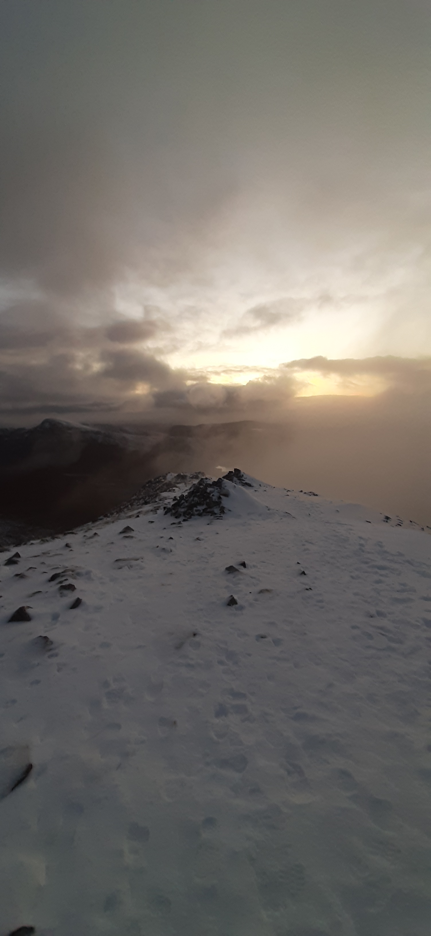
Following the footsteps in the snow and the path faintly visible in the light of my head torch I made steady progress and soon reached the rest point just below the summit. This is a ring of stones approximately 4m wide and built up to a height of about 1m. Just enough to provide shelter from the wind. Just as I arrived another heavy shower of snow and fine hail blew in but once I had my hood up and sitting on my seat pad, leaning against my rucksack it was reasonably comfortable. Less than 10 minutes later and the group joined me. We were way too early for the dawn and with zero shelter at the peak we waited in the shelter until 7:45am and then headed for the top all together. Along the way the clouds lifted and there was a tantalising vague view of the mountainside falling away and the nearby landscape and mountains highlighted with drifts of snow.
Very quickly we were on the first summit and crossed over the narrow ridge to the second. The cloud was fairly thick again but the brisk wind was keeping it moving with the full moon appearing every now and again as the clouds blew over.
The other group moved back to the first summit to check the view for photos and fire up a drone. I stayed where I was as I was keen to experience the dawn peacefully on my own.
The temperature was close to freezing and the windchill sub zero which made it difficult. As usual toes and fingers suffered the most, especially my right hand as I had to remove my glove to take photos.
As the light gradually appeared the sky started to ripple with the pink of dawn and as the clouds blew past I soon forgot about the cold. Ever so slowly the landscape below began to materialise as the light increased and eventually the sun’s glow was visible through the clouds.
The whole experience was amazing. It’s easily one of the best things I’ve ever done and I found it quite uplifting and emotional. A morning I don’t think I’ll ever forget ♥
The descent was pretty straightforward now that daylight had arrived. It needed care though as the path was compacted and slippy with a mix of snow and ice. Lots of people were making an early ascent of the mountain and it was really nice to get a chorus line of Happy New Year all the way back to the end of the scree. The bog was running wet for the rest of the descent and very muddy for the last few hundred metres but much easier descending and daylight made pathfinding much easier.
I met at least 40 people on my way back down and the car park was full to overflowing with more cars parked along the road. Seems like I’m not the only one who forgot about the 5km limit today!
Two of group I met on the hill are very talented photographers and are active on Instagram. These are the photos they chose from this morning. They have a lot more talent than I do and are worth following.