Starting my new job at the end of August came with an unexpected seven days of annual leave to use before the end of the year. Four of these are required for my first Xmas off since 2012 leaving three to be used elsewhere. I used one to make the Halloween Bank Holiday into a four-day weekend and used the other two this weekend to do the same.
My Friday off coincided with a friend Gary’s suggestion to attend a Mountaineering Ireland event in Dublin on Thursday evening to hear Demort Somers speak before being presented with the annual Lynam Award for his contribution to Irish Mountaineering. Dermot was part of the 1993 expedition which saw the first Irish person reach the summit of Everest. Although he spoke only a little about Everest he was very entertaining. I’m not a climber in any sense but it coincided nicely with a podcast I’ve been listening to in the last few weeks.
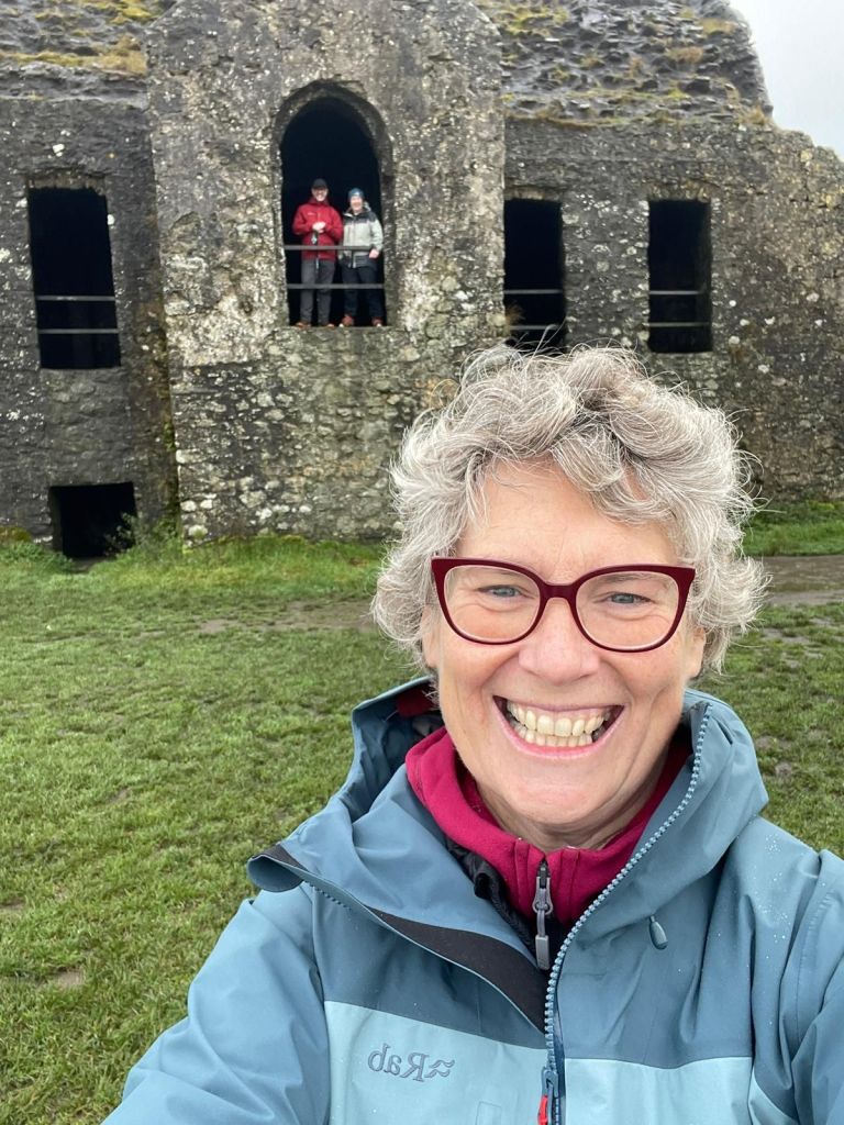
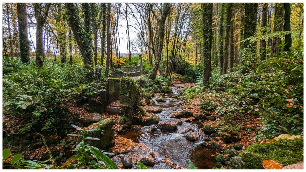
Gary and myself were very kindly hosted for the night by Miriam, another friend. She attended the event with us and our plan was to go for a day hike in the Wicklow Mountains on Friday. However, a low cloud forecast required a change of plans and we headed for the Dublin Mountains instead and visited a place I’ve been interested in visiting for a long time
Montpelier Hill (Irish: Cnoc Montpelier) is a 383-metre hill in County Dublin, Ireland.It is topped by the Hell Fire Club, the popular name given to the ruined building. This building – an occasional summer residence built in around 1725 by William Conolly – was originally called Mount Pelier and since its construction the hill has also gone by the same name.
Members of the Irish Hell Fire Club, which was active in the years 1735 to 1741, used Mount Pelier summer residence as a meeting place. Stories of wild behaviour and debauchery and occult practices and demonic manifestations have become part of the local lore over the years.
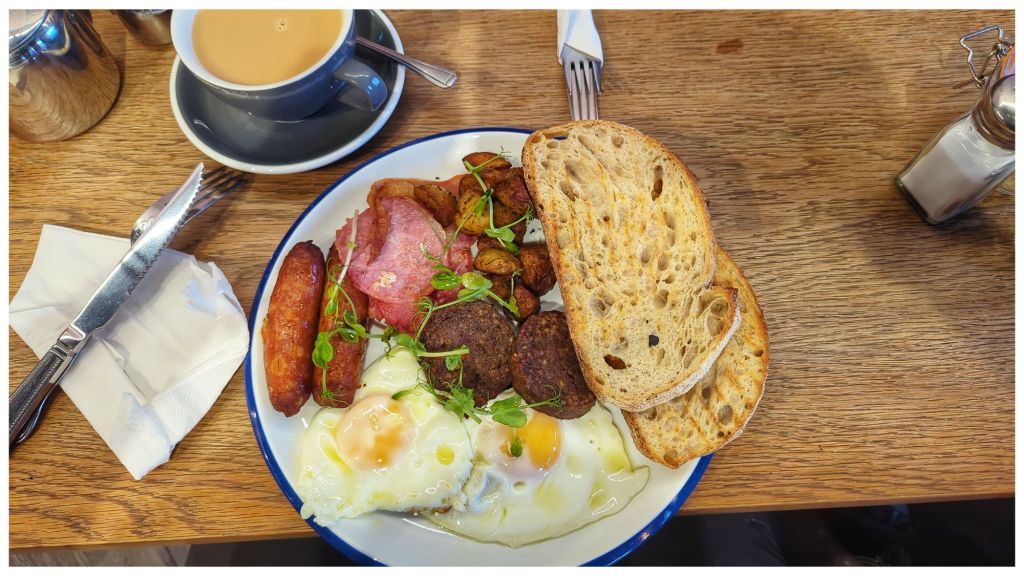
All of this was fuelled by possibly the best ever breakfast I’ve had, supplied by the East Village Coffee Shop in Clondalkin.
Close by the building at the summit there was a trig pillar which I dutifully tapped. Sadly it has been vandalised over the years with all the metalwork removed but the concrete pillar is still in decent shape.
Gary was a geocacher at one time and between the two of us we made a short diversion to grab a nearby cache that was close to the path, making for a trilogy of lists that got ticked off in one short visit.
Following a short diversion into a very picturesque Massey Estate we headed for Timbertrove which according to Miriam, has the best scones in Ireland. They are certainly among the biggest I’ve ever seen anyway!
One thing for sure, I didn’t go hungry on my mini trip to Dublin!
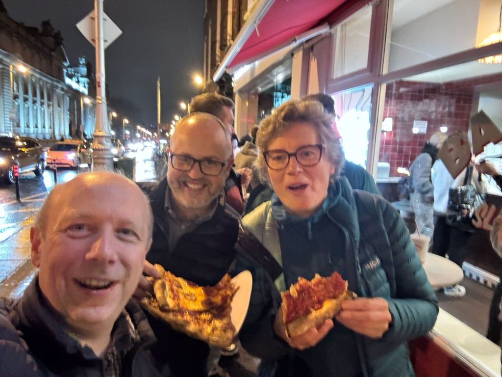
Thursday Evening Street Pizza
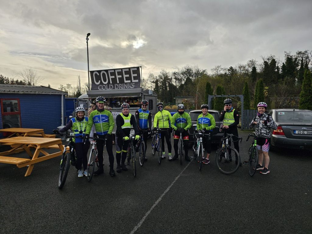
Saturday morning saw me joining the Club Stabiliser Group for the weekly ride. That’s six weeks out with this group now which is becoming a really good and very enjoyable routine again. Also my 5th ride over 50km which I didn’t expect to be coming close to this soon after starting cycling again at the beginning of September.
Coffee Stop
Sunday afternoon it was my turn to look after my Great Aunt Ruby while Mum and Dad had a few hours to themselves. I’ve spoken here about Ruby before but she is now the oldest living person in Ireland and it’s an honour to be able to spend time with her like this. Unsurprisingly, she is not the same lady at the end of the year that she was at the beginning but she still has moments to make me laugh.
NYE 2023
Today I had planned to cycle in the morning but Winter has come rushing in late but with a wicked bite. Temperatures hovering just above freezing created a fog thick enough to make it unsafe that didn’t lift until well after noon. By that stage I was too lazy, was settled in with the heating on and a really good book (The Reckoningby Jane Casey) with a few episodes of Justified to break up the day.
There’s something in me that tends to see days like today as a waste but I managed to ease the “guilt” with a bit of housework in the afternoon. Going back to work tomorrow I may appreciate the rest better in the morning.
Four days definitely is a good long weekend but it has felt a good bit longer in a positive way.
I don’t think I’ve ever written on this blog about geocaching before? It’s a hobby that I picked up in 2005 and it was my main pastime for a good few years. It suited my lifestyle perfectly at the time as it was just before Owen was born, work was very busy and it was a hobby that I could fit in with family life very easily. It was also a great way to spend more time outdoors as I had let that slide quite a lot at the time.
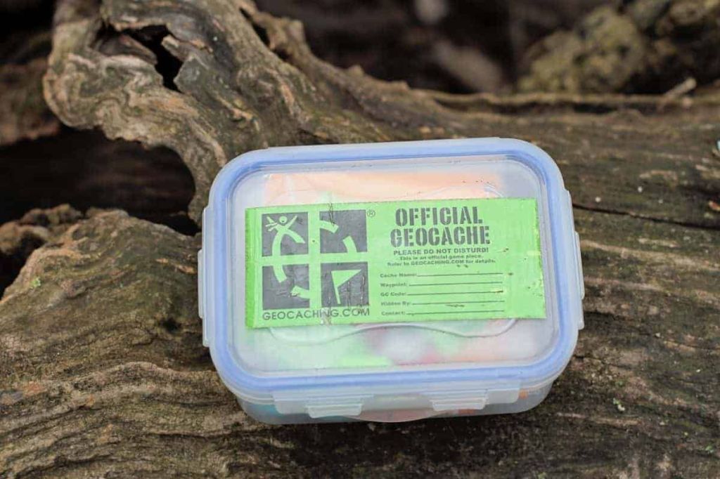
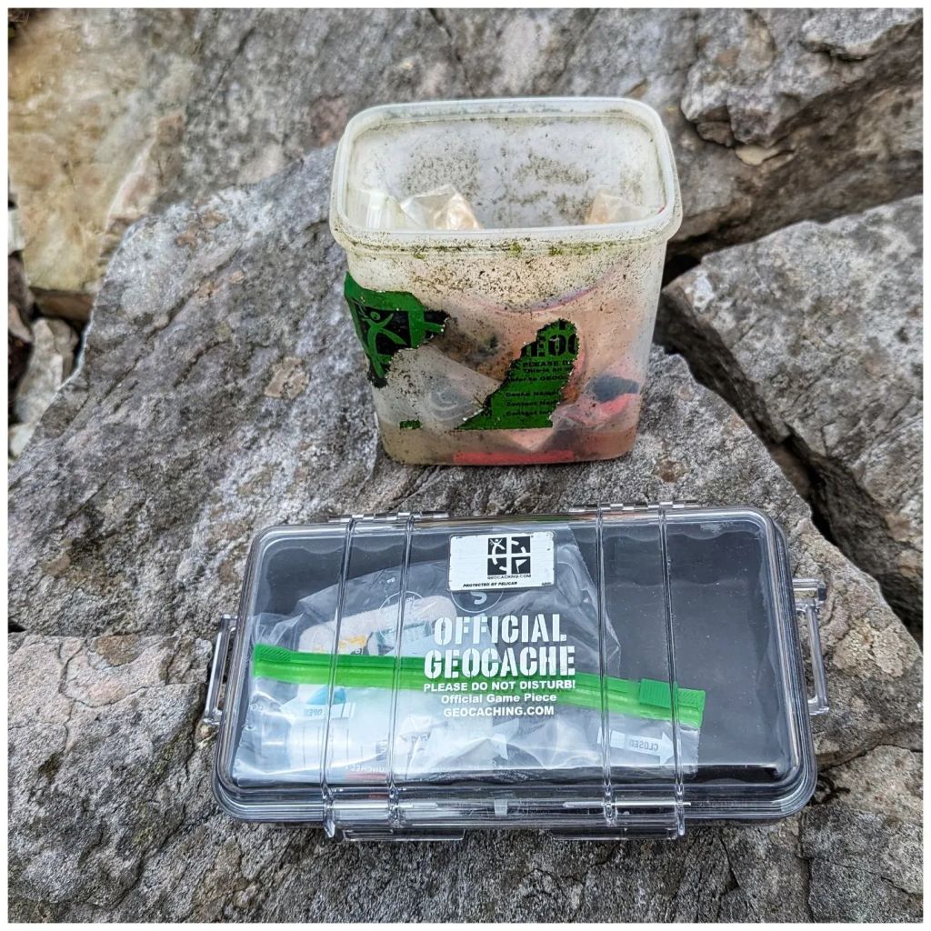
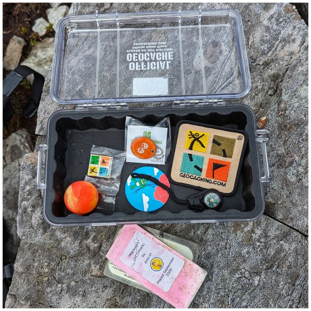
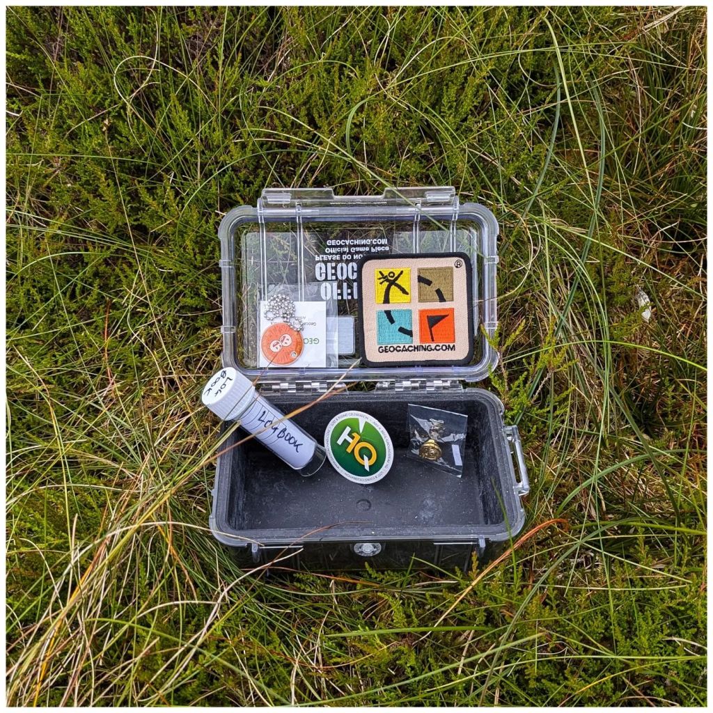
What is Geocaching? Well essentially a geocacher hides a container (sometimes large, sometimes small, often tiny), records the GPS coordinates and shares the location on Geocaching.com along with some information on the location and maybe a hint to help find it. Other geocachers then use this information to go and find the container and log their find on the website and in the physical logbook in the container.
a variety of geocache containers a lot looklike this though
In 2007 I also became a geocaching reviewer which meant I checked listing submissions to make sure they were in suitable places and not contravening any of the placement guidelines. All checks were done virtually using digital maps and asking questions of the cache owner.
The geocaching community is incredibly diverse and mostly very friendly. Through my geocaching duties and attending social events I made many good friends and a lot of them I’m still in touch with today. However, as time moved on I retired as a reviewer (2017) and gradually geocached less and less as other hobbies (mostly cycling) took over. My last physical cache find was back in 2018 and since then I’ve only logged virtual caches on holidays in Prague and Venice to add them to my list of countries.
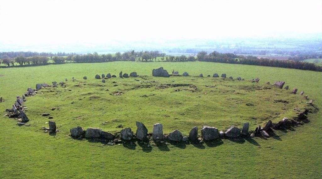
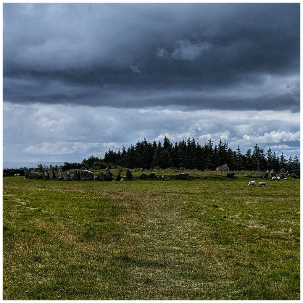
I have either removed or transferred ownership of most of my placed caches to other active geocachers but a small number still remain active under my account. One of these is at Beltany Stone Circle just outside Raphoe and a 10-15min drive from home.
Beltany is a place I really enjoy and being so close to home this is one I hadn’t really thought of giving up. It’s not one that gets a huge amount of visitors due to it’s category of Multi-Cache so it rarely gives me any issues. In the last couple of weeks though it seems to have gone missing and I have been communicating over and back with a number of people that have been trying to find it. The weather for Sunday was a bit iffy so I dug out a box of old containers and Geocaching.com branded items and soon had a new one ready to go.
I had a very enjoyable walk up to the stone circle, replaced the cache and had a mooch around the neighbouring small stand of trees. I have a notion of bivvy camping up here at the stone circle to get the sunset and sunrise some time, getting in touch with my pagan side! I also found a couple of great spots in the small forested area for a hammock or maybe even a tent camp.
All the discussions over the last week or so must have re-ignited some dormant spark of interest as I also downloaded the geocaching app and had a quick look to see what new cache placements have been published in the last 8 years. Unsurprisingly there are a few!
My nearest one is a 5min drive from my house, on the edge of my home village and a spot I drive past at least once every day. On my way home from Raphoe I came this way, found it and logged my first geocache for 8 years. Took way longer to find it than it should have (it’s a very small hide but in the logical place, it just took a while for the penny to drop) but I put that down to being rusty.
I wouldn’t say I’m fully back into the hobby but it’s definitely sparked something again. There’s a whole new category of geocaches called Adventure Labs that sound interesting and there are two locally that I’ve highlighted to have a closer look at.
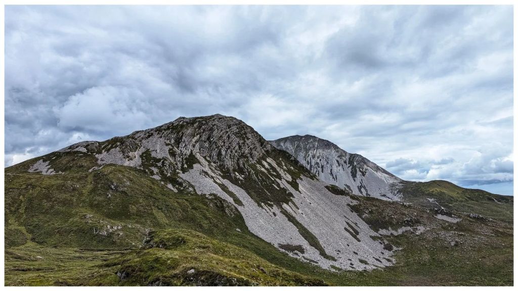
The geocaching theme continued into Monday. The weather forecast looked promising and significantly, even where showers were forecast, the cloud base was predicted to stay high. That has been a real issue for me this year! I initially had a hike in the Sperrins earmarked but instead decided to head for the Derryveagh Mountains.
I have a series of caches on two summits beside Errigal and a third at Lough Altan that are designed to be a great hike if done together. I did have one on Errigal as well but someone agreed to adopt it a while ago. All three of these caches were in need of some TLC and coincidentally I had 3 more containers left and enough Geocaching.com stuff to stock them. So my new plan was to hike the route, skipping Errigal and replace them all. This turned out to be a great decision!
9.8km with 605m of climbing
I started at the Errigal car park and followed the new path until I reached the cairn where the climb up Errigal proper starts. Here I diverted right and followed the faint track up the steep and rocky side of Mackoght (555m) which is also known as “little Errigal” or “Errigal’s little brother“.
in 100m, at the cairn, turn tight
Mackoght is a really enjoyable climb. In many ways I prefer this climb to Errigal. It’s a really satisfying mix of short grass, heather and broken rock. The summit itself is fantastically rocky with a really nice marker cairn and in my opinion the best view around of Errigal’s twin peaks.
reverse view over lough altan with the aghlas behind and muckish in the distance
I spent well over an hour on the summit of Mackoght replacing the cache container, having lunch, flying my drone and soaking in the views. The weather was perfect, lots of sunny spells and hardly any wind, a stark contrast to my last Irish mountain experience! Best of all I had it all to myself while there was a steady parade up to the summit of Errigal as the good weather drew people in. Sitting on Mackoght I could occasionally hear voices carrying across while I sat in splendid isolation.
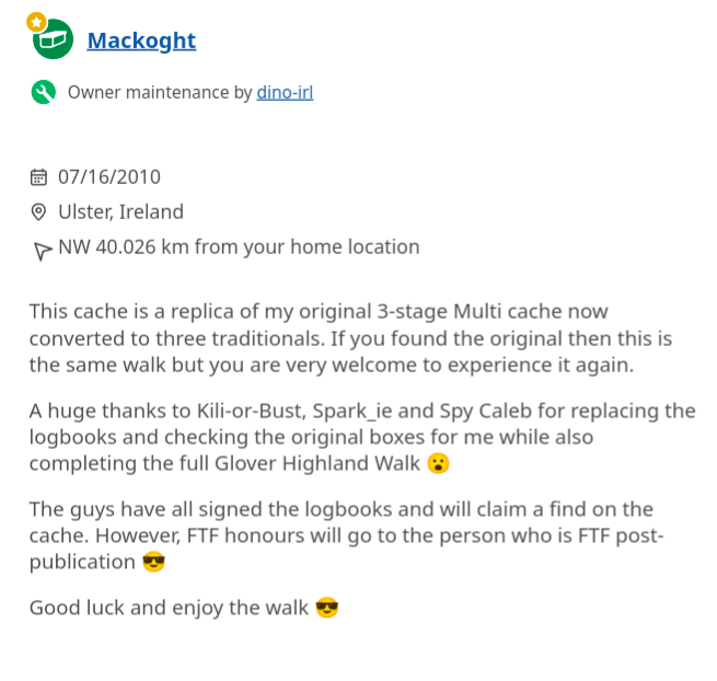
The publication date of the cache on Mackoght is 2010 but it was part of the original multi stage cache placed in 2006. That box has been up there for 18 years! The logbook was the real surprise. It’s the 2010* logbook and was still in good shape, good enough to keep using. I guess the box did a good job all things considered!
old cache, new cache still in good shape after 14 years restocked and ready to go
*I made a new logbook in September 2009 but wasn’t able to get it in place until July 2010 thanks to some help from a group of geocaching friends.
Leaving Mackoght it was a steady drop to the damp col between Mackoght and Breaghy. This descent required careful route selection to avoid the many rocky outcrops on this side of the summit that make it so impressive looking from the top of Breaghy.
little brother with big brother behind
The col wasn’t as damp as it looked from above and I was soon picking my way back up towards the top of Breaghy (392m). Some confusion set in here as there are a number of rocky outcrops. The summit always felt like it should be closer and somehow even OSI have managed to mark the wrong one as the actual summit!
actual summit with a marker cairn marked by the red circle
Anyway, after enjoying the brilliant views out over Lough Altan and towards the Aghlas I found the cache container (half full of water and contents thoroughly waterlogged) and replaced it with the brand new box and logbook.
lough altan and aghla more, breaghy summit off to the left
The final descent from Breaghy to Lough Altan was “fun“! Instead of the longer and more gentle route I decided to take the steeper, direct route. Halfway down, scratched to bits by heather and with a bum wet from sliding numerous times, I realised it wasn’t a great idea and contoured around to a much more sensible and easier descent and was soon crossing the stones on the river just before the ruined tower.
altan farm from partway down breaghy
Here I met the first people I’d seen since leaving the Errigal footpath. A Mum and Dad and 3 teenagers were just heading back to the road. They were friendly but not chatty and I did wonder if they were geocachers. I wouldn’t imagine that many people make the effort to walk out to here and they didn’t really look like hikers if that makes any sense? I haven’t had any logs on that cache yet so they probably weren’t.
As I was now alone I headed to the cache location, retrieved and replaced it. The original container was a large vitamin bottle in a hole between rocks. The issue here is that the hole is deeper than I originally thought. The first container from 2006 disappeared into the bowels of the earth as it was too small and this one replaced it in 2010. Even still this one required the full length of my arm to retrieve which wouldn’t be pleasant on a wet day! So, the replacement is much larger and is attached to a hidden external tent peg via a length of paracord that should make it simple to retrieve yet still unlikely to be discovered accidentally.
I took a while here on the edge of the lough to enjoy the view and take some photos but with time marching on I couldn’t sit too long and began the climb out along the boggy track. I was last here in August 22 and back then the track was horrible with large sections flooded with deep boggy holes. Thankfully it has dried out a lot since then and only one or two spots caused me any concerns.
neighbours at the back door compulsory photo of the tree through the front window with the lough in the background altan farm and the aghlas from the track out
I arrived back at the Errigal car park approximately 5.5 hours after starting with 9.8km hiked and 605m of climbing. It should have been quicker but I spent a lot of time enjoying the views and it was time well spent. This was the most enjoyable hike I’ve done for a long time and part of that was the good feeling from getting these caches back to the standard that the locations deserve.
I’m not sure how far my renewed geocaching interest will take me but it’s a start anyway and totally unexpected…
Last weekend I made the long drive to Portlaoise (3.5hrs each way) to take part in the annual Geocaching Ireland New Year Resolution Event. This takes place each year on the first/second Saturday in January. There’s a meetup in a scenic location followed by a walk, usually around 10km. As January is usually a busy month for retail and Saturday a key day I haven’t been able to make this event since 2013! However, changing jobs meant that I was able to book it off this year.
The walk mostly followed the waymarked Glenbarrow Mill Loop and for the first half it was along the River Barrow. After a few weeks of rain the river and waterfalls were in full spate with the waterfalls being especially impressive. The second half was along forest trails and a boardwalk across the more open hillside.
The walk was really enjoyable, a gentle rambling pace and beautiful scenery. However, the main aim and most enjoyable thing about the day was meeting old friends that I haven’t seen for a good few years. That was by far the best part of the day and more than worth the long drive each way 😊
with my old bud – mammy eileen
On Wednesday I then reacquainted myself with another old friend that I haven’t seen much of since August. We’ve seen each other in passing but I’ve always felt awkward about not spending time together like we used to and I’ve usually rushed on past with my eyes averted pretending not to notice him….
Since I screwed up my digestive system back in August I haven’t been cycling at all hardly and anything I did do was on the MTB. On Wednesday, after a 5 month gap, I finally went out for a road spin. I was way more nervous and anxious than I expected but despite my fitness being shot to shit I managed a pretty hilly route and even managed to enjoy myself. It felt good to be back out and good to finally break my duck 💪🚴