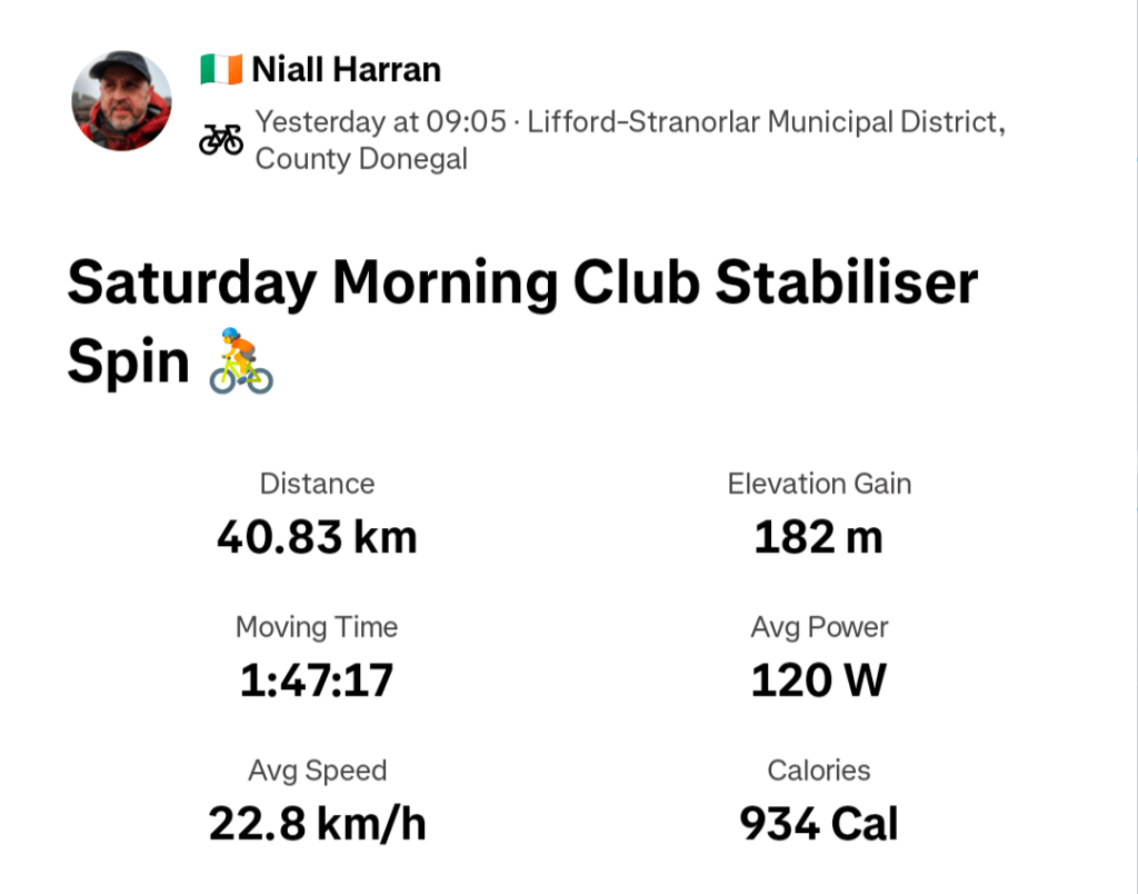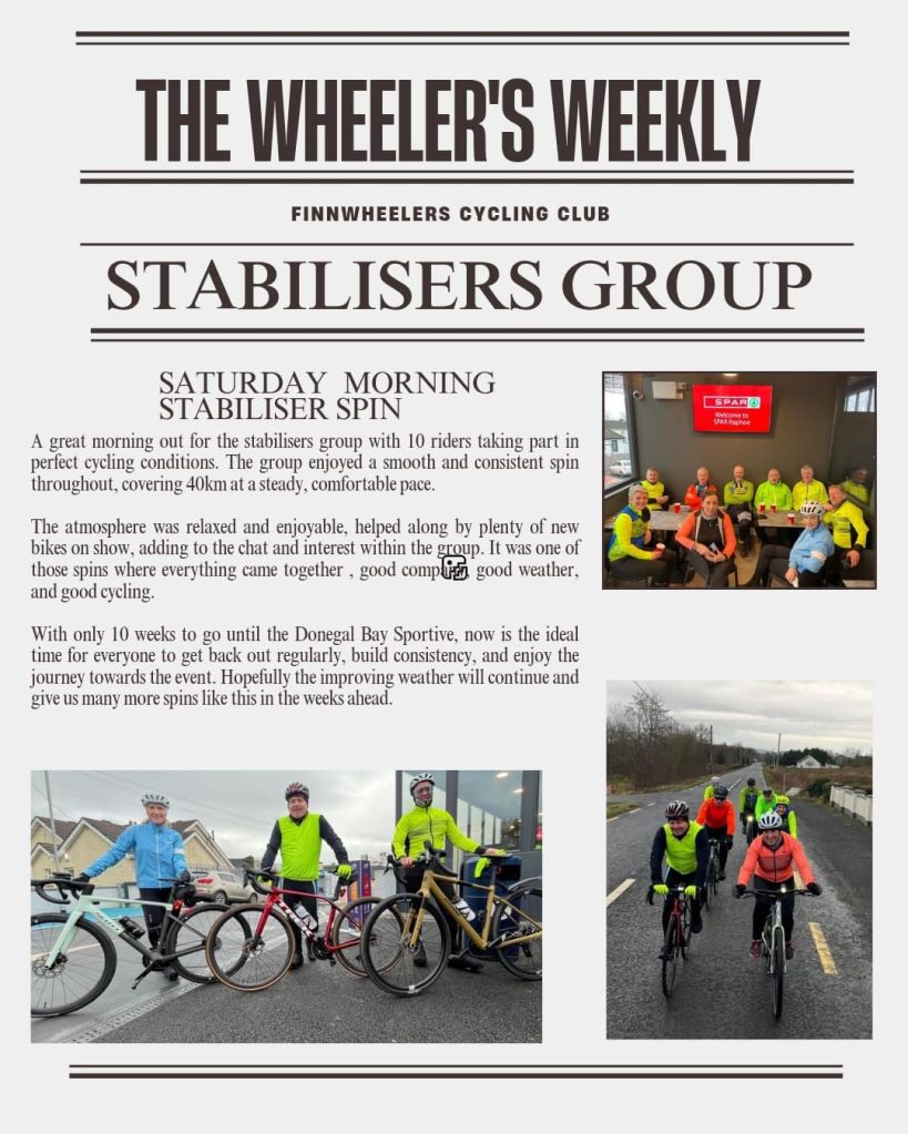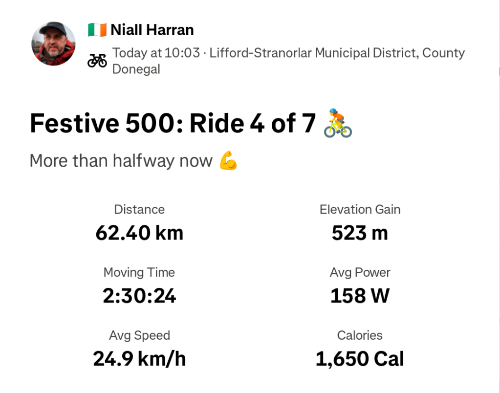
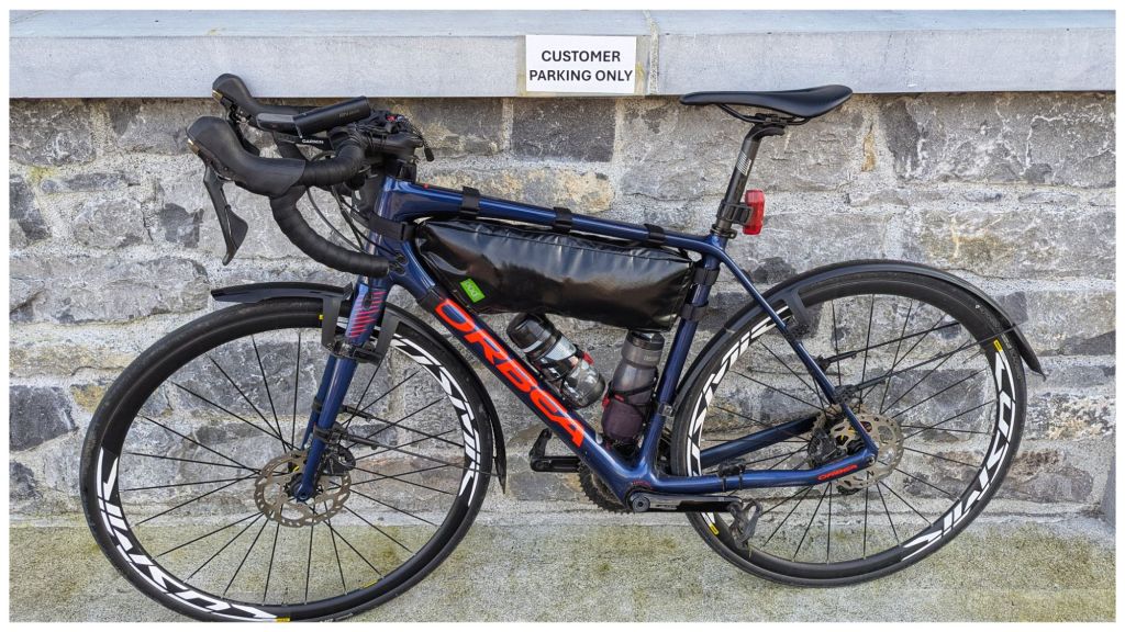
TL;DR I went, it was much harder than I expected but I finished!
I slept better than I expected in the B&B and woke with the alarm at 6am. Plenty of time for a shower to waken me up before a very decent breakfast. The B&B host had left me out an early continental breakfast and with the dining room to myself I filled up on cornflakes, toast, ham slices and a hard boiled egg with a couple of cups of tea. Just as well I had plenty of time to let that settle before starting to ride!
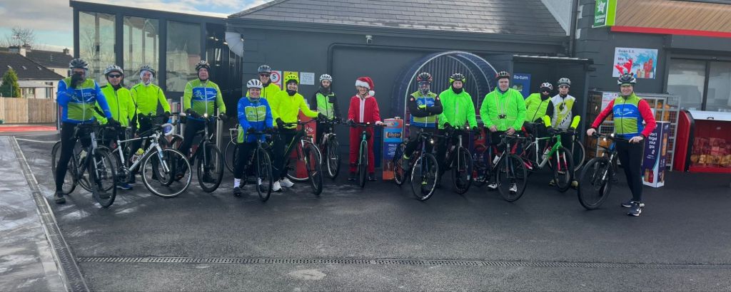
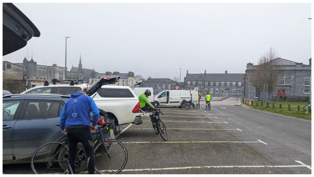
I got to the car park a few minutes after 7:30am and there were a lot of people ready to go already and some heading off for an early start. The official start time was 8am but with no mass start people were free to go from 7:30 and some were taking advantage. According to the organiser 52 people started altogether.
There were a few faces I recognised from events back in 2016/17 and others I knew from the WhatsApp group. I spotted one guy I met on my very first Audax ride and a few rides after that, but by the time I registered he was gone with a group from his Club and I didn’t see him at any of the checkpoints. Looking at his average speed on Strava I’m not surprised at that.
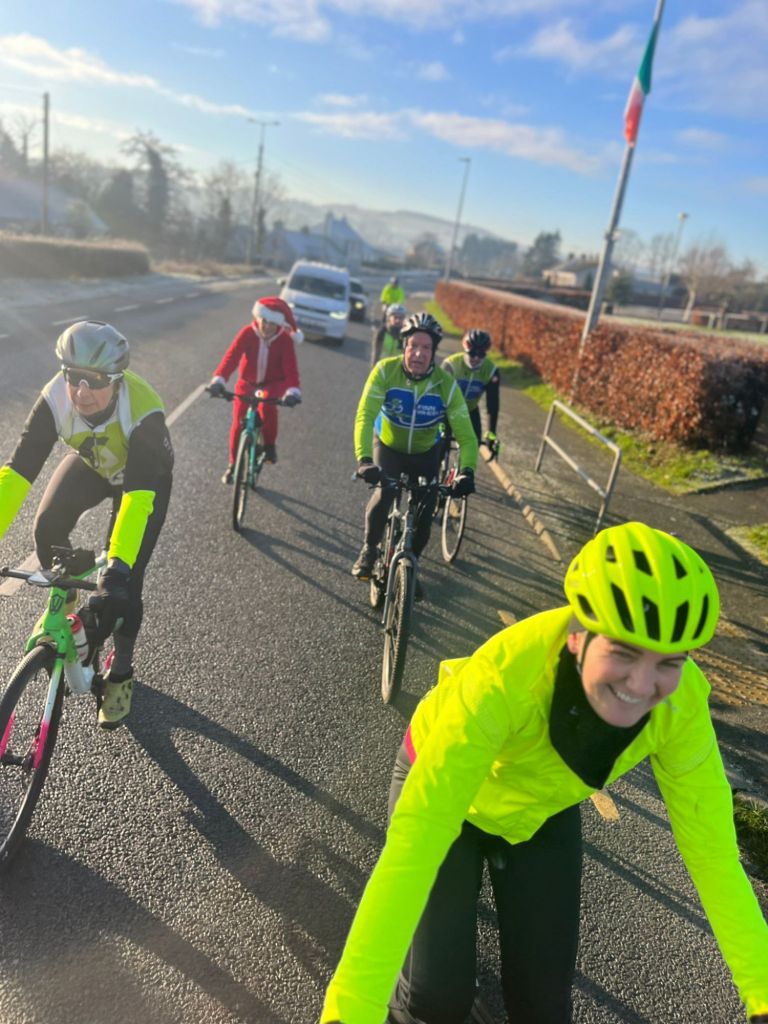
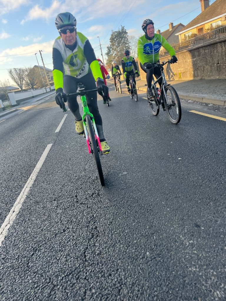
I was ready to go just before 7:45am and as I rolled out the road I picked up a group of lads from Co. Mayo. They were fit and fast looking but I ended up staying with them for over half the ride. They were a really friendly bunch and while the group was changing as everyone took their turn up front there was plenty of time to chat and get to know them a bit.
I was a bit concerned by the speed which was 27-30km/h but I was comfortable in the bunch and was just about able to do a stint up front between 20-30km. That was my only time up front apart from a very short pull later in the afternoon but they were more than happy for me to sit in and come with them.
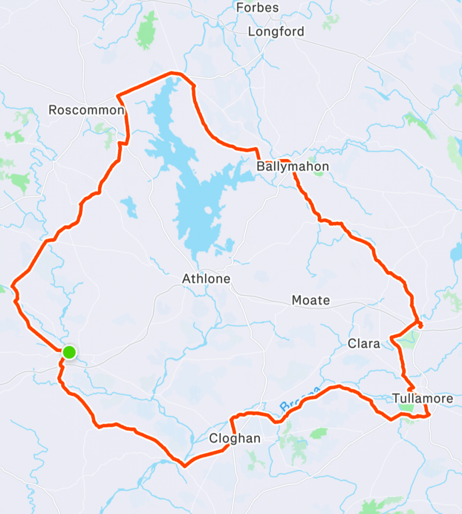
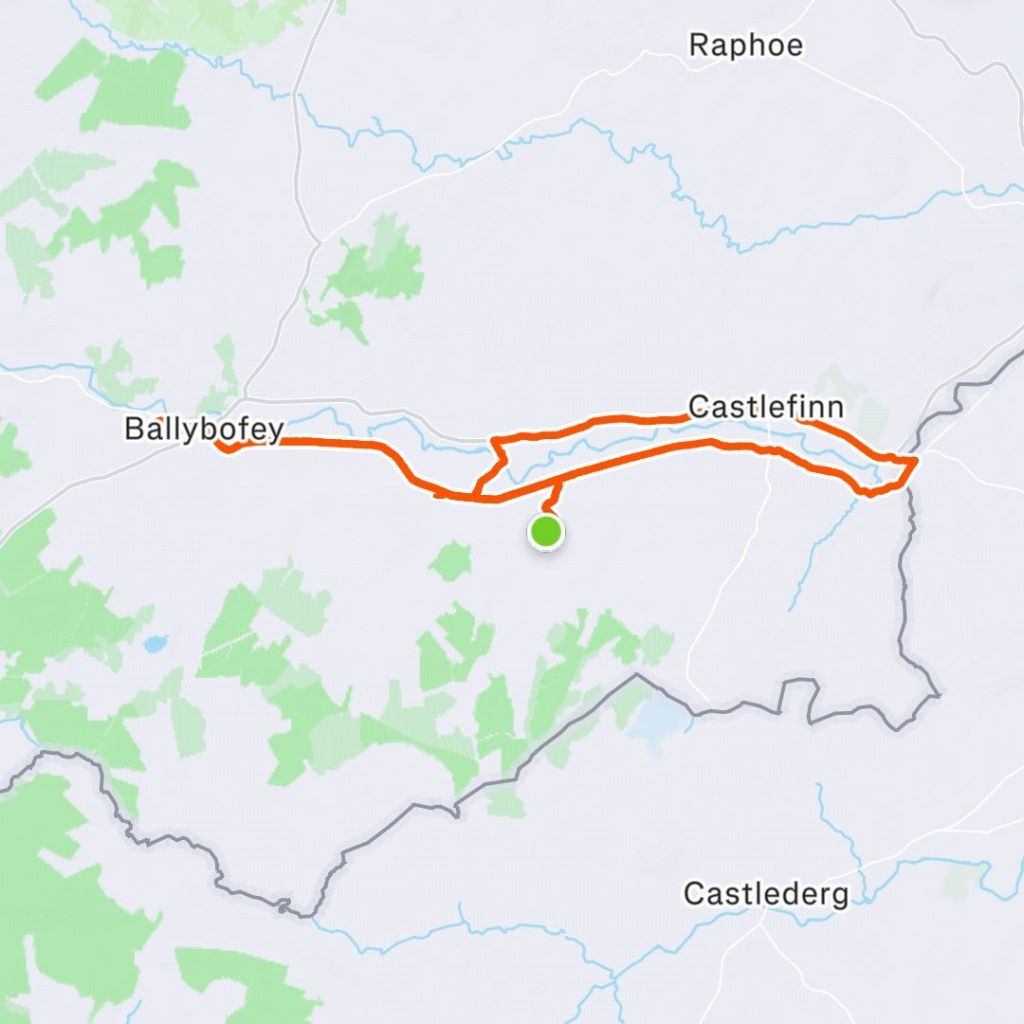
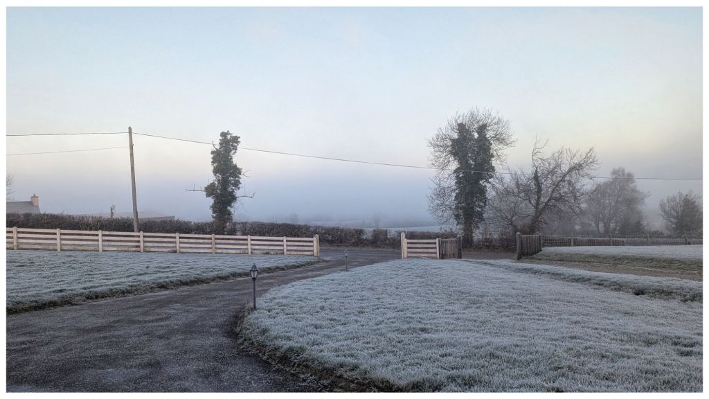
Starting off there was a lot of fog in Ballinasloe with visibility quite poor, down to less than 100m at times. There were quite a few cars on the road and some of the overtaking was pretty dodgy in the first hour as visibility ahead was questionable, especially with some approaching cars driving without lights in the fog!
We started getting glimpses of sun from about 30km in and suddenly the fog quickly thinned and disappeared. It was only then that I realised how wet I was from riding through the constant thick fog all morning as the sun glistened off wet arms and legs. I’d been wiping my glasses all morning and watching drips from my helmet but to be honest I was enjoying the chat and the ride too much to really take notice.
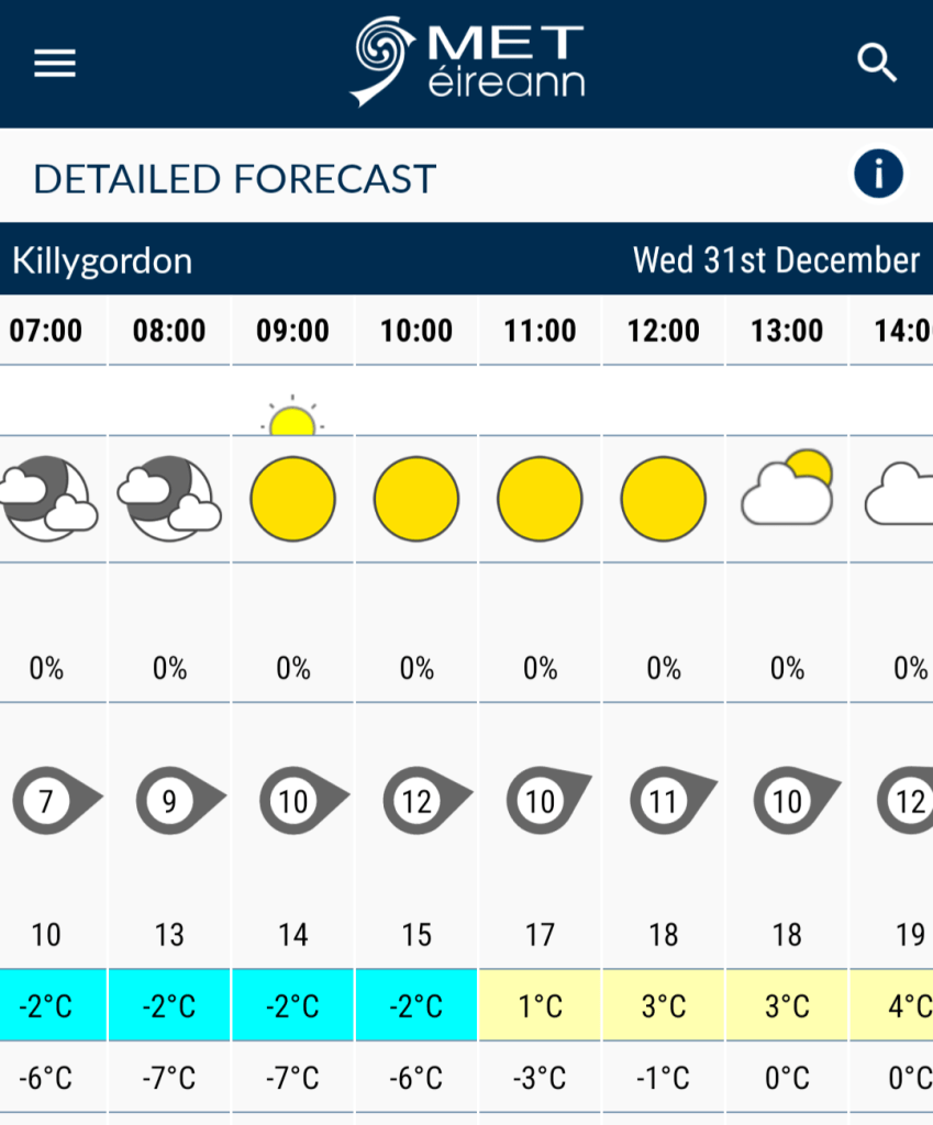
By the time we left the roads at 48km and picked up The Grand Canal Greenway North of Cloghan we were dry again and enjoying the first feelings of warm sunshine. Despite the starting temperature of 1°C and feeling cold for the first 30km I was glad I’d chosen to wear leg warmers rather than leggings and toe covers instead of full booties.
The Greenway was an absolute pleasure to ride on. The canal was a novelty for me and this was my first experience of riding along one. Most of the surface was tarred with some sections hard packed fine gravel. One section was along an old disused road. There were plenty of people out early, enjoying the Spring sunshine, but everyone was very accommodating. We were clipping along at a decent pace but pedestrians were watchful, everyone was sharing the space well and we got plenty of smiles, waves and hellos. I have a feeling the guys up front were playing their part too which definitely helped.
Altogether we had almost 23km on the Greenway and it was definitely the most enjoyable part of the day. We had plenty of chat and negotiating the occasional gate and bridge broke up the monotony enough to keep it interesting.
My initial plan had been to stop every 50km, to stretch for a few minutes and have a small snack and have something substantial to eat at 100km. The guys I was with planned to stop at 70km and 150km. I didn’t think I would be able to stay with them very long but I was enjoying myself and still feeling comfortable so decided to push on with them to the first checkpoint in Tullamore at 70km.
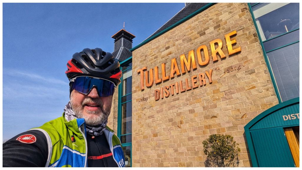
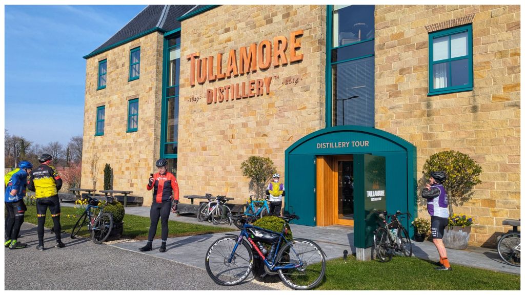
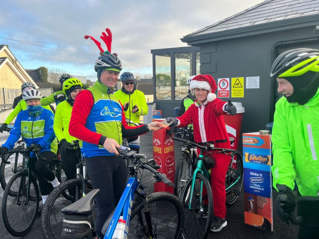
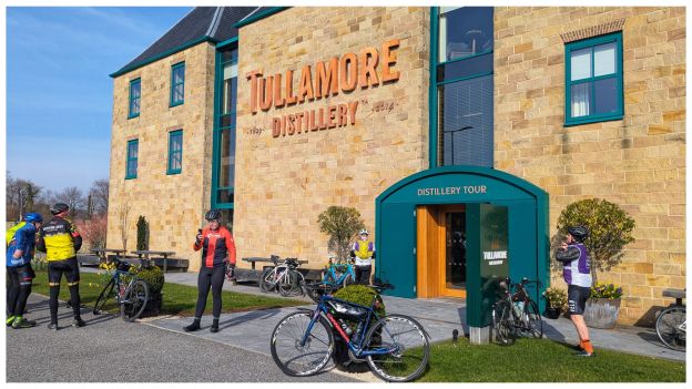
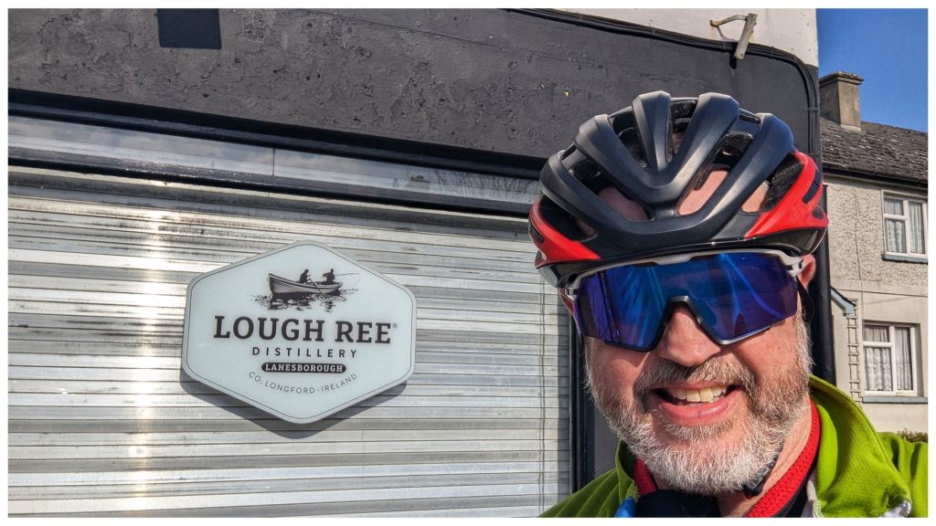
All four checkpoints for the route are at distilleries. Tullamore Distillery was the first and definitely the largest and most impressive of the day. We had had clear blue skies for a while now and with temperatures rising I took the opportunity to ditch the thermal skullcap and full finger gloves, switch the buff to my head and change to short finger gloves.
While I scoffed a banana the lads were discussing food. Most of them weren’t that hungry so the decision was made to push on to checkpoint 2 in Kilbeggan which was just under 20km away. I decided to go with them and they were pleased to bring me along.
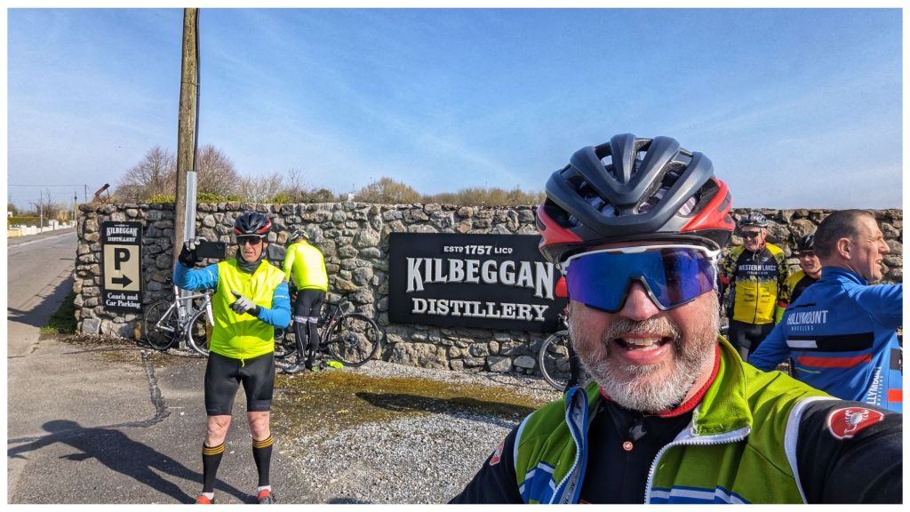
At checkpoint 2 (Kilbeggan Distillery) we found a much more functional factory rather than the very tourist orientated one in Tullamore. Photos done and another helpful rider pointed us in the direction of a good filling station on the edge of town.
This was just over 1km off our route but was a great shout as it had hot food and sandwiches as well as good toilets and a sitting area that we soon took over. The place was mental busy so while the rest of the lads headed for food I dived for the loo taking the chance to strip off my heavier base layer, take the sleeves off my Perfetto jacket and reapply some very welcome chamois cream. Although I wasn’t sore I was feeling the distance a little and it was very refreshing just to remove my shorts for a few minutes to apply the cream (TMI?)
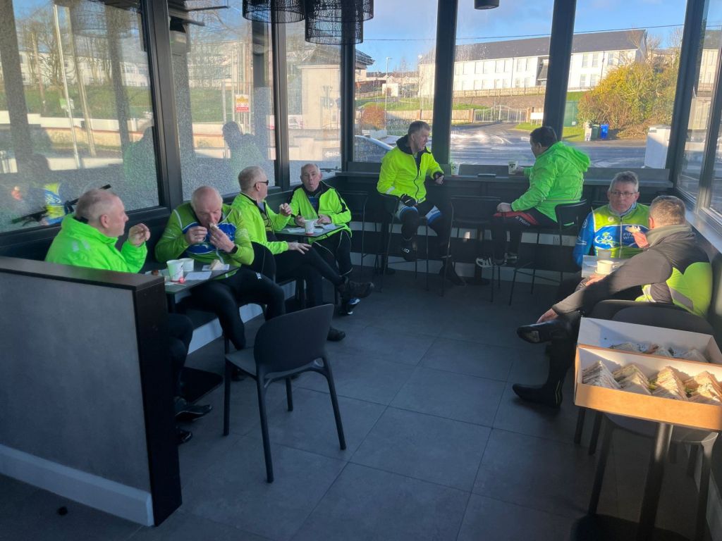
Feeling much better I loaded up with a huge sandwich, a very welcome cup of tea and a Lucozade Sport. We stopped here for about 30min and the lads were good company with plenty of banter.
After lunch we headed back to the distillery to rejoin the route. In Audax it’s OK to leave the route but you must rejoin at the same location.
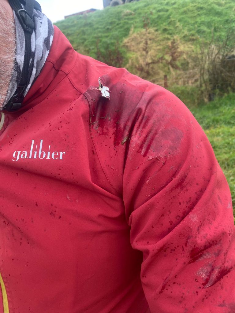
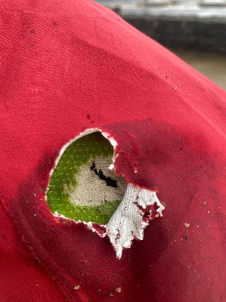
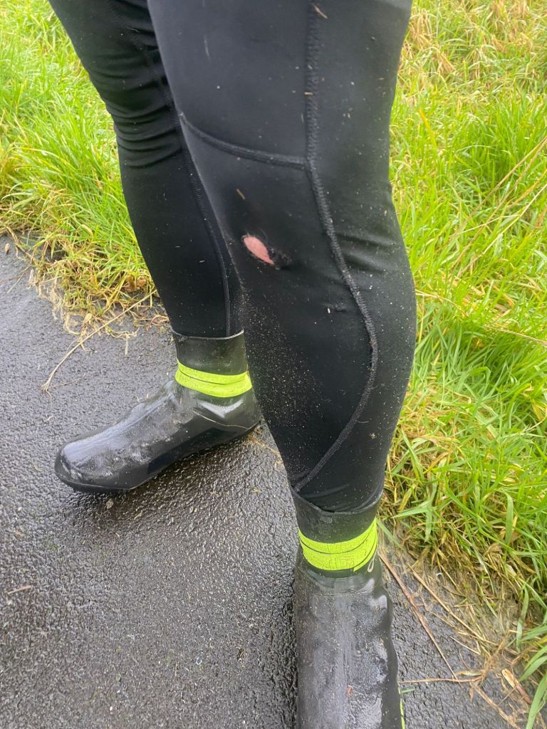
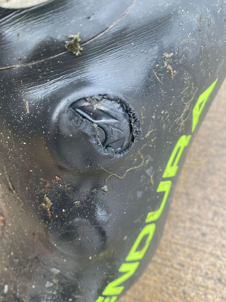
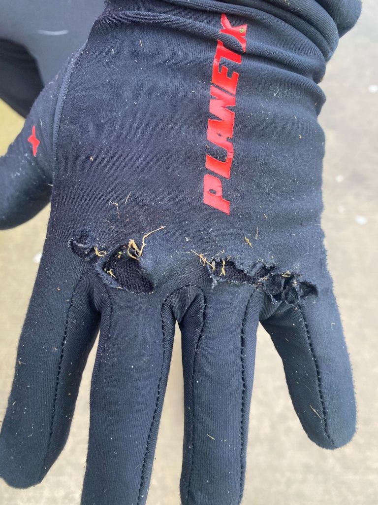
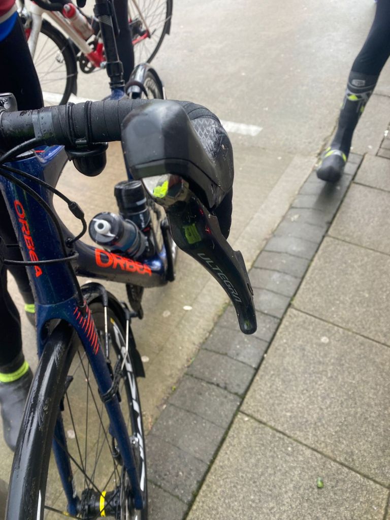
Heading away from the filling station one of the lads (Noel) had a bit of a problem with his back wheel but a bit of footerin’ and it was sorted. However, a few kilometres later as we hit the first climb on the outskirts of town it happened again and it turned out to be his free hub. One of the other lads tried to sort it. He even headed off into a local estate with the wheel, found two fellas working on a car and got a load of WD40 into it but with no joy. When he got back Noel decided to scratch. We waited while he called his brother for a lift and one of the other lads (John) somehow spotted a problem with his rear tyre! He had hit a pothole earlier in the ride but thought he was OK. Turned out he had split his sidewall very slightly and a tiny piece of inner tube was bulging out! That could have caused a nasty accident later in the day if it had failed at the wrong time.
Noel gratefully donated his tyre and after a quick change we were off again. Altogether we lost about 45min but at least it was warm and dry and the guys were gutted about having to leave Noel. They tried their best but they seem to be a close knit bunch and it was nice to see how much it genuinely affected them.
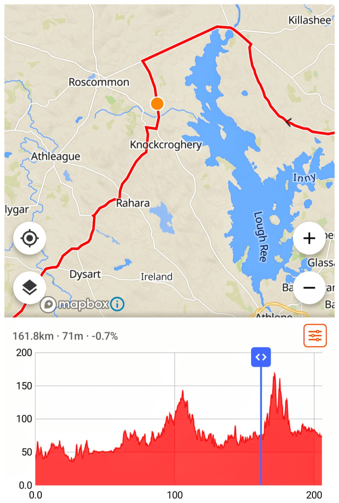
I didn’t realise it at the time but there’s a significant climbing section just after Kilbeggan. I’d already said to the lads at lunch that I didn’t expect to stay with them for much longer and that they were to leave me if I fell off the back. The next 30km was pretty full on. We followed a network of small roads from Kilbeggan, through the small village of Ballymore and across the border out of Co. Offaly and into Co. Longford to Ballymahon.
I’m not sure if it was the delay outside Kilbeggan but the group was flying. I tucked myself into the middle and just did my best to stay with them. I had no chance to watch the route so left it to the guys up front. I was barely able to look at my Garmin and was riding mostly by feel but I definitely saw 30km/hr way more than I would expect to!
My memory of this section was nice country roads with just the ocassional car or tractor that were friendly, holding back to let us by waving and smiling. There were also a lot of people out gardening, cutting hedges and lawns, once again all friendly with waves and smiles and even some kids out cheering us on. It reminded me of stories of Paris-Brest-Paris and was a really lovely surprise considering it’s not a publicised event and the first year it’s been on. Maybe it was the good weather putting everyone in good form?
Leaving Ballymahon at just over 120km I was really feeling the pace. I was now consistently at the back of the group and kept falling back on the short punchy climbs as my legs were unable to summon much power any longer. My heart rate was red-lining far too often and I was trying to get the lads to go on without me. They were slowing up to let me catch on and two of them fell back to encourage me on different occasions. Eventually I convinced the second guy that they should go on without me at about 135km. They weren’t going that much faster than me as it was at least 15min before I lost sight of them but I felt a lot better with the pressure off and able to keep my own pace.
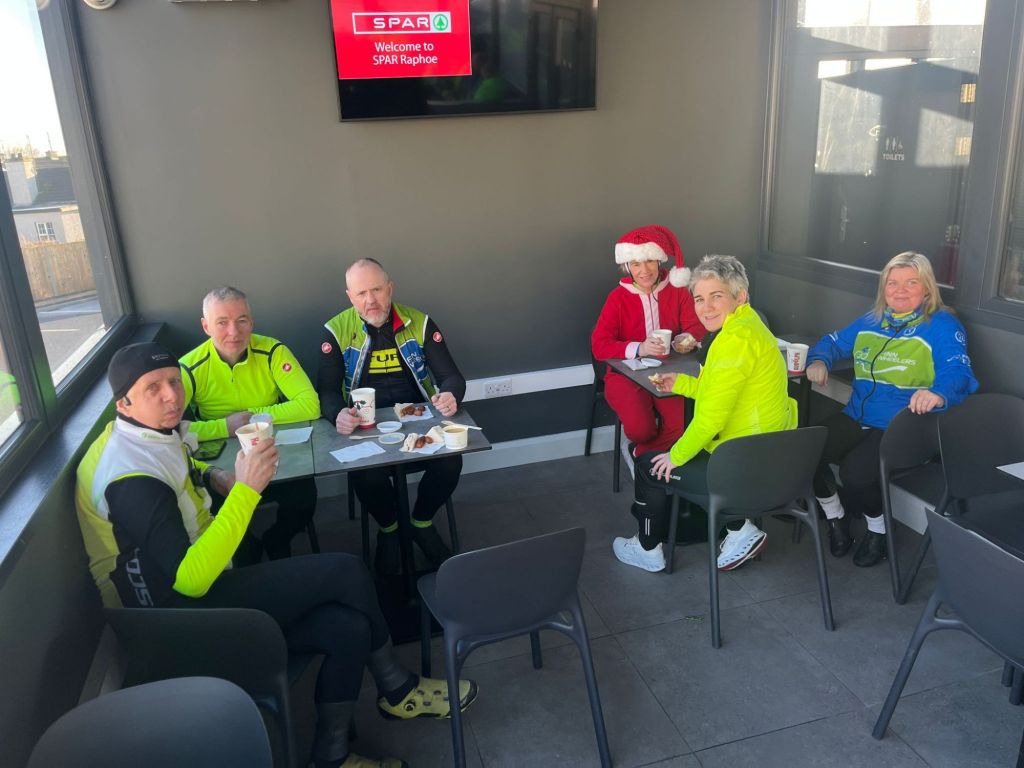
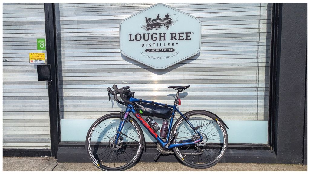
The third checkpoint was at 148km in Lanesborough at the northern tip of Lough Ree and I spotted telltale bright colours clustered outside the filling station about 700m before. It was time for a second lunch and a toilet stop. The Mayo lads were all here and I got the impression they weren’t much more than 10min earlier than me. I sat chatting to them and a few other riders that were there before us while I just about managed to eat the driest ham sandwich I’ve ever had!
I topped up myself and my bottle with a bottle of Boost and managed to persuade the lads to go on again without me. They genuinely wanted me to come with them and were reluctant to leave but I knew the last 50km were going to be tough and I wanted the space to take it on my own terms. They accepted my thanks and headed off while I got out the earphone for my left ear and put on an audiobook. I figured listening to the story of Touching The Void would be good motivation to keep going.
If one of the other riders hadn’t warned me at the filling station I would have ridden right past the very unimpressive third distillery which was basically a shop front and closed on a Saturday.
Leaving Lanesborough on the main N63 Roscommon road I could feel a fairly steady breeze had risen with flags flying free. After 7km I turned off the main road, heading down the western side of Lough Ree and straight into the breeze. It wasn’t very strong, probably 10-15km/hr but with tired legs it wasn’t particularly helpful or welcome.
Along a totally non-descript stretch of country road I stopped to record an important personal milestone.

I’ve been trying to get to the Imperial Century since October when I first started feeling that full distance Audax rides could well be a thing again. It surprised me just how good it was to see it today.
That feeling didn’t last long! The next 25km almost broke me. A series of three climbs sapped whatever little energy I had left. Combined with the headwind and legs that couldn’t summon any power the hills seemed endless. They weren’t massive but on the straight roads they looked endless and seeing 6% on all three felt like they were missing a 1 on the front. The only way I managed to get up them was to promise myself a rest stop at every 10km. Thankfully this managed to coincide with the top of each climb.
Since leaving Lanesborough I was also dealing with a queasy stomach. On my longer rides I’ve been in the habit of topping up my bottle with a sugary drink and I’d taken the same approach today. Unfortunately, that seemed to be backfiring. A combination of too much sugar and probably dehydration, were upsetting my stomach and I couldn’t eat or drink while riding. Thankfully when I stopped it would settle allowing me to eat a mini Snickers, a few jelly babies and have a drink. All I had to drink was more of the sugary Boost when I would have loved some plain water, but I coped OK with the frequent breaks.
A long 3km descent after my 180km stop was incredibly welcome but one last short, steep climb sucked me back into the red and I had to stop again at 190km despite the last checkpoint being only 5km away.
With only 11km to the end I was hoping to be able to get it done in one last push but I really was running on fumes by now and despite the fairly level road and less of a breeze, I was more than happy to stop and record my 200km time.
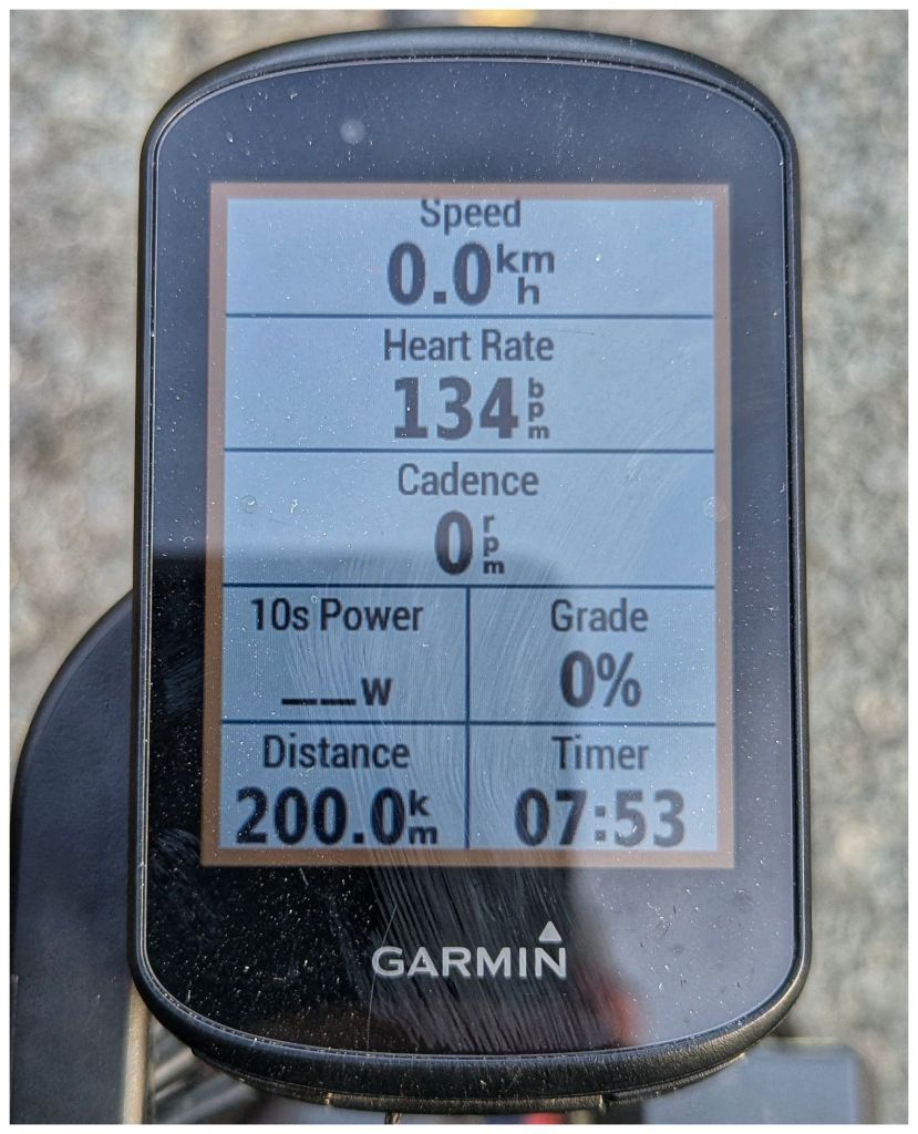
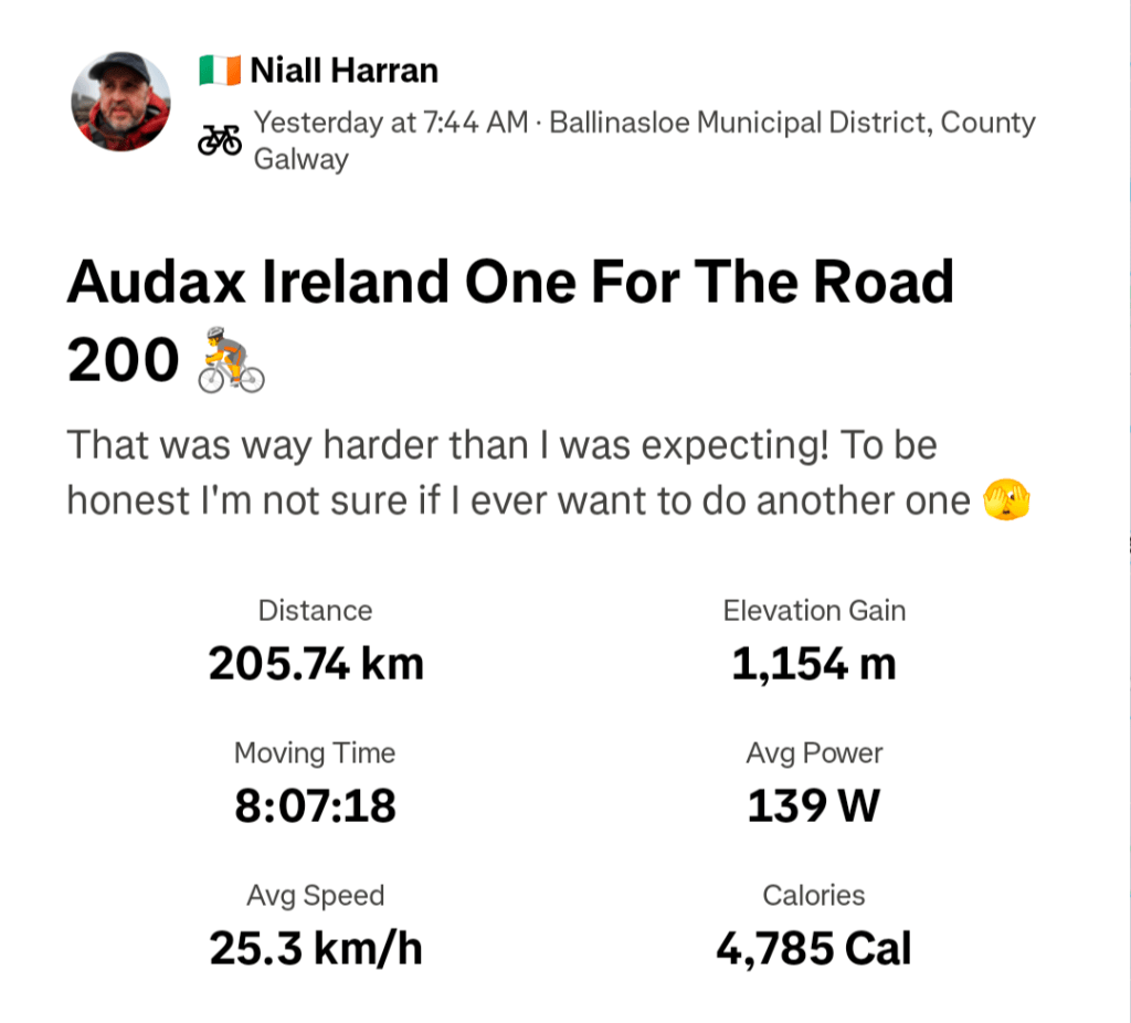
Although Audax does have time limits racing is not part of it in any way. In fact, as well as having a time limit for each checkpoint there is also a minimum time limit and you’re not supposed to arrive or depart a checkpoint before a set time. However, no form of cycling can be competition free and a “good” 200 is considered to be less than 8hrs cycling time and less than 10hrs total time. Seeing 7hrs53min was very satisfying especially with how I’d been feeling for the last 50km.
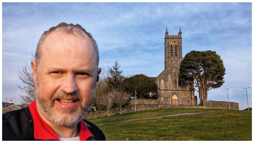
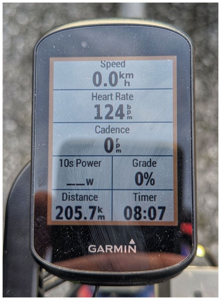
The last 5km slowly rolled by as I spun gently towards Ballinasloe watching the road signs count down the final few km and finally seeing the welcome sign on the edge of town. A very tired and sweaty version of me climbed off the bike for the final time and one last selfie to record my finish time.
Overall I really enjoyed the route. It was far harder than I expected from a flat route and took way more out of me than I was prepared for. Although I really enjoyed riding with the Mayo lads I probably should have let them go in Kilbeggan and burned matches I couldn’t afford in that 30km stretch.
I need to reflect over the next week and work out what went well and what lessons need learned. Despite my comment on Strava I already registered for the next event a few days ago and I’m pretty sure that I’ll be there on the starting line 🤞